Ross Sea Region Soil Sites
67000
67
3-Dec-1964
IBC, GGC
Shackleton Glacier, Queen Maud Mountains, on mountain slopes to the south of McGregor Glacier at the Nth end of the Cumulus Hills
Soil characterisation
USGS 1:250 000 1968; Liv Glacier SV 1-10/5
B&W Lscp & CS Lscp
No
174.7500
-85.2167
85deg 13.0'S
-174deg -45.0'E
Northern end of the Cumulus Hills, 1.5km SSE of Shenk Pk. on lateral moraine mounds on a hill slope alongside a stagnant rock-covered alpine glacier
25
W
2,200
cf. Notes for GEOLAND below
(25o)
0
-8.0
air
0
6.0
surface
36
-8.0
xerous; few small scattered snow pockets but no melting observed
-35
Central mountain
Loose bouldery till from dolerite and sedimentary rocks
Nil observed
Nil
| SURFACE WEATHERING or |
| SURFACE FEATURES |
Boulders predominantly angular to subangular but with slight rounding on edges; mainly weak but distinct surface staining
Nil
67 8-0cm
101
surface dolerite boulders and cobbles
102
weakly to moderately stained
103
thin pale encrustations on some stones,
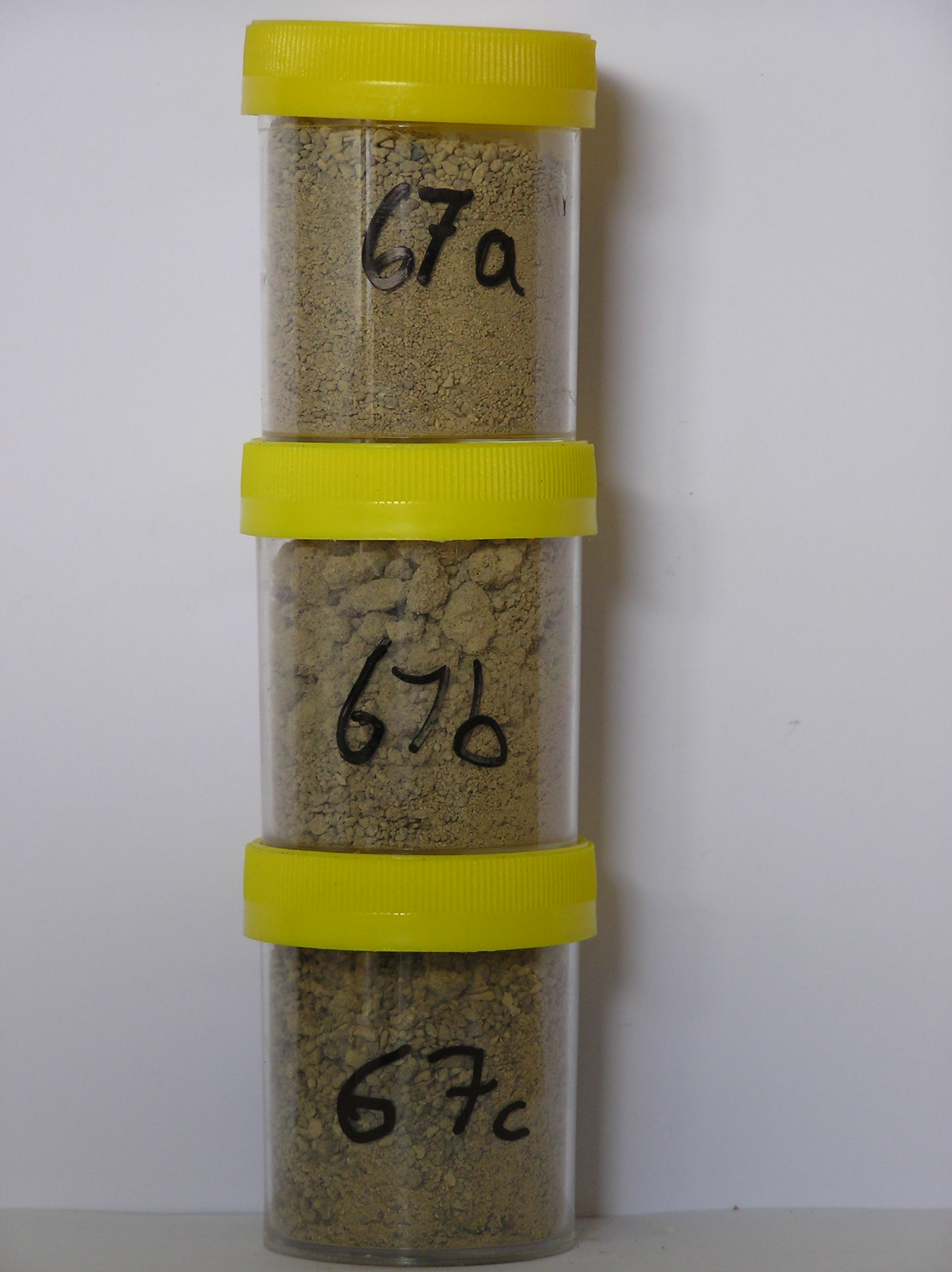
67a 0-5cm
201
light brown to very pale brown (7.5YR 6/4-10YR 7/4) sandy to silty cobble and boulder gravel
202
a thin vesicular crust merging into loose skeleton
203
rock particles mainly subangular to subrounded with weak staining
204
few thin brownish carbonate coatings
205
distinct boundary,
67b 5-20cm
301
very pale brown to light yellowish brown (10YR 7/4-6/4) gravelly sand
302
loose
303
few fine salt flecks
304
rock particles mainly subangular and unstained but some subrounded with distinct surface staining
305
indistinct boundary,
67c 20-40cm
401
very pale brown to light yellowish brown (10YR 7/4-6/4) gravelly sand
402
loose
403
few fine salt flecks
404
| larger rock particles mainly subangular and unstained but smaller particles subrounded with distinct staining and |
| alteration, on frozen ground. |
Yes
a,b,c
Hard ice-cemented
40
2
(40cm)
Geoland
| The till forms the middle of three deposits representing three retreat stages of a local alpine type glacier, the youngest being the most extensive; the larger clasts |
| in the till are mainly dolerite but the finer fractions are probably from Beacon Group sediments |
| Soluble Salt |
| Concentration |
6700001
67a
0-5cm
0
5
none
6700002
67b
5-20cm
5
20
none
6700003
67c
20-40cm
20
40
none
12-Dec-2005
Page 67 of 896
67