Ross Sea Region Soil Sites
69000
69
4-Dec-1964
IBC, GGC
Shackleton Glacier, Queen Maud Mountains, on mountain slopes to the south of McGregor Glacier at the Nth end of the Cumulus Hills
Soil characterisation
USGS 1:250 000 1968; Liv Glacier SV 1-10/5
B&W Lscp & CS Lscp
No
174.3670
-85.1667
85deg 10.0'S
-174deg -22.0'E
| On hill slopes on the south side of McGregor Glacier, at Rougier Hill; in a small hanging valley containing two sets of moraines part way up the valley; the site is on a |
| down-valley ridge of moraine |
10
W
1,800
cf. Notes for GEOLAND below
(10o)
| Xerous; few small scattered snow pockets in patterned ground troughs but no melting |
| observed |
-30
Central mountain
Till derived mainly from dolerite and Beacon Group sedimentary rocks, possibly with some granitic material
Nil observed
Well developed pattern of 5-10m nets but with subdued surface expression
| SURFACE WEATHERING or |
| SURFACE FEATURES |
Some sorting of surface materials by wind; surface boulders with distinct surface staining, some exfoliation and partly rounded
Nil
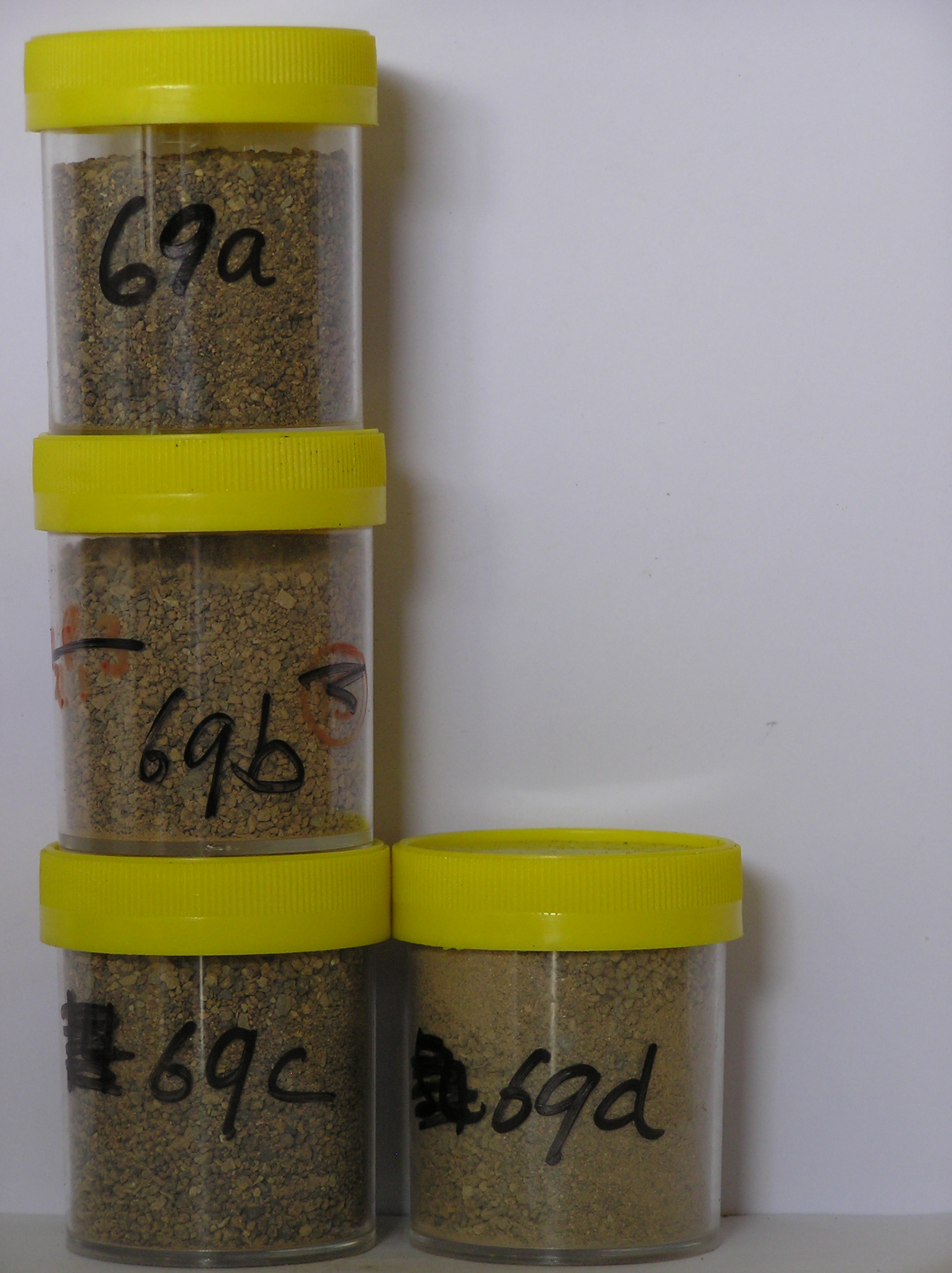
69 3-0cm
101
surface pebbles, cobbles and boulders
102
weakly stained and partly exfoliated,
69a 0-1cm
201
brown (7.5YR 5/4) granule and cobble gravel
202
loose
203
rock particles mainly subrounded to subangular with distinct brown surface staining
204
distinct boundary,
69b 1-8cm
301
brown to light brown (7.5YR 5/4-6/4) pebbly gravelly sand
302
weakly cohesive in patches with weakly developed vesicular structure
303
few fine salt flecks
304
rock particles mainly subangular and unstained but some coating with fines
305
indistinct boundary,
69c 8-20cm
401
brown (7.5YR 5/4) pebbly gravelly sand
402
loose
403
rock particles mainly subangular and unstained but some dolerite particles are partly altered
404
sharp boundary,
69d 20-25cm
501
frozen ground
Yes
a,b,c,d
Hard ice-cemented
20
2
(20cm)
Geoland
| The moraine at this site forms a small ridge across the narrow valley and is from till derived from dolerite, Beacon Group sediments and possibly some granite; it |
| appears from it's geomorphic position that it may have been deposited by an expanded McGregor Glacier which entered local valleys |
| Soluble Salt |
| Concentration |
6900001
69a
0-1cm
0
1
none
6900002
69b
1-8cm
1
8
none
6900003
69c
8-25cm
8
25
none
6900004
69d
20-25cm
20
25
none
12-Dec-2005
Page 69 of 896
69