Ross Sea Region Soil Sites
78000
78
10-Dec-1964
IBC, GGC
Shackleton Glacier, Queen Maud Mountains, at the southern end of the Cumulus Hills, just north of Zaneveld Glacier junction with Shackleton Glacier
Soil characterisation
USGS 1:250 000 1968; Liv Glacier SV 1-10/5
CS Pro
No
176.2330
-85.4000
85deg 24.0'S
-176deg -14.0'E
Approximately 1.5km east of Wiest Bluff on an uneven ice- cored till surface; on the side of a patterned ground mound
5
NE
2,100
cf. Notes for GEOLAND below
(5o)
Ultraxerous, intermittent snow cover and adjacent snow patch but no thawing observed
-40
Inland mountain
Gravelly till including weathered dolerite (alongside site 77)
Nil observed
Ice cored moraine with low (<1m) mounds, in places forming low ridges
| SURFACE WEATHERING or |
| SURFACE FEATURES |
Mainly subangular weakly and moderately stained dolerite boulders with slight surface exfoliation
Nil
78 4-0cm
101
surface pebbles, cobbles and boulders
102
mainly subangular and weakly stained,
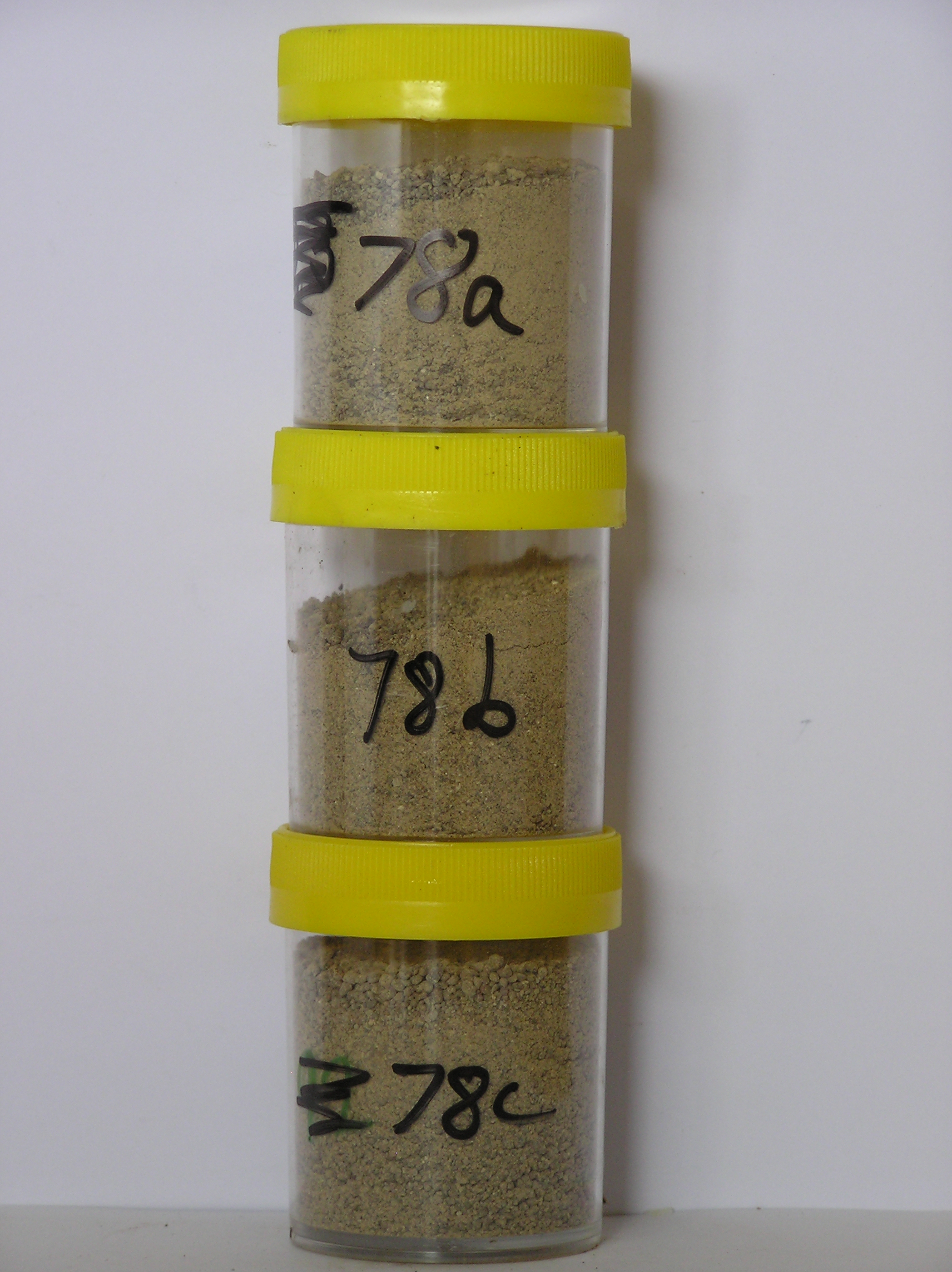
78a 0-3cm
201
pale brown (10YR 6/3) pebbly granular silty sand
202
moderately cohesive
203
many fine salt flecks with salt coatings on some stones
204
moderately developed vesicular structure
205
finer rock particles mainly subrounded, moderately stained and strongly altered
206
distinct boundary,
78b 3-13cm
301
light yellowish brown (10YR 6/4) gravelly silty sand
302
weakly cohesive
303
many salt flecks diffused through the horizon
304
finer rock particles strongly altered, mainly subrounded and moderately stained
305
distinct boundary,
78c 13-25cm
401
pale brown to very pale brown (10YR 6/3-7/3) gravelly sandy silt
402
loose
403
rock particles mainly subangular and weakly stained but smaller particles subrounded and strongly altered
404
sharp boundary, on ice
Yes
a,b,c
Stagnant glacial ice
25
2
(25cm)
Geoland
| Dolerite outcrops widely in an undulating ice overridden landscape; cover deposits are patchy varying from bouldery felsenmeer regolith to intermittent till |
| patches; surface age is variable owing to remnant snow fields which behave as local nevee glaciers possibly reworking older surface deposits; the drift mantle is |
| young |
| Soluble Salt |
| Concentration |
7800001
78a
0-3cm
0
3
none
7800002
78b
3-13cm
3
13
none
7800003
78c
13-25cm
13
25
none
12-Dec-2005
Page 78 of 896
78