Ross Sea Region Soil Sites
79000
79
10-Dec-1964
IBC, GGC
Shackleton Glacier, Queen Maud Mountains, at the southern end of the Cumulus Hills, just north of Zaneveld Glacier junction with Shackleton Glacier
Soil characterisation
USGS 1:250 000 1968; Liv Glacier SV 1-10/5
CS Prof
No
176.2330
-85.3667
85deg 22.0'S
-176deg -14.0'E
Approximately 1.5km ENE on the upper convex surface of a broad moraine ridge
7
N
2,000
cf. Notes for GEOLAND below
(7o)
Ultraxerous, intermittent snow cover and adjacent snow patch but no thawing observed
-40
Inland mountain
Doleritic fine textured slightly compact till
Nil observed
Nil
| SURFACE WEATHERING or |
| SURFACE FEATURES |
Surface dolerite cobbles and boulders are moderately and weakly stained, subrounded to subangular, non-pitted but have moderate exfoliation
Nil
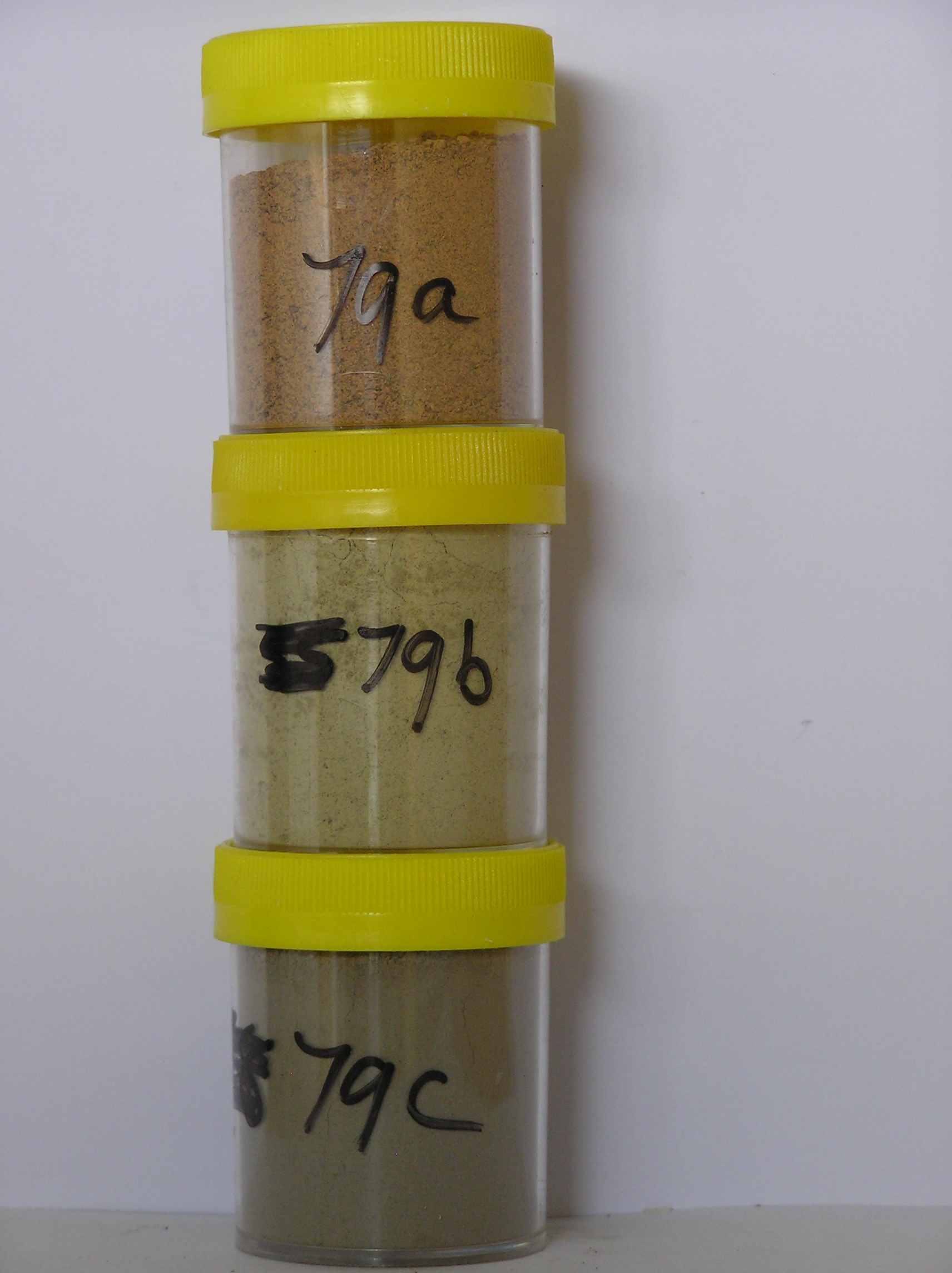
79 6-0cm
101
surface boulders, cobbles and pebbles
102
subrounded and subangular
103
moderately to weakly stained
104
79? 0-2cm
201
pale yellow (5Y 5/3) granular sandy silt
202
moderately cohesive
203
moderately developed vesicular structure
204
abrupt boundary,
79a 2-20cm
301
yellowish red (5Y 5/6) fine gravelly silt forming a discrete mass almost entirely surrounded by pale yellow soil
302
cohesive
303
small salt flecks diffused throughout
304
finer rock particles subrounded and moderately altered
305
abrupt boundary,
79b 2-20cm
401
pale yellow (5Y 7/3) fine gravelly sandy silt enclosing the yellowish red soil material
402
cohesive
403
small salt flecks diffused throughout
404
sharp boundary,
79c 20-45cm
501
olive grey (5Y 5/2) fine gravelly sandy silt
502
moderately cohesive
503
larger rock particles fresh but smaller particles strongly altered
504
sharp boundary, on frozen ground
Yes
a,b,c
Dry frozen over hard ice cemented
45
(45cm)
Geoland
| Cover deposits are patchy, varying from bouldery felsenmeer regolith to intermittent till patches; surface age is variable owing to remnant snow fields which |
| behave as local nevee glaciers possibly reworking older surface deposits; weathered soil overlies unweathered soil but it is not clear if the soil stratigraphy is due |
| to weathering or reworking |
| Soluble Salt |
| Concentration |
7900001
79a
0-2cm
0
2
none
7900002
79b
2-20cm
2
20
none
7900003
79c
20-45cm
20
45
none
12-Dec-2005
Page 79 of 896
79