Ross Sea Region Soil Sites
86000
86
12-Dec-1964
IBC, GGC
Head of Shackleton Glacier at Roberts Massif, Queen Maud Mountains, on the edge of the Polar Plateau
Soil characterisation
USGS 1:250 000 1968; Liv Glacier SV 1-10/5
B&W Prof & Lscp
No
177.0670
-85.5167
85deg 31.0'S
-177deg -4.0'E
On a broad undulating slightly concave surface on the north slopes of Roberts Massif, about 2km south of a small ice tongue, just south of Everett Nunatak,
3
W
2,100
cf. Notes for GEOLAND below
(3o)
Ultraxerous; surface devoid of snow cover
-45
Inland mountain
Shallow doleritic till
Nil observed
Nil
| SURFACE WEATHERING or |
| SURFACE FEATURES |
| Surface boulders are rounded on edges; moderately stained and show only slight exfoliation; between boulders, a pebble pavement is moderately developed; |
| salts are extensive beneath surface stones |
Nil
86 2-0cm
101
surface pebbles forming a pavement between surface boulders
102
weakly to moderately stained with distinct polish
103
subangular to subrounded
104
thick salt accumulations beneath most boulders,
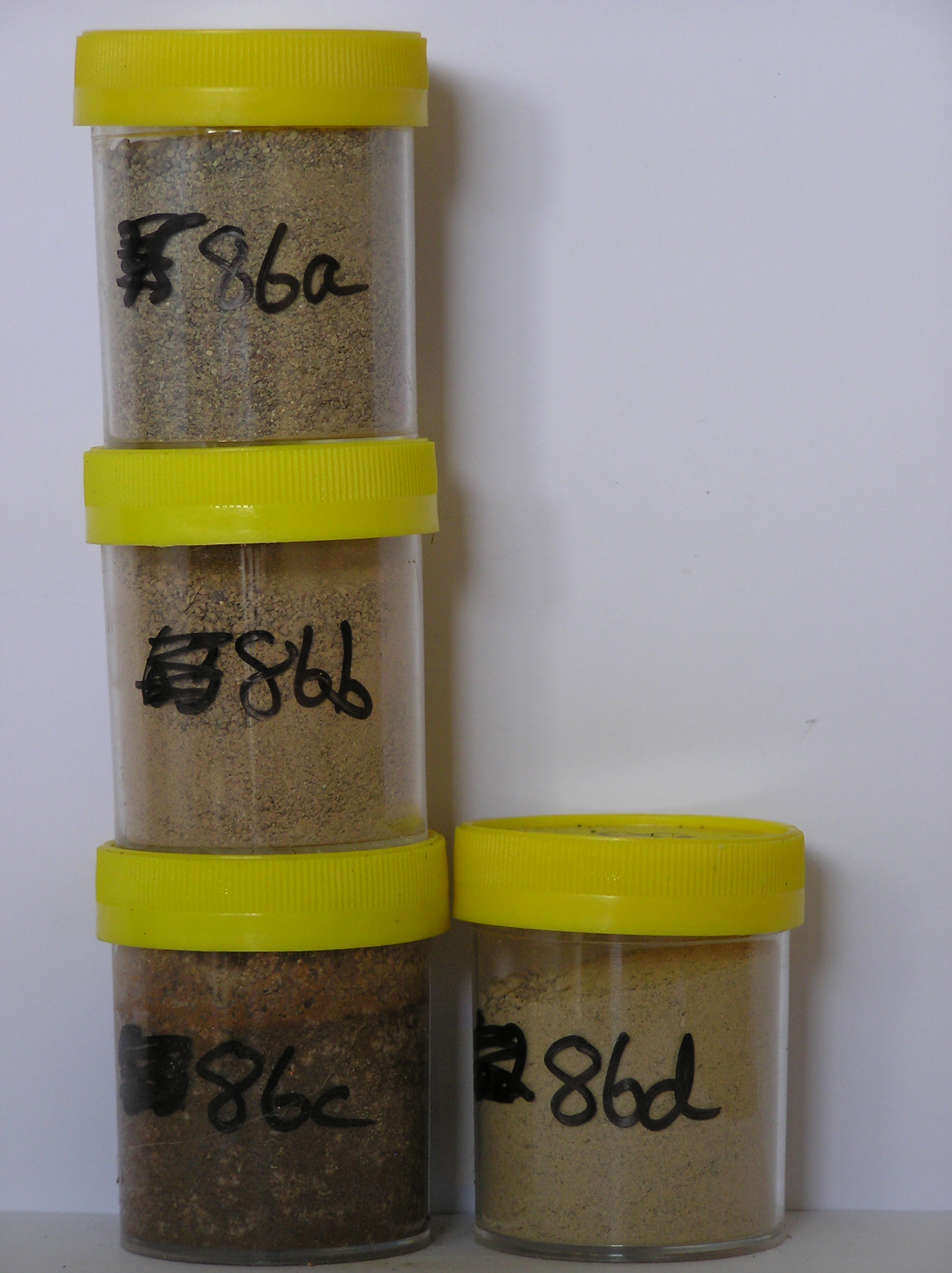
86a 0-3cm
201
pale brown (10YR 6/3) sandy pebble gravel
202
loose
203
rock particles mainly subrounded, moderately stained, and moderately to strongly altered
204
abrupt boundary,
86b 3-7cm
301
light brown (7.5YR 6/4) sandy pebble and cobble gravel
302
loose
303
rock particles mainly subrounded, moderately stained and moderately to strongly altered
304
sharp boundary,
86c 7-13cm
401
pink (7.5YR 7/4) gravelly sand
402
moderately cohesive
403
profuse salts forming a continuous salt horizon
404
rock particles subrounded, moderately to strongly stained and moderately altered
405
abrupt boundary,
86d 13-25cm
501
light yellowish brown (10YR 6/4) sandy pebbly gravel
502
loose
503
rock particles mainly subangular and unstained to weakly stained
504
abrupt boundary, on consolidated old tillite.
Yes
a,b,c,d
Dry frozen
0
3
Geoland
| Till occurs extensively on the lower slopes of Roberts Massif forming mainly shallow deposits over dolerite, Beacon Group sediments and tillite which outcrop |
| in places; the younger unconsolidated tills increase in age away from the ice front and in places form distinctive ridges or loops 1-2m high that mark pauses in |
| ice recession |
| Soluble Salt |
| Concentration |
8600001
86a
0-3cm
0
3
none
8600002
86b
3-7cm
3
7
none
8600003
86c
7-13cm
7
13
none
8600004
86d
13-25cm
13
25
none
12-Dec-2005
Page 86 of 896
86