Ross Sea Region Soil Sites
112000
112
31-Dec-1964
IBC, GGC
Victoria Land, Trans-antarctic Mountains; at the southern end of the Cook Mountains in the Brown Hills region of the Darwin Glacier
Soil characterisation
USGS 1:250,000 1963; Carlyon Glacier ST 57-60/13*
B&W & CS Pro
No
158.5830
-79.7500
79deg 45.0'S
-158deg -35.0'E
cf. Notes for DESCR below
0
Nil
1,050
cf. Notes for GEOLAND below
| Xerous to subxerous; the site is dry with available water coming only from occasional |
| snowfalls |
-26
Coastal mountain
Granitic till
Yellow and black lichen are present
Moderately developed
| SURFACE WEATHERING or |
| SURFACE FEATURES |
Scattered surface boulders with variable staining, weakest in polygon centres and stronger towards edges; small salt deposits under some stones;
Nil
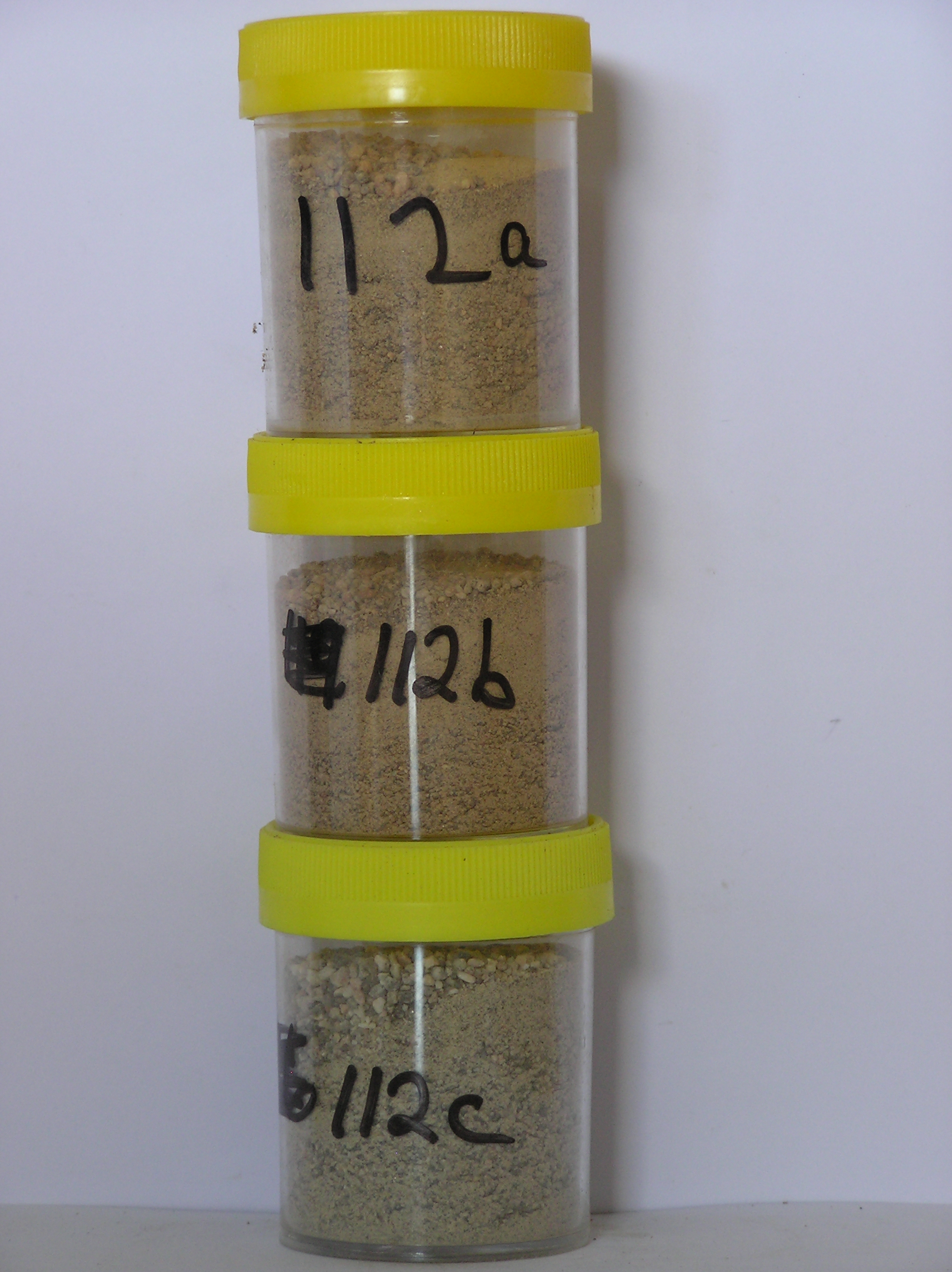
112a 0-8cm
201
light yellowish brown (10YR 6/4) sandy to silty gravel
202
moderately cohesive and forming a distinct surface crust
203
weakly developed vesicular structure
204
| rock particles mostly subangular and moderately stained but some moderately to strongly stained and altered |
| throughout |
205
distinct boundary,
112b 8-15cm
301
light yellowish brown to pale brown (10YR 6/4-6/3) sandy to silty cobble and granule gravel
302
moderately cohesive
303
coarser particles partly cemented with fines
304
a few fine salt flecks
305
rock particles subangular, moderately to weakly stained and unaltered
306
distinct boundary,
112c 15-30cm
401
light grey (2.5Y 7/2) sandy pebbly granular gravel
402
loose
403
rock particles subangular to subrounded and weakly stained
404
sharp boundary, on frozen ground.
5-0cm
101
surface pebbles and cobbles with loose granular sand
102
moderately stained,
Yes
a,b,c
Hard ice-cemented
30
3
(30cm)
Descr
| A moraine filled basin, north of the terminus of the Foggydog Glacier and west of the Bartrum Glacier with a series of distinct moraine loops, formed by the |
| retreat of the two glaciers; the is site flat, on one of the furthermost loops of the Bartrum Glacier and is towards the edge of a polygon |
Geoland
| Granite Harbour Intrusives and dolerite sills occur widely on surrounding mountains; the till is dominantly granitic with minor dolerite but some schist is |
| present; the till sequence reflects the deposition of moraines in association with retreat of the Foggydog and Bartrum Glaciers |
| Soluble Salt |
| Concentration |
11200001
112a
0-8cm
0
8
none
11200002
112b
8-15cm
8
15
none
11200003
112c
15-25cm
15
25
none
12-Dec-2005
Page 112 of 896
112