Ross Sea Region Soil Sites
118000
118
4-Jan-1965
IBC, GGC
Victoria Land, Trans-antarctic Mountains; at the southern end of the Cook Mountains in the Brown Hills region of the Darwin Glacier
Soil characterisation
USGS 1:250,000 1963; Carlyon Glacier ST 57-60/13*
B&W & CS Pro & Lscp
No
159.2500
-79.8500
79deg 51.0'S
-159deg -15.0'E
Eastern end of the Brown Hills, about 2km NE of the top of Diamond Hill, on an uneven, sloping, broad bouldery ridge surface near a dark coloured granodiorite outcrop
8
NE
1,000
cf. Notes for GEOLAND below
0
1.0
surface
0
-7.0
air overcast
3
0.0
10
0.0
20
-1.0
30
-3.0
| Oceanic subxerous; some snow patches on ridges and light a light recent snowfall which |
| quickly ablated; the surface 1cm of the soil was slightly moist |
-25
Coastal mountain
Largely locally derived disaggregated granodioritic bedrock with minor till drift
Patches of black and greenish lichen
Active patterned ground movement with coarser textured more oxidised material in the cracks and finer less stained material near the centres
| SURFACE WEATHERING or |
| SURFACE FEATURES |
| Surface boulders are disaggregating by exfoliation; also some cavernous weathering is present; accumulations of salts occur beneath some surface stones; |
| surface rocks are subrounded and moderately stained |
Nil
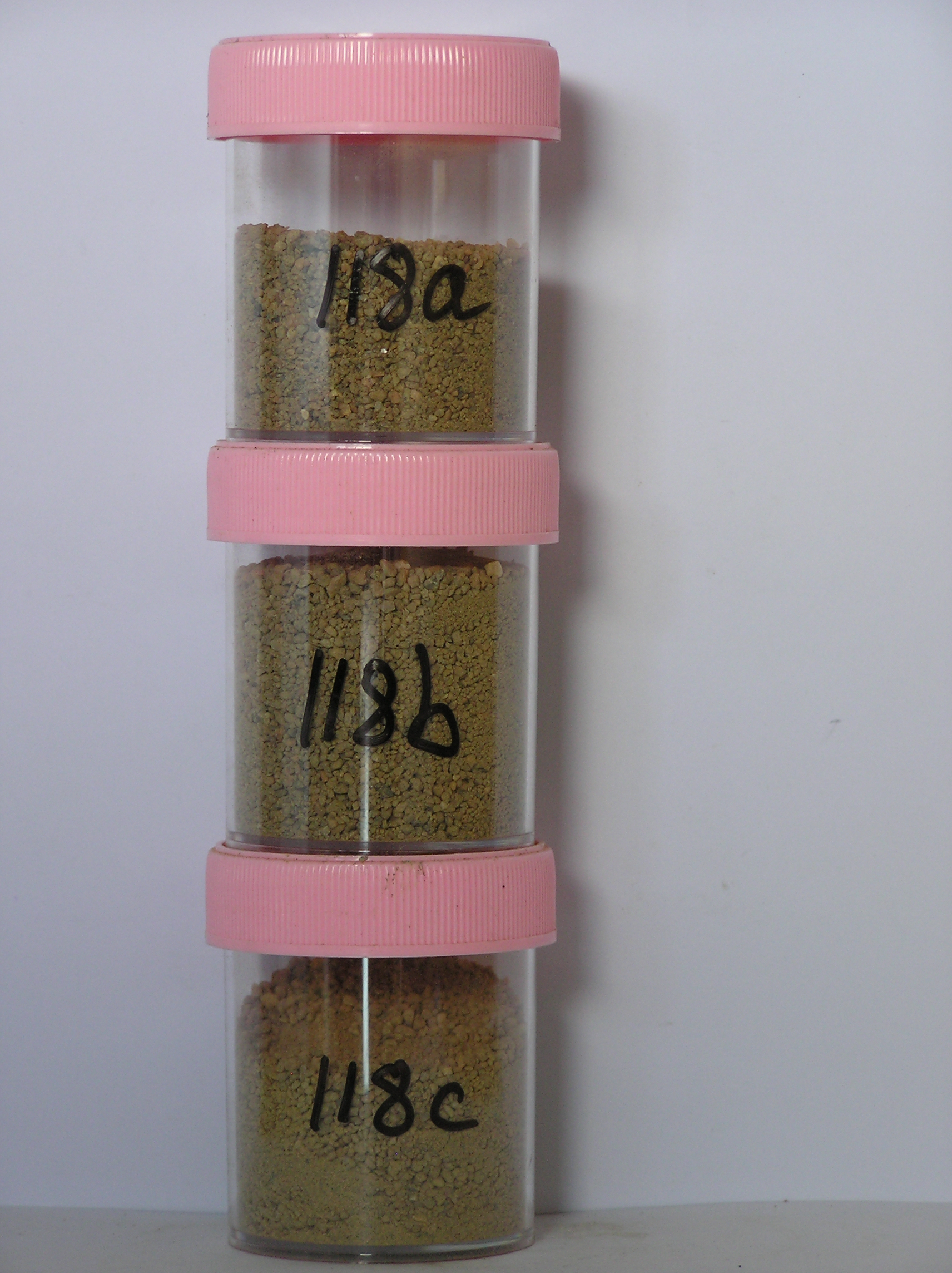
118a 0-3cm
201
yellowish brown (10YR 4/4) granular sand
202
loose
203
rock particles subangular to subrounded and moderately stained, some particles with red staining throughout
204
sharp boundary,
118b 3-8cm
301
yellowish brown to light yellowish brown (10YR 5/4-6/4) sandy pebbly gravel
302
weakly cohesive
303
many particles coated with fines forming a weakly developed siltball structure
304
salts diffused throughout and concentrated beneath some stones
305
rock particles subangular and moderately stained with some partly altered
306
indistinct boundary,
118c 8-30cm
401
light yellowish brown (10YR 6/4) pebbly gravelly sand
402
moderately to firmly cohesive (ice cementing)
403
rock particles mainly subangular and weakly to moderately stained
404
sharp boundary, on frozen ground
3-0cm
101
surface pebbles and granules
102
subangular and moderately stained,
Yes
a,b,c
Hard ice-cemented
30
3
(30cm)
Geoland
| Granodiorite of the Granite Harbour Intrusives outcrops more extensively on the upper slopes of Diamond Hill with till being more abundant on the lower |
| slopes; there is no obvious till mantle but some dolerite fragments in the soil are indicative of the presence of residual till |
| Soluble Salt |
| Concentration |
11800001
118a
0-3cm
0
3
none
11800002
118b
3-8cm
3
8
none
12-Dec-2005
Page 118 of 896
118