Ross Sea Region Soil Sites
122000
122
7-Jan-1965
IBC, GGC
Victoria Land, Trans-antarctic Mountains; at the southern end of the Cook Mountains in the Brown Hills region of the Darwin Glacier
Soil characterisation
USGS 1:250,000 1963; Carlyon Glacier ST 57-60/13*
B&W Pro & Lscp
No
158.5670
-79.8000
79deg 48.0'S
-158deg -34.0'E
cf. Notes for DESCR below
4
NE
575
cf. Notes for GEOLAND below
Oceanic subxerous; the soil is dry; a nearby lake is partly thawed and beginning to re-freeze
23
Coastal mountain
Young bouldery till from mainly granite and granodiorite with minor dolerite
Nil observed
Very weakly developed
| SURFACE WEATHERING or |
| SURFACE FEATURES |
| Boulders up to 3m across with many about .3m; mostly subangular to angular with weak oxidation staining on some granites and occasional strong staining |
| on some; a weakly developed surface pavement |
Nil
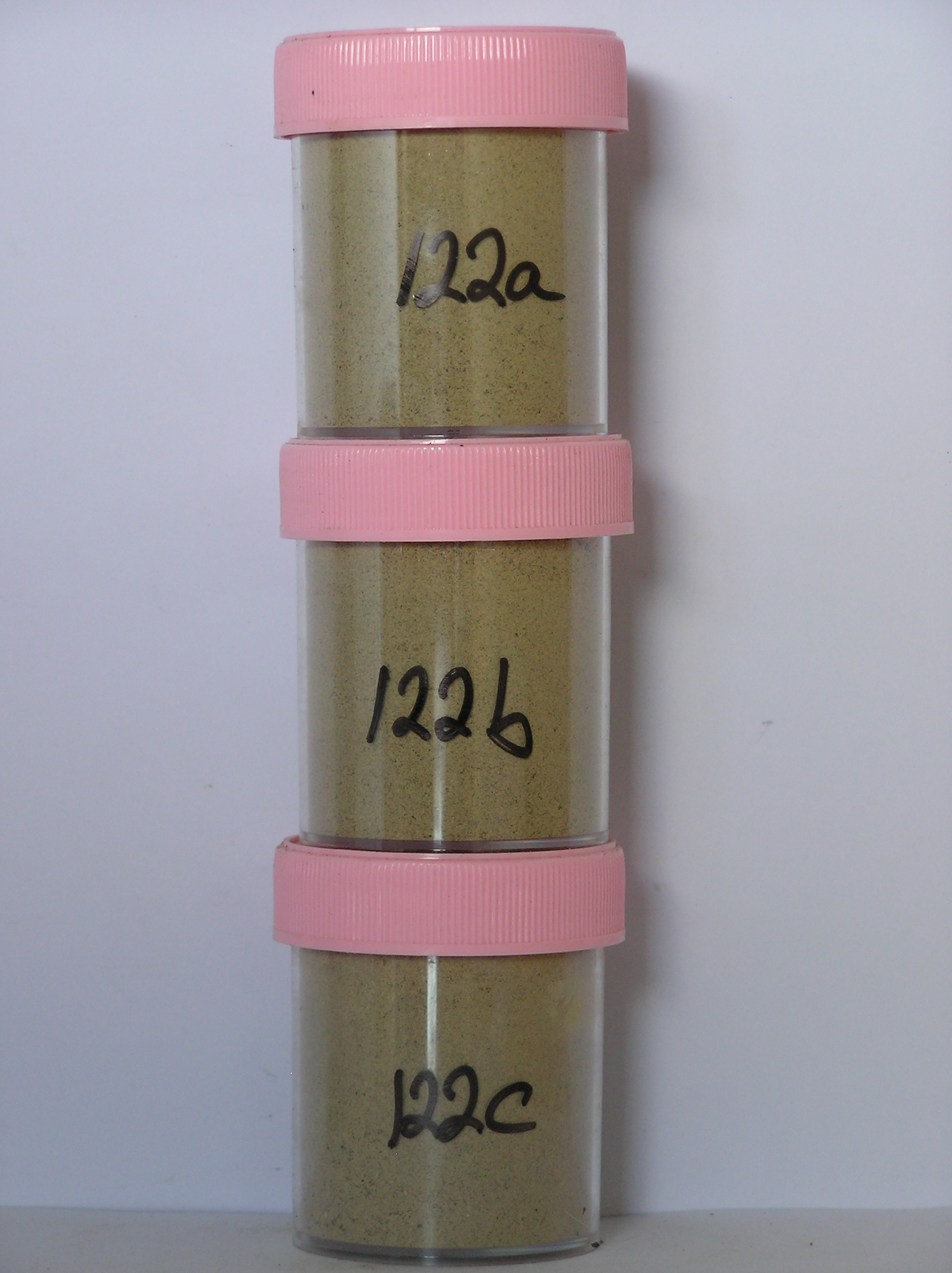
122a 0-5cm
201
very pale brown (10YR 7/4) sandy silty boulder to granule gravel
202
loose
203
rock particles mostly subangular and unstained to weakly stained
204
distinct boundary,
122b 5-10cm
301
very pale brown (10YR 7/4) sandy silty pebble gravel
302
loose to weakly cohesive
303
rock particles subangular to subrounded and unstained
304
diffuse boundary
122c 10-35cm
401
very pale brown (10YR 7/4) sandy silty pebble gravel
402
loose to weakly cohesive
403
a few fine salt flecks
404
rock particles subangular to subrounded and unstained
405
sharp boundary, on frozen ground.
4-0cm
101
surface boulders
102
cobbles and pebbles
103
subangular and weakly stained,
Yes
a,b,c
Hard ice-cemented
35
2
(35cm)
Geoland
| Grounding of the Ross Ice Shelf during the Ross Glaciation and back-flooding of ice into outlet glaciers such as the Darwin caused much of the lower lying land |
| to be covered with ice; subsequent ice retreat has gradually exposed the landscape and deposited tills, particularly on the lower altitude surfaces; the youngest |
| tills and soils are closest to the glacier |
Descr
| On low moraine in the Brown Hills region, between the Foggydog and Darwin Glaciers and about 1km S of the Foggydog Glacier, approximately 30m from a |
| partially thawed lake and on the SW side; a till covered glacial retreat surface with an uneven very bouldery surface |
| Soluble Salt |
| Concentration |
12200001
122a
0-5cm
0
5
none
12200003
122c
10-25cm
10
25
none
12-Dec-2005
Page 122 of 896
122