Ross Sea Region Soil Sites
132000
132
16-Jan-1965
IBC, GGC
Victoria Land, Trans-antarctic Mountains; in Barwick Valley, part of the McMurdo Sound Dry Valley system
Soil characterisation
USGS 1:250 000 1986; Ross Island and Vicinity, Antarctica
No
161.5420
-77.3583
77deg 21.5'S
-161deg -32.5'E
| On the floor of Barwick Valley near it's eastern end, about 8.5km East of Lake Vashka; on the north side of the valley on a broad undulating till surface with low relief moraine |
| loops |
0
Nil
575
cf. Notes for GEOLAND below
(0o)
0
2.0
soil surface
3
4.5
8
3.0
Xerous to subxerous; a dry site with no moisture available from seepages, snowbanks etc.
-23
Central mountains
Bull Drift till containing much sandy/silty rock flour like material; coarse materials concentrated at the surface
Nil observed
A stable surface with old subdued inactive patterned ground
| SURFACE WEATHERING or |
| SURFACE FEATURES |
| Most boulders are less than 250mm; pebbles and cobbles form a well developed pavement with well formed abundant ventifacts; coarser grained rocks are |
| very crumbly; surface staining and exfoliation are strongly developed |
Nil
132 2-0cm
101
surface pebbles, granules and coarse sand
102
subrounded to subangular and moderately stained,
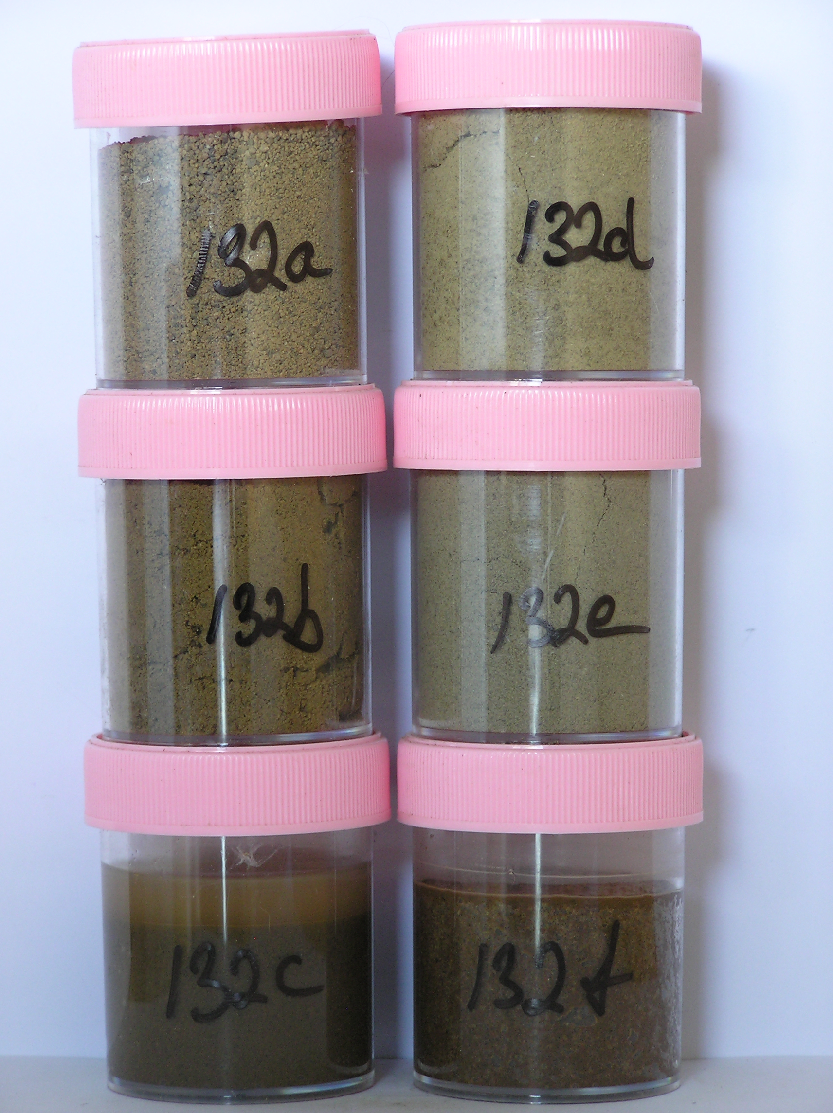
132a 0-5cm
201
| light yellowish brown (10YR 6/4) pebbly gravelly sand with strong brown (7.5YR 5/6) zones (sampled |
| separately) beneath some stones and extending deeper in places |
202
moderately cohesive surface crust with weakly developed vesicular structure
203
| some larger coarse grained rocks disaggregated but smaller rock particles subrounded, moderately stained and |
| partly altered |
204
distinct boundary,
132b 5-15cm
301
light yellowish brown (2.5Y 6/4) pebbly silty sand
302
loose to weakly cohesive
303
some coarse grained rocks partly disaggregated but smaller rock particles subrounded and moderately stained
304
distinct boundary,
132c 15-20cm
401
pale brown (2.5Y 5/4) pebbly sandy silt
402
cohesive
403
diffuse salt flecks forming a discontinuous salt horizon
404
rock particles mainly subrounded and weakly stained
405
distinct boundary,
132d 20-40cm
501
pale brown (10YR 6/3) bouldery sandy silt
502
weakly cohesive
503
few diffuse salt flecks, mainly around stones
504
rock particles mainly subangular and weakly stained,
132e 40-60+
601
pale brown to light brownish grey (10YR 6/3 -2.5Y 6/2) bouldery sand and silt
602
cohesive
603
rock particles angular to subangular and weakly stained, on pale olive till
Yes
a,b,c,d,e,f
Dry frozen
0
3
Geoland
| Tills on the lower Barwick Valley were mapped by Calkin as Bull Drift, the third of a sequence of glacial deposits; in Barwick Valley, Bull Drift deposits may |
| have originated from the East, in part due to the earlier expansion of the Ross Ice Shelf and the inland invasion of it's ice into the Dry Valleys; boulders are |
| seldom larger than 30cm |
| Soluble Salt |
| Concentration |
13200001
132a
0-5cm
0
5
none
13200002
132b
5-15cm
5
15
none
13200003
132c
15-20cm
15
20
none
13200004
132d
20-40cm
20
40
none
13200005
132e
40-60cm
40
60
none
13200006
132f
2-5cm
2
5
none
12-Dec-2005
Page 132 of 896
132