Ross Sea Region Soil Sites
139000
139
19-Jan-1965
IBC, GGC
Victoria Land, Trans-antarctic Mountains; in lower Barwick Valley, part of the McMurdo Sound Dry Valley system
soil characterisation
USGS 1:250 000 1986; Ross Island and Vicinity, Antarctica
B&W Pro & CS Lscp
No
161.3220
-77.3467
77deg 20.8'S
-161deg -19.3'E
| About 4km E of Lake Vashka on a high bench surface on the North side of Barwick Valley; the surface mapped as Insel Drift by Calkin (1964) is a broad undulating gently |
| sloping till surface; the profile site was on a slight rise |
5
S
860
| Insel Drift is considered to represent the deposits of a former eastward flowing ice stream from an early glaciation; however the till at this site occurs at a much lower altitude |
| than some other deposits mapped as Insel Drift |
Xerous to subxerous; the site is dry with moisture derived only from snow fall
-25
Central mountains
Partly weathered till derived from dolerite granite and Beacon Group sediments
Nil observed
No patterned ground
| SURFACE WEATHERING or |
| SURFACE FEATURES |
cf. Notes for SURFWEA below
Nil
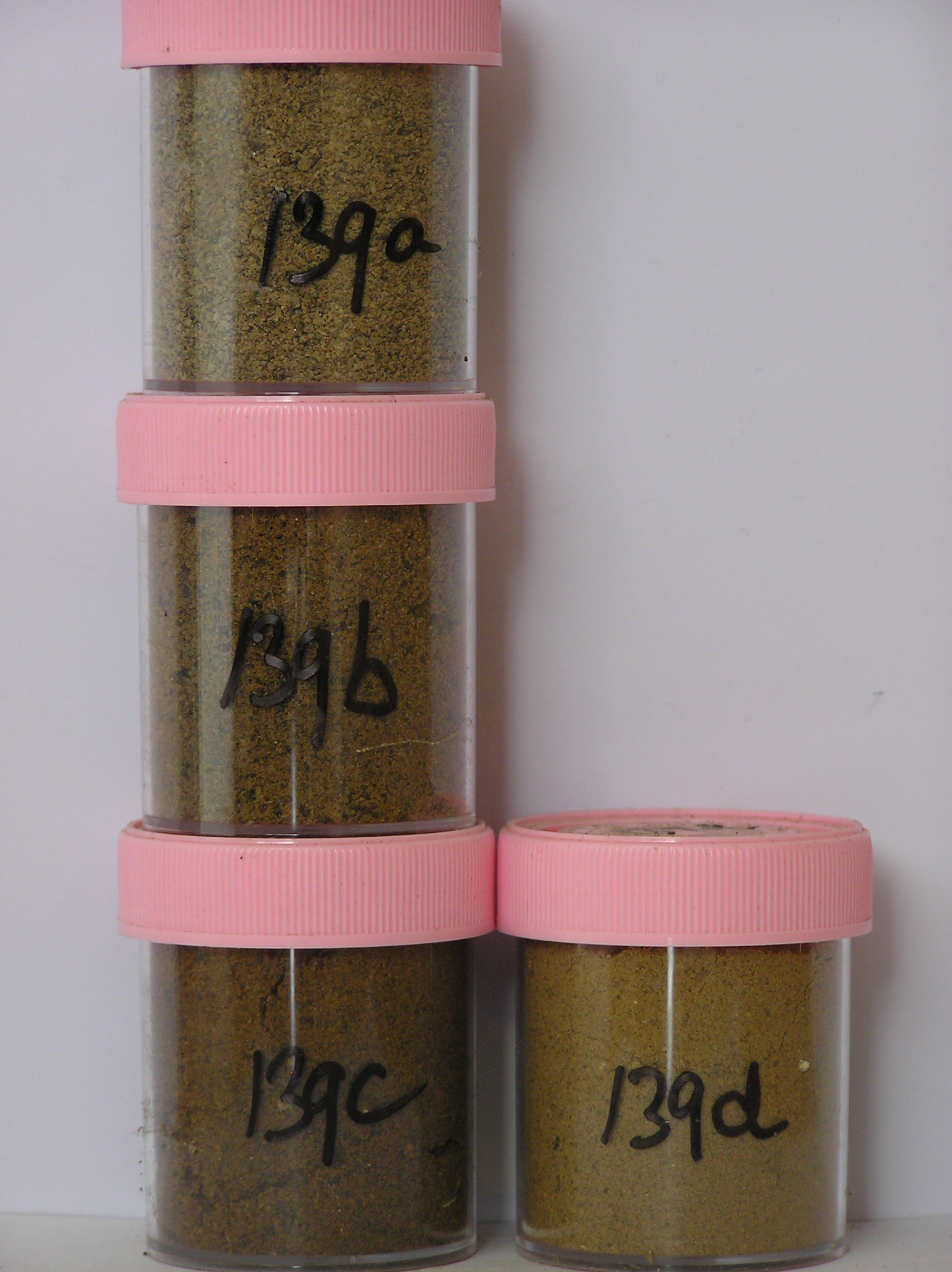
139a 0-3cm
201
dark yellowish brown (10YR 4/4) granular pebbly sand
202
weakly to moderately cohesive with a weakly developed crust
203
salt patches beneath the crust and some crystalline calcium carbonate accumulations
204
| rock particles subangular to subrounded, moderately stained partly coated with silt and clay and some moderately |
| altered |
205
abrupt boundary,
139b 3-13cm
301
light olive brown (2.5Y 5/6) cobbly, pebbly, granular sand
302
weakly cohesive
303
some salts in scattered accumulations
304
some sandstone and granite boulder to pebble sized ghosts
305
rock particles mainly subangular and moderately stained with some partly altered
306
distinct boundary,
139c 13-35cm
401
yellowish brown (10YR 5/8) bouldery, pebbly, silty sand
402
loose to weakly cohesive
403
abundant salt accumulations scattered throughout and adjacent to stones
404
| larger rock particles subangular and unstained, smaller particles subrounded and moderately stained with some |
| moderately altered |
405
diffuse boundary,
139d 35-55cm+
501
yellowish brown (10YR 5/4) bouldery silty sand
502
loose
503
larger rock particles subangular and unstained
2-0cm
101
surface cobbles, pebbles, granules and coarse sand
102
subrounded and moderately stained,
Yes
a,b,c,d
Dry frozen
0
4
Surfwea
| Some accumulation of small pebbles in hollows; a well developed stone pavement with some ventifacts and abraded clasts; some cavernous weathering of |
| sandstone and also dolerite; salts abundant beneath surface stones and some oxidised patches beneath sandstone clasts; a few boulders between 60-120cm |
| diameter |
| Soluble Salt |
| Concentration |
13900001
139a
0-3cm
0
3
none
13900002
139b
3-8cm
3
8
none
13900003
139c
10-30cm
10
30
none
13900004
139d
45-55cm
45
55
none
12-Dec-2005
Page 139 of 896
139