Ross Sea Region Soil Sites
141000
141
21-Jan-1965
IBC, GGC
Victoria Land, Trans-antarctic Mountains; Balham Valley, part of the McMurdo Sound Dry Valley system
Soil characterisation
USGS 1:250 000 1986; Ross Island and Vicinity, Antarctica
B&W Pro
No
161.0630
-77.4283
77deg 25.7'S
-161deg -3.8'E
cf. Notes for DESCR below
4
W
1,150
cf. Notes for GEOLAND below
(4o)
| Xerous to subxerous; the surface is almost totally covered with 2.5cm of snow from a recent |
| fall; there is no thawing and the soil is dry |
-26
Central mountain
Sandy silty till from dolerite, sandstone and granitic rocks; the fine fraction may be a little coarser that in soil 140
Some lichens on surface boulders
No patterned ground
| SURFACE WEATHERING or |
| SURFACE FEATURES |
| Surface boulders are up to 1.5m; dolerite boulders are moderately stained and subrounded; moderate to strong surface exfoliation; well developed pavement |
| with ventifacts; salts occur beneath surface stones |
Nil
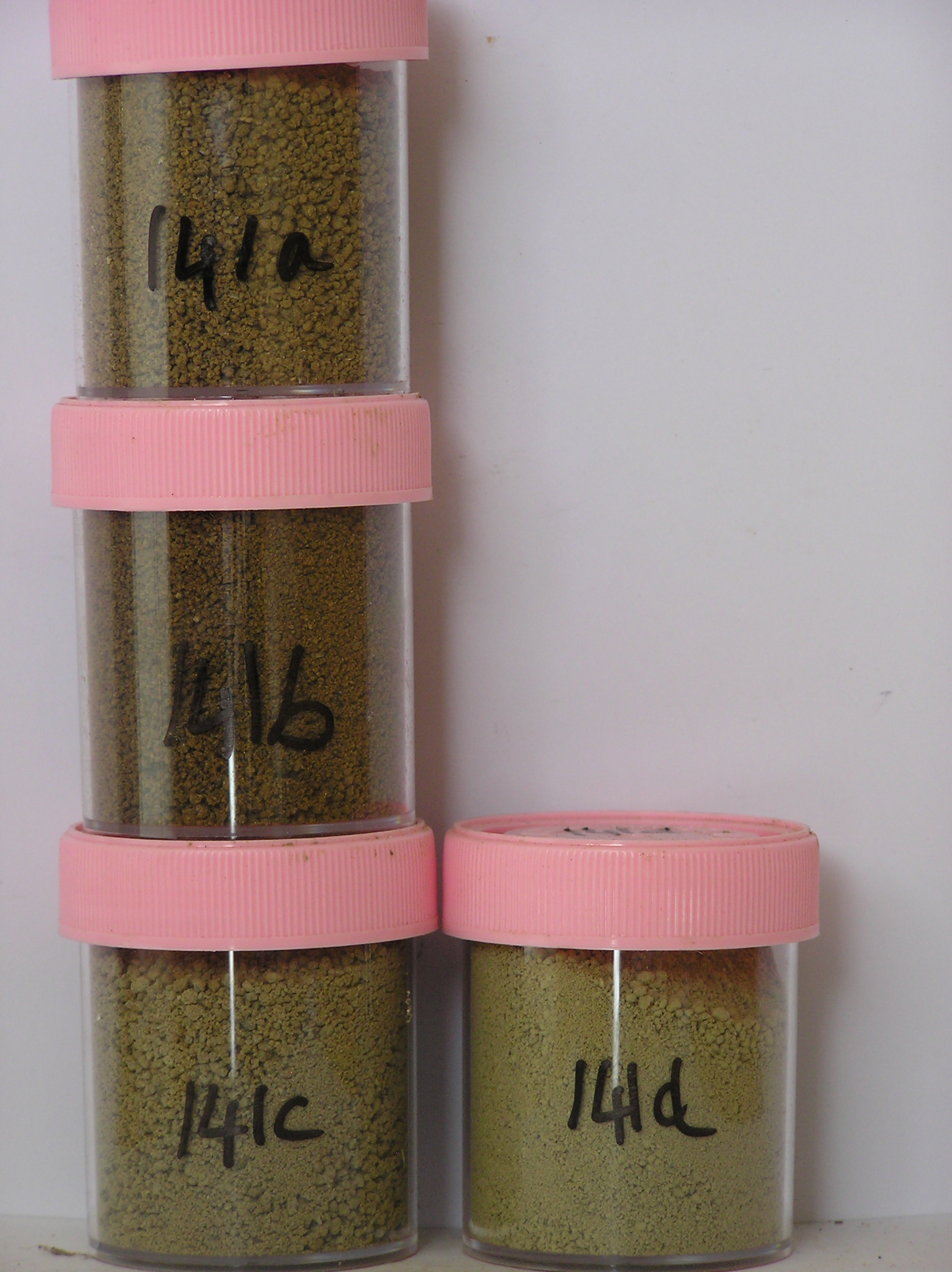
141a 0-1cm
201
yellowish brown (10YR 5/4) granular sandy pebble gravel
202
weakly to moderately cohesive with a distinct surface crust and moderately developed vesicular structure
203
some darker coloured patches where coarser particles are present
204
rock particles subangular to subrounded and strongly stained
205
diffuse boundary,
141b 1-15cm
301
yellowish brown (10YR 5/8) sandy silty gravel
302
moderately cohesive
303
salts as flecks and as concentrations beneath some larger clasts
304
rock particles subangular to subrounded and weakly stained
305
diffuse boundary,
141c 15-35cm
401
pale olive (5Y 6/2) sandy to silty bouldery gravel
402
loose to weakly cohesive
403
rock particles subangular to subrounded and unstained
404
diffuse boundary,
141d 35-70+cm
501
light grey (5Y 7/2) sandy to silty bouldery gravel
502
loose
503
rock particles subangular to subrounded and unstained
3-0cm
101
surface pebbles, cobbles and granular sand
102
subrounded and moderately to strongly stained,
Yes
a,b,c,d
Dry frozen
0
4
Descr
| About 9.5km SSW of Lake Vashka at the western end and on the top of the Insel Range; a broad undulating basin like surface with patches of till; the site is |
| about 50m N of site 140 on a gently sloping surface at the foot of a low bouldery ridge; although the sites are similar the soils are a little different |
Geoland
| Insel Drift is considered to represent the deposits of a former eastward flowing ice stream from an early glaciation; the till at this site occurs at a higher altitude |
| than some other deposits mapped as Insel Drift and forms small loops around the basin; some basement rocks may be present in the till; granite in the till may |
| indicate an up-valley source as in tills from the Asgard Range |
| Soluble Salt |
| Concentration |
14100001
141a
0-1cm
0
1
none
14100002
141b
2-12cm
2
12
none
14100003
141c
25-33cm
25
33
none
14100004
141d
60-68cm
60
68
none
12-Dec-2005
Page 141 of 896
141