Ross Sea Region Soil Sites
145000
145
23-Jan-1965
IBC, GGC
Victoria Land, Trans-antarctic Mountains; in Upper Victoria Valley, part of the McMurdo Sound Dry Valley system
Soil characterisation
USGS 1:250 000 1986; Ross Island and Vicinity, Antarctica
CS Lscp
No
161.5870
-77.3500
77deg 21.0'S
-161deg -35.2'E
cf. Notes for DESCR below
3
S
575
Small fans have formed as a result of rapid thaw of valley side snow or ice accumulations in nevees which, for a short period, provide a source of water to transport sediment
(3o)
Xerous to subxerous; the site is dry with little available moisture
23
Central mountain
Colluvial sands and fine gravels of mixed lithology
Nil observed
Weakly developed, non active nets
| SURFACE WEATHERING or |
| SURFACE FEATURES |
Moderately developed pavement surface but with little wind polish or ventifact formation; some slight staining and some thin coatings of calcium carbonate
Nil
1-0cm
101
small pebbles, granules and sand forming a distinct pebble pavement,
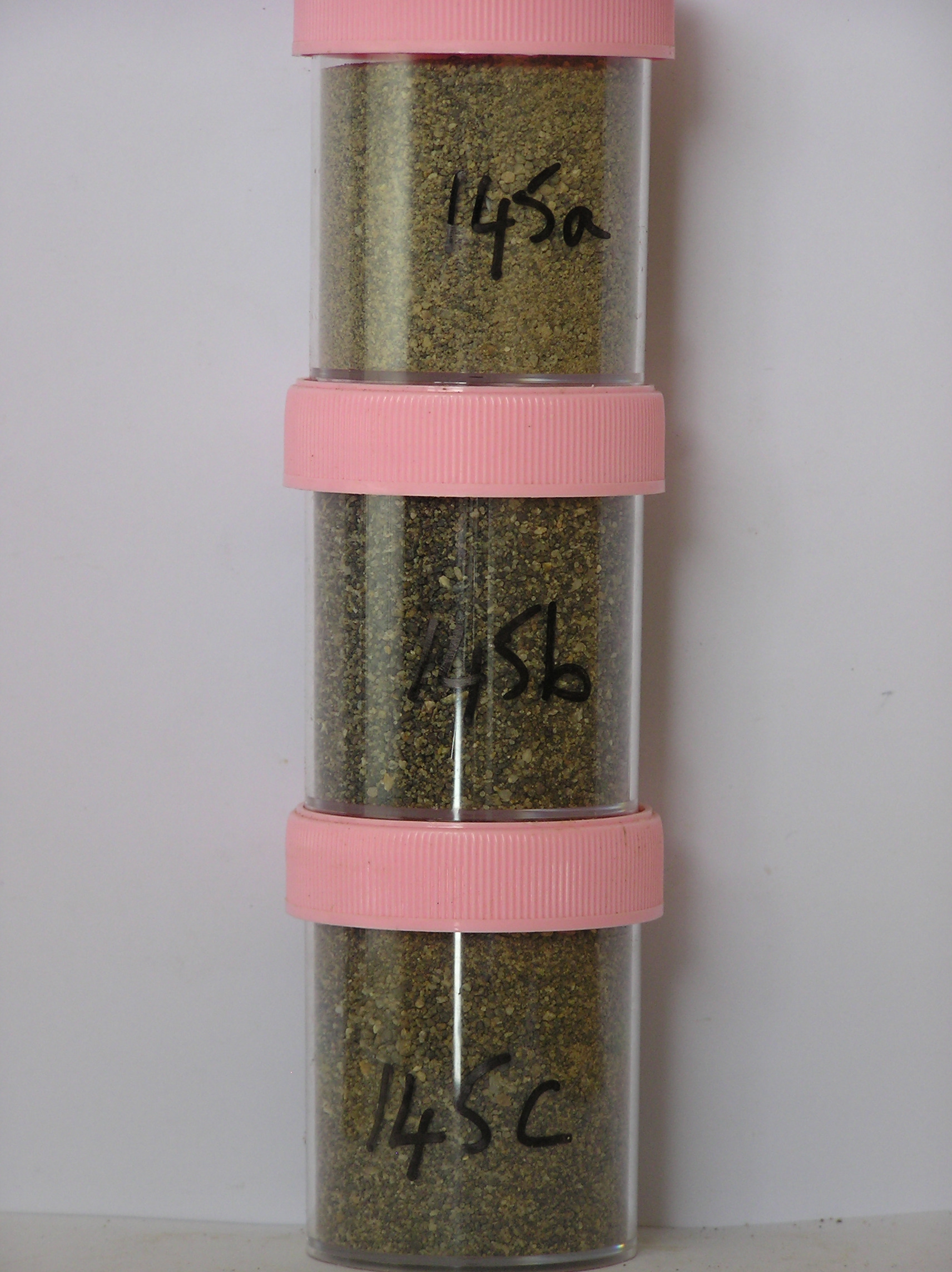
145a 0-4cm
201
pale brown (10YR 6/3) granular pebbly sand
202
loose to weakly cohesive
203
weakly developed vesicular structure
204
rock particles mainly subrounded and weakly stained,
145b 4-30cm
301
dark greyish brown (10YR 4/1) layered pebbly granular sand
302
loose
303
rock particles rounded to subrounded and weakly to moderately stained
304
indistinct boundary,
145c 30-45cm
401
greyish brown (10YR 5/2) gravelly sand
402
loose
403
rock particles rounded to subrounded and weakly to moderately stained
404
sharp boundary, on frozen ground
Yes
a,b,c
Hard ice-cemented
45
1
Descr
| on the lower slopes of Barwick Valley, approximately 6.5km E of lake Vashka; a low angle fan surface formed below a shallow gully cut in the north side of the |
| Barwick Valley; the site is on the lower toe slope of the fan surface where the soil profiles appear to show weakest development |
| Soluble Salt |
| Concentration |
14500001
145a
0-3cm
0
3
none
14500002
145b
5-15cm
5
15
none
14500003
145c
35-45cm
35
45
none
12-Dec-2005
Page 145 of 896
145