Ross Sea Region Soil Sites
213000
213
23-Nov-1969
IBC, GGC
Scott Glacier region, southern Trans-antarctic Mountains on Ackerman Ridge
Soil weathering examination
US Geological Survey 1:250 000, 1968, Mount Blackburn
B&W Lscp
No
-148.1000
-86.5600
86deg 33.6'S
148deg 6.0'E
On an east-west trending part of Ackerman Ridge about 300m above the Scott Glacier near the edge of a basin on the ridge
4
SW
2,050
Some of the higher slopes of Ackerman Ridge have old moraine deposits, judged by increased weathering; local rock appears to be granite
| Scattered small snow patches; weak soil crust in places suggests occasional surface |
| moistening |
-40
Inland Mountain
Granitic bouldery till and fines with a rock flour consistence; some boulders up to 4m but most around 0.3m
Nil Observed
Nil
| SURFACE WEATHERING or |
| SURFACE FEATURES |
| Rounding and surface oxidation of many boulders; undersides unstained indicating surface stability; some surface crumbling and spalling; pavement |
| moderately developed |
Nil
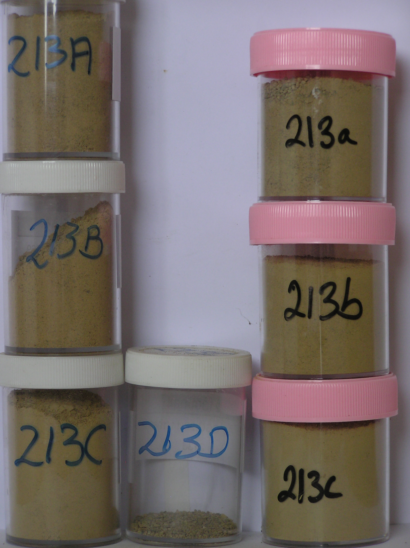
213 3-0cm
101
surface pebbles and granules forming a weakly developed pavement
102
angular to subangular and moderately stained,
213a 0-12cm
201
light yellowish brown (10YR 6/4) sandy to silty cobble and boulder gravel
202
loose but surface is weakly cohesive
203
rock particles mainly subrounded and unstained
204
indistinct boundary,
213b 12-25cm
301
light yellowish brown to brownish yellow (10YR 6/4 - 6/6) bouldery sandy to silty gravel
302
loose to weakly cohesive
303
few salt flecks with small accumulations round some rocks
304
larger clasts rounded to subrounded and some boulders with a weak surface oxidation
305
indistinct boundary,
213c 25-60cm
401
light yellowish brown to pale yellow (10YR 6/4 - 2.5YR 7/4) bouldery sandy to silty gravel
402
loose
403
rock particles subrounded and unstained
404
indistinct boundary,
213d
501
on loose sandy to silty till
Yes
a,b,c(x2),d
Dry frozen
60
3
(>60cm)
| Soluble Salt |
| Concentration |
21300001
64.00
21300002
71.00
21300003
68.00
21300004
74.00
21300001
21300002
21300003
21300004
gypsum
21300001
21300002
21300003
21300004
12-Dec-2005
Page 170 of 896
213