Ross Sea Region Soil Sites
228000
228
28-Nov-1969
IBC, GGC
Scott Glacier region, southern Trans-antarctic Mountains on the east side of Bartlett Glacier
Soil weathering examination
US Geological Survey 1:250 000 1968, Nilsen Plateau
B&W Pro
No
-152.2830
-86.4083
86deg 24.5'S
152deg 17.0'E
| Table Top, a small peak on the east side of Bartlett Glacier, 13km SE of Mt Gardiner and 9km NW of Mt Denauro; on a broad undulating till-covered ridge approximately 100 |
| below the crest |
3
N
1,975
| The upper surface of Table Top has a cover of till which shows a moderate degree of weathering; the till has a typical sandy/silty rock flour fine fraction; granite, dolerite and |
| sandstone clasts indicate a non local source |
Scattered snow patches but no indications of snow thaw or liquid water
-38
Inland Mountain
Sandy to silty bouldery till from granite dolerite and sandstone
Nil at site
Weakly developed broad nets
| SURFACE WEATHERING or |
| SURFACE FEATURES |
| Small to medium sized boulders, subangular to subrounded, with negligible pavement formation; distinct to strong surface staining and some clasts |
| polished; some surface exfoliation; salt accumulations beneath some clasts |
Nil
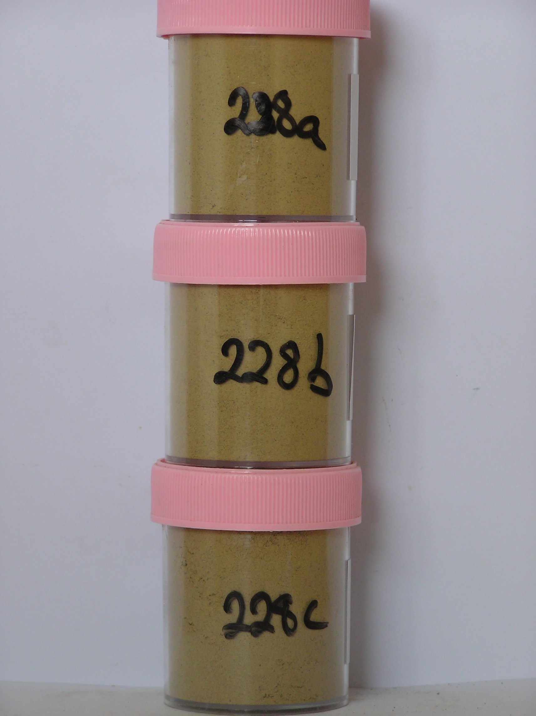
228 3-0cm
101
surface boulders, pebbles and granules
102
moderately to strongly stained and some exfoliated
228a 0-3cm
201
brownish yellow (10YR 6/6) granular pebbly silty sand
202
loose to weakly cohesive
203
weakly developed vesicular structure
204
a few scattered salts
205
rock particles subrounded and weakly stained
206
distinct boundary,
228b 3-15cm
301
brownish yellow to light yellowish brown (10YR 6/6 - 6/4) silty granular bouldery gravel
302
indistinct zone of salts around 10- 12cm
303
loose
304
| rock particles subangular to subrounded and weakly stained and a few some with thin reddish yellow (7.5YR |
| 5/8) coatings |
305
indistinct boundary,
228c 15-40cm
401
brownish yellow to light yellowish brown (10YR 6/6 - 6/4) sandy gravel
402
loose
403
rock particles subangular to subrounded and weakly stained
404
sharp boundary, on ice
Yes
a,b,c
Dry frozen over stagnant ice?
40
3
(40cm)
| Soluble Salt |
| Concentration |
22800001
76.00
22800002
72.00
22800003
57.00
22800001
22800002
22800003
22800001
22800002
22800003
12-Dec-2005
Page 185 of 896
228