Ross Sea Region Soil Sites
247000
247
12-Dec-1969
IBC, GGC
Scott Glacier region, southern Trans-antarctic Mountains on the Watson Escarpment
Soil weathering examination
US Geological Survey 1:250 000 1968, Mount Blackburn
CS Lscp
No
-146.1000
-86.2333
86deg 14.0'S
146deg 6.0'E
| Valley floor surface at the head of Long Valley; a series of glacial retreat surfaces with hummocky patterned ground topography; the site is on the north side of the valley on |
| remnant bench surface |
0
Nil
1,750
cf. Notes for GEOLAND below
Scattered snow patches but no thaw observed
-35
Inland Mountain
Bouldery till and accumulated fragmental erosion detritus with boulders up to 1.5m
Nil observed
| SURFACE WEATHERING or |
| SURFACE FEATURES |
Distinct staining on dolerite boulders and also some pitting; some cavernous weathering; salts beneath some surface boulders
Nil
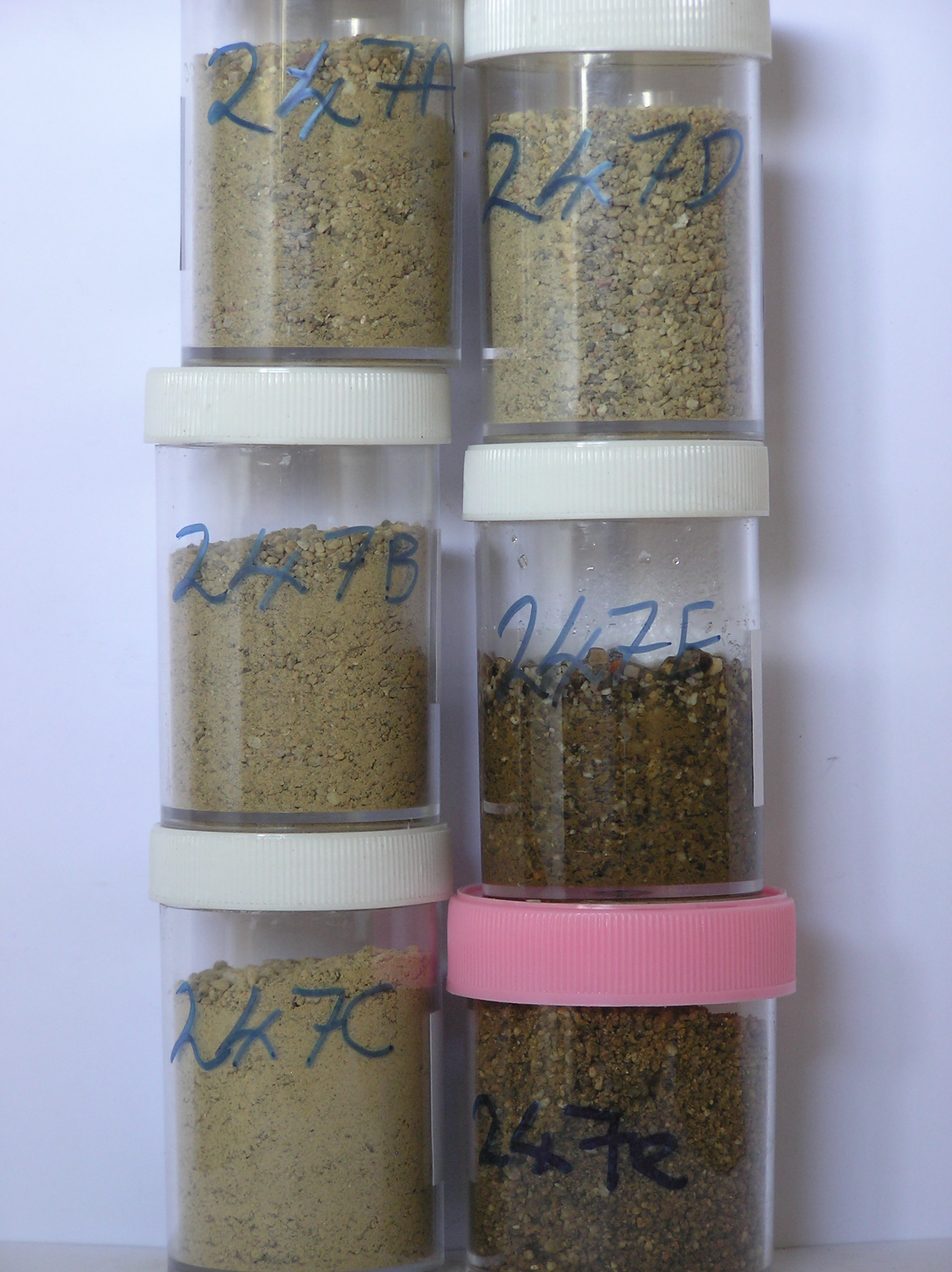
247 5-0cm
101
surface boulders, pebbles and granular sand
102
some distinct surface staining
103
salt beneath some clasts,
247a 0-3cm
201
| light yellowish brown (2.5Y 6/4) sandy granular pebble gravel but brownish yellow (10YR 6/6) where salt |
| patches are present |
202
loose but cohesive where salts are present
203
patchy distinct salt accumulations
204
rock particles angular to subangular with some slight alteration but some clasts distinctly altered
205
distinct boundary,
247b 3-20cm
301
light yellowish brown to olive yellow (2.5Y 6/4 - 6/6) sandy to slightly silty gravel
302
loose
303
rock particles subangular to subrounded with some weak alteration
304
indistinct boundary,
247c 20-25cm
401
light yellowish brown (2.5Y 6/4) sandy to slightly silty gravel
402
loose
403
rock particles subangular to subrounded
404
some weak surface staining
405
indistinct boundary
406
247d 25-60cm
501
pale yellow (2.5Y 7/4) sandy gravel
502
loose
503
rock articles sub angular to subrounded
504
some very weak surface staining
505
sharp boundary, on ice-cemented ground
Yes
a,b,c,d,e
Dry frozen over ice-cemented
60
3
(60cm)
Geoland
| The valley floor moraines are formed by northward down-valley retreat of ice from Long Valley; moraine patterns are complicated by local ice stranding on the |
| valley sides; the soils and till on benches on the valley side may be older than on the valley floor; the till composition reflects the geology of local rocks, |
| dominantly granite with some sandstone and dolerite |
| Soluble Salt |
| Concentration |
24700001
55.00
24700002
61.00
24700003
69.00
24700004
69.00
24700005
71.00
24700001
24700002
24700003
24700004
24700005
gypsum/calcite
24700001
24700002
24700003
24700004
24700005
12-Dec-2005
Page 204 of 896
247