Ross Sea Region Soil Sites
255000
255
19-Dec-1969
IBC, GGC
Scott Glacier region, southern Trans-antarctic Mountains, at the junction of the Albanus and Scott Glacier at Mt Zanuck
Soil weathering examination
US Geological Survey 1:250 000 1968, Mount Goodale
B&W Lscp
No
-150.6500
-85.9333
85deg 56.0'S
150deg 39.0'E
North of a saddle on a ridge to the NE of Mt Zanuck; an old high and broad sloping moraine surface with patterned ground
8
N
1,575
cf. Notes for GEOLAND below
Few snow patches and no snow thaw observed
-35
Central Mountain
Bouldery till with predominantly biotite granite
Nil observed
Subdued patterned ground with cracks filled with exfoliated and crumbled granite
| SURFACE WEATHERING or |
| SURFACE FEATURES |
| Exfoliation and disaggregation has exposed large feldspar crystals (up to 8cm); distinct surface staining on boulders but no cavernous weathering; some |
| slight ventifaction |
Nil
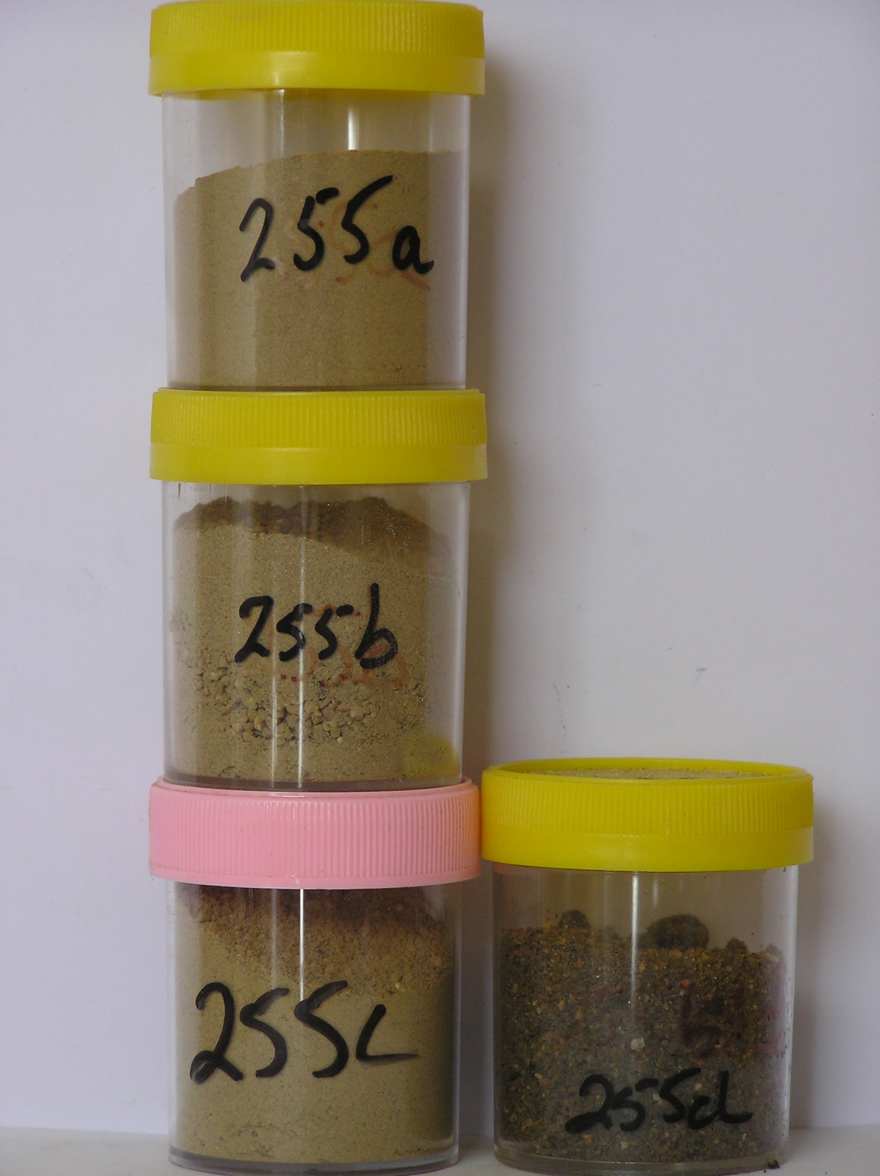
255 2-0cm
101
surface granular sand and rounded boulders with distinct staining on boulders,
255a 0-5cm
201
brownish yellow (10YR 6/6) silty to sandy granular to bouldery gravel
202
loose
203
salts beneath some surface boulders
204
rock particles subangular and weakly stained
205
indistinct boundary,
255b 5-25cm
301
light yellowish brown (10YR 6/4) silty to sandy granular to bouldery gravel
302
loose
303
rock particles subangular to subrounded with some boulders and cobbles disaggregating
304
indistinct boundary,
255c 25-40cm
401
light yellowish brown (10YR 6/4) silty to sandy gravel
402
loose
403
rock particles subangular to subrounded
404
sharp boundary, on hard ice-cemented ground,
255d
501
salty soil beneath surface stones
Yes
a,b,c,d
Dry frozen over ice-cemented
40
4
(40cm)
Geoland
| Rocks on Mt Zanuck are mainly granites, some with very coarse feldspar crystals; on the high altitude northern slopes old cirque basins have till deposits, |
| possibly lateral or terminal moraine, which appear to have remained undisturbed; subsequent glacial activity seems to have trimmed the lower slopes of the |
| Zanuck massif |
| Soluble Salt |
| Concentration |
25500002
50.00
46.40
16.10
15.80
5.00
7.50
7.30
1.40
0.40
25500003
44.00
44.10
14.60
16.50
6.40
9.00
8.30
1.60
0.42
25500004
56.40
13.00
13.40
3.80
4.80
5.70
2.30
0.34
25500001
67.00
43.20
12.90
15.40
6.40
8.60
8.70
4.20
0.46
25500002
6.40
1.00
7.00
2.80
4.10
0.20
2.80
9.00
0.60
25500003
6.50
0.50
9.10
0.60
2.10
0.10
3.00
3.60
0.40
25500004
5.90
3.20
1.10
62.00
53.00
3.10
2.00
138.00
90.00
25500001
6.00
3.40
12.40
25.50
11.90
0.30
3.90
38.20
1.20
25500002
50
15
10
10
5
3
7
25500003
60
10
20
5
5
25500004
70
5
15
10
25500001
50
5
25
3
10
4
12-Dec-2005
Page 212 of 896
255