Ross Sea Region Soil Sites
260000
260
27-Dec-1969
IBC, GGC
Scott Glacier region, southern Trans-antarctic Mountains, on the West side of the Robert Scott Glacier near Cox Peaks
Soil weathering examination
Nilsen Plateau
B&W Lscp
No
-153.7000
-86.0250
86deg 1.5'S
153deg 42.0'E
On a south facing valley side in a valley just north of Cox Peaks; on the lower slopes of the valley side on a steep scree slope, about 75m above the valley floor
34
S
1,200
cf. Notes for GEOLAND below
Patchy snow cover is present; the soil was slightly damp
30
Central Mountain
Silty till from predominantly granitic rocks
Nil observed
Weakly developed
| SURFACE WEATHERING or |
| SURFACE FEATURES |
The surface is unstable if disturbed but there are no debris cones at the base of the slope; most boulders are rounded and have some light surface staining
Nil
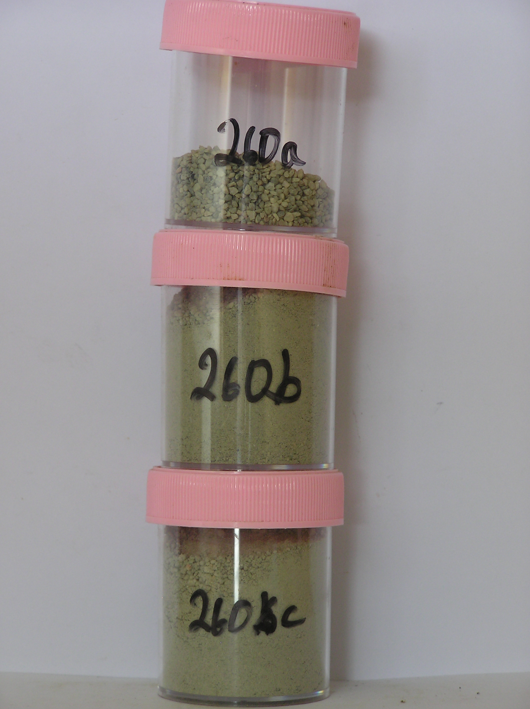
260a 6-0cm
101
surface boulders, pebbles and granules
102
subrounded and weakly stained,
260b 0-12cm
201
light olive grey (5Y 6/2) silty to sandy bouldery to granular gravel
202
weakly cohesive
203
weakly developed vesicular structure
204
slightly moist
205
rock particles subangular to subrounded and unstained
206
distinct boundary,
260c 12-37cm
301
light olive grey silty to sandy bouldery to granular gravel
302
loose
303
a few fine salt flecks
304
rock particles subangular to sub rounded and unstained
305
sharp boundary
306
on ice cemented ground
Yes
a,b,c
Hard ice-cemented
37
2
(37cm)
Geoland
| Argillaceous sediments and volcanic and acid volcanic rocks, comprising conglomerates and breccias and intruded by granites occur in the area; the valley was |
| formerly invaded by Ross Ice Shelf ice which entered the mouth to a level of around 1550m; subsequent retreat has left younger lower altitude surfaces which |
| are distinctly demarcated from higher elevation surfaces; the steep slopes have scree-like granitic till deposits from the retreating and lowering ice |
| Soluble Salt |
| Concentration |
26000001
4.00
26000002
53.00
26000003
54.00
26000001
26000002
26000003
26000001
26000002
26000003
12-Dec-2005
Page 217 of 896
260