Ross Sea Region Soil Sites
261000
261
28-Dec-1969
IBC, GGC
Scott Glacier region, southern Trans-antarctic Mountains, on the West side of the Robert Scott Glacier near Cox Peaks
Soil weathering examination
Nilsen Plateau
B&W Lscp & Pro
No
-153.3170
-86.0333
86deg 2.0'S
153deg 19.0'E
Eastern end of the Cox Peaks range in a small NE trending hanging valley, about 150m above the ice level, on the valley floor and on a small moraine ridge;
0
Nil
1,200
cf. Notes for GEOLAND below
| Scattered snow patches but no liquid thaw observed; probably some occasional surface soil |
| moistening |
30
Central Mountain
Bouldery granitic till with occasional dolerite
Nil observed
Nil
| SURFACE WEATHERING or |
| SURFACE FEATURES |
Surface boulders show some weak staining; minor exfoliation; few diffuse salts beneath some clasts
Nil
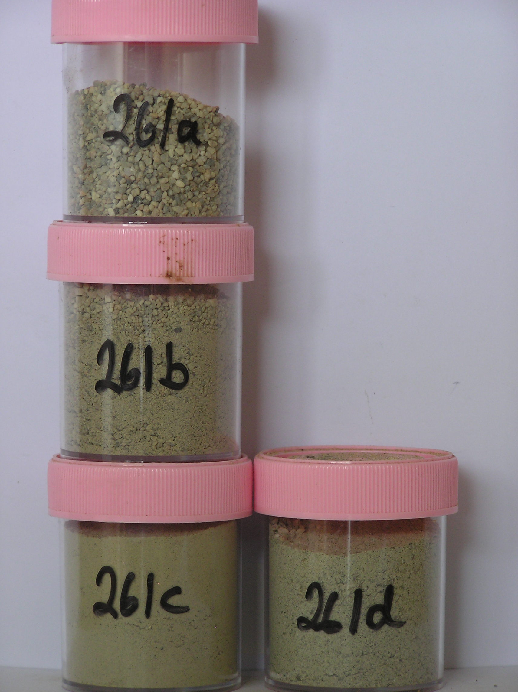
261a 5-0cm
101
surface granules to boulders
102
mainly subrounded but very weakly stained,
261b 0-7cm
201
very pale brown (10YR 7/3) sandy granular to bouldery gravel
202
loose to weakly cohesive
203
slightly moist
204
weakly developed vesicular structure
205
few salt flecks
206
rock particles subangular to sub rounded and non to very weakly stained
207
distinct boundary,
261c 7-37cm
301
pale yellow (2.5Y 7/4 - 5Y 7/3) sandy to silty cobble gravel
302
moderately cohesive
303
rock particles angular to subangular and unstained
304
sharp boundary,
261d 37-65cm
401
light grey (5Y 7/2) bouldery sandy to silty gravel
402
loose
403
rock particles angular to subrounded and unstained, on loose bouldery till
Yes
a,b,c,d
Dry frozen
65
2
(>65cm)
Geoland
| Argillaceous sediments and volcanic and acid volcanic rocks, comprising conglomerates and breccias and intruded by granites occur in the area; the valley was |
| formerly invaded by Ross Ice Shelf ice which entered the Cox Peaks basin to level of around 1550m; the hanging valleys are part of a former landscape that has |
| been invaded by later ice advances; ice has retreated out of the valley leaving older soils and deposits at higher levels |
| Soluble Salt |
| Concentration |
26100001
26100002
64.00
42.00
18.50
21.90
6.30
4.80
3.40
2.90
0.16
26100003
61.00
41.80
15.60
15.60
5.00
8.00
7.60
6.20
0.13
26100004
49.00
38.80
20.50
19.90
4.90
8.20
5.10
2.50
0.12
26100001
26100002
6.40
0.03
0.20
0.04
0.04
0.05
0.03
0.20
0.01
26100003
7.30
1.20
7.00
6.60
2.00
0.60
1.50
2.20
0.50
26100004
7.50
1.35
4.60
14.50
1.30
0.30
0.80
3.60
0.30
26100001
26100002
45
10
5
5
5
15
5
10
26100003
46
6
14
6
14
6
10
26100004
40
10
15
10
10
15
12-Dec-2005
Page 218 of 896
261