Ross Sea Region Soil Sites
309000
309
18-Nov-1972
IBC, GGC
Taylor Dry Valley, McMurdo Dry Valley region near Lake Bonney
Soil weathering examination
USGS 1:50,000 Antarctic Topo. Ser. Lake Bonney Quadrangle
B&W Pro & Lsc
No
162.4830
-77.6833
77deg 41.0'S
-162deg -29.0'E
| Approximately 2.8km NW from the NE end of Lake Bonney, and 1km SE of Matterhorn; on a till covered uneven bench surface; a small gravelly patch in a bouldery surface; |
| on the west side of a low mound 20m from the crest |
5
E
1,050
| Granite outcrops in nearby exposures along with dolerite intrusives; although the surface is close to the La Croix and Matterhorn Glaciers, weathering features indicate an |
| advanced age for the surface; the till is probably from the Matterhorn Glacier |
(5o)
A dry site with no adjunct snow patches or evidence of snow thaw
-24
Central Mountain
Granitic bouldery sandy till with some dolerite
Nil observed
Nil
| SURFACE WEATHERING or |
| SURFACE FEATURES |
cf. Notes for SURFWEA below
Nil
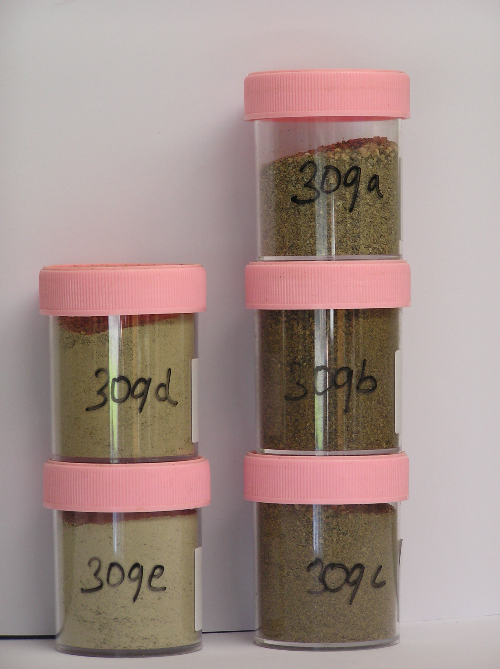
309a 3-0cm
101
surface cobbles, pebbles and granular sand
102
rock particles subangular to subrounded with variable moderate to weak staining
103
a few particles weakly altered,
309b 0-5cm
201
light yellowish brown (2.5Y 6/4) sandy pebble gravel
202
loose
203
rock particles subrounded and weakly stained
204
some coarse grained particles crumbly
205
indistinct boundary,
309c 5-25cm
301
light olive brown (2.5Y 5/4) sandy bouldery gravel
302
rock particles mainly subangular and unstained but some weakly stained,
309d 25-45cm
401
pale yellow (2.5Y 7/4) bouldery gravel
402
weakly cohesive
403
weakly frosted
404
rock particles angular and unstained,
309e 45-60cm
501
light grey (2.5Y 7/2) bouldery gravel
502
moderately cohesive
503
pulverulent
504
rock particles angular and unstained
Yes
a,b,c,d,e
Dry frozen
60
3
(>60cm)
Surfwea
| Some large upstanding granite boulders (2-3m length) with weak cavernous weathering and sculptured forms; surface boulders dominantly subrounded to |
| rounded, some granites crumbling but others with oxidised and case hardened surfaces; a well developed pebble/cobble pavement between boulders with weak |
| ventiforms and some pitting |
| Soluble Salt |
| Concentration |
30900001
32.00
30900002
92.00
30900003
81.00
30900004
68.00
30900005
65.00
30900001
30900002
30900003
30900004
30900005
30900001
30900002
30900003
30900004
30900005
12-Dec-2005
Page 266 of 896
309