Ross Sea Region Soil Sites
332000
332
27-Nov-1972
IBC, GGC
Taylor Dry Valley, McMurdo Dry Valley region, Rhone Glacier
Soil weathering examination
USGS 1:50,000 Antarctic Topo. Ser. Lake Bonney Quadrangle
B&W+CS Lsc & Pro
No
162.1000
-77.6883
77deg 41.3'S
-162deg -6.0'E
| 4.5km N of Taylor Glacier and 550m from the edge of the Rhone Glacier; on the oldest and slightly uneven but gently sloping moraine surface derived from a former extension |
| of the Rhone Glacier |
6
S
1,325
cf. Notes for GEOLAND below
(6o)
| Soil dry; some small snow patches; some small snow melt patches on rock surfaces; no soil |
| moistening observed |
-25
Inland Mountain
Sandy gravel till from mixed granite, dolerite and sandstone
Nil observed
| Old non-active patterned ground with fine gravel accumulations in patterned ground cracks; a distinct wedge of granular gravel in the profile probably |
| indicates former patterned ground activity |
| SURFACE WEATHERING or |
| SURFACE FEATURES |
cf. Notes for SURFWEA below
Nil
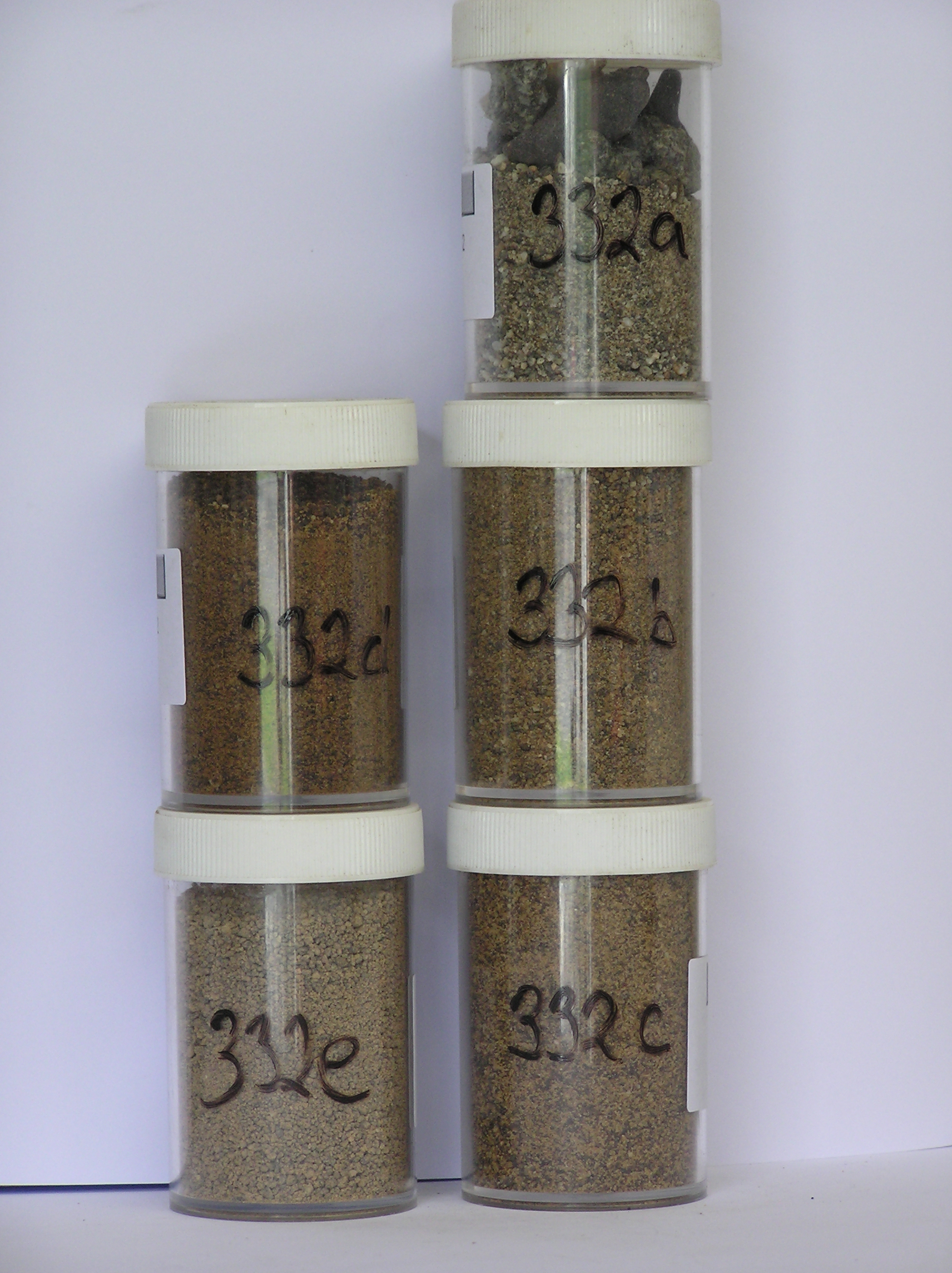
332a 2-0cm
101
surface pebbles and granular sand
102
subrounded and weakly to moderately stained,
332b 0-5cm
201
yellowish brown (10YR 5/6) sandy granular gravel
202
weakly cohesive
203
weakly developed vesicular structure
204
rock particles subrounded, weakly to moderately stained and some weakly altered
205
distinct boundary,
332c 5-16cm
301
yellowish brown (10YR 5/6) sandy granular gravel
302
weakly cohesive
303
few distinct scattered salt flecks with concentrations around fragmenting rocks
304
rock particles subrounded, weakly stained and some weakly altered
305
some partly crumbled dolerite clasts
306
indistinct boundary,
332d 16-50cm
401
yellowish brown (10YR 5/6) sandy gravel
402
weakly cohesive
403
rock particles subrounded and weakly stained and some partly altered
404
some brown oxidised patches around some clasts
405
sharp boundary,
332e 50-60cm
501
very pale brown (10YR 7/3) sandy gravel
502
very firm, ice cemented
Yes
a,b,c,d,e
Hard ice-cemented
60
3/4
(60cm)
Geoland
| The Rhone Glacier has a series of till deposits that increase in age in a SW direction away from the present glacier position; not far from the glacier edge, the till |
| passes into till-free granite bedrock with well developed cavernous weathering; the weathering sequence suggests that there may have been little fluctuation of |
| the Rhone Glacier from its present position; this furthermost till is the most weathered of the sequence |
Surfwea
| Few small boulders with some well developed cavernous weathering; moderately developed ventiforms; some rocks with distinct staining on flat surfaces; |
| coarse grained rocks with well developed granular disintegration; a subdued surface with a moderately developed predominantly pebble pavement |
| Soluble Salt |
| Concentration |
33200001
43.00
33200002
88.00
22.60
39.30
31.60
1.50
1.00
1.40
2.20
0.33
33200003
99.00
23.20
40.90
31.50
1.30
1.00
0.90
0.90
0.27
33200004
82.00
28.30
35.00
29.70
1.80
1.70
1.80
1.20
0.38
33200005
76.00
34.00
35.90
22.60
1.40
1.40
1.60
2.70
0.57
33200001
33200002
7.90
0.60
3.90
7.20
2.00
0.20
4.00
16.70
0.60
33200003
7.30
0.90
3.40
13.00
1.20
0.20
3.40
17.00
0.50
33200004
6.50
0.50
6.10
0.30
0.70
0.20
5.40
0.30
1.00
33200005
6.50
0.40
4.60
0.70
0.90
0.20
3.50
2.20
0.50
33200001
33200002
40
20
15
15
10
33200003
40
30
30
33200004
40
30
20
10
33200005
40
5
20
5
10
10
10
12-Dec-2005
Page 289 of 896
332