Ross Sea Region Soil Sites
345000
345
2-Dec-1972
IBC, GGC
Wright Valley, McMurdo Dry Valley region
Soil weathering examination
USGS 1:50,000 Antarctic Topo. Ser. Labyrinth Quadrangle
B&W Pro & Lsc
No
160.7000
-77.5750
77deg 34.5'S
-160deg -42.0'E
cf. Notes for DESCR below
4
W
950
cf. Notes for GEOLAND below
(4o)
A dry site but some small scattered snow patches
-24
Central Mountain
Dolerite/sandstone bouldery sandy till; one schistose rock observed; the till may include much reworked material from the older adjacent landscapes
Nil observed
Weakly developed broad nets
| SURFACE WEATHERING or |
| SURFACE FEATURES |
cf. Notes for SURFWEA below
Nil
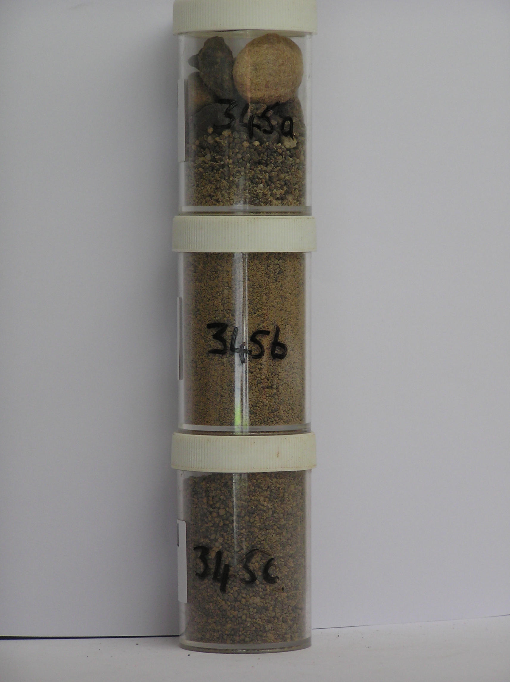
345a 4-0cm
101
surface cobbles, boulders and granular sand
102
weakly to moderately stained
103
sandstone clasts unstained and non case hardened,
345b 0-5cm
201
light yellowish brown (10YR 6/4) cobbly sandy gravel
202
weakly to moderately cohesive
203
moderately developed vesicular structure
204
rock particles subrounded and weakly to moderately stained
205
distinct boundary,
345c 5-18cm
301
light yellowish brown (10YR 6/4) gravelly granular sand
302
slightly moist
303
rock particles subrounded, moderately stained and some partly altered
304
sharp boundary, on ice-cemented ground
Yes
a,b,c
Hard ice-cemented
18
3
(18cm)
Descr
| South side of the Labyrinth, upper Wright Valley, approximately 0.5km SE of the SE corner of the Wright Upper Glacier; on a lateral moraine surface about |
| 100m above the Labyrinth surface; a smooth but gently sloping terrace or bench-like surface about 10m from the escarpment edge |
Geoland
| The Labyrinth has a negligible till cover with the Wright Upper Glacier carrying only occasional supraglacial boulders; in a more extended form more debris |
| was probably carried as lateral drift; this lateral moraine gives an indication of the former extent and age of previous advances or retreat stages of the Wright |
| Upper Glacier |
Surfwea
| Scattered surface boulders from 1-4m showing some abrasion weak exfoliation and granular disintegration and weak ventiforms; boulders upstanding to 50cm; a |
| close packed cobble and boulder pavement but weakly deflated; slight to moderate surface staining; some weathering may be inherited |
| Soluble Salt |
| Concentration |
34500001
15.00
28.70
52.10
14.40
0.80
0.70
1.50
1.60
0.17
34500002
85.00
35.00
35.60
19.20
1.30
1.20
2.20
5.00
0.43
34500003
97.00
39.20
43.90
13.50
0.30
0.40
0.20
2.00
0.38
34500001
8.90
0.41
1.30
0.04
0.06
1.30
0.40
0.80
34500002
8.00
0.65
2.80
0.30
0.70
0.03
1.40
1.10
0.70
34500003
8.80
0.02
0.30
0.05
34500001
75
10
15
34500002
90
5
5
34500003
100
12-Dec-2005
Page 302 of 896
345