Ross Sea Region Soil Sites
353000
353
7-Dec-1972
IBC, GGC
Wright Valley, McMurdo Dry Valley region, The Dais
Soil weathering examination
USGS 1:50,000 Antarctic Topo. Ser. Lake Vanda Quadrangle
B&W Pro & B&W+CS Lsc
No
161.1580
-77.5500
77deg 33.0'S
-161deg -9.5'E
The w end of Dais, about 750m E of a small hill; a broad gently undulating till covered surface on an even smooth surface and on the S side of the Dais
3
S
825
cf. Notes for GEOLAND below
(3o)
Dry site, few snow patches
-23
Central Mountain
sandy gravel till from predominantly granite with some dolerite
Nil observed
Nil
| SURFACE WEATHERING or |
| SURFACE FEATURES |
| A well developed pebble pavement with occasional small boulders; moderately developed ventiforms and boulder faceting; granites with some cavernous |
| weathering; dolerite with some staining and showing some exfoliation; salts beneath some surface stones |
Nil
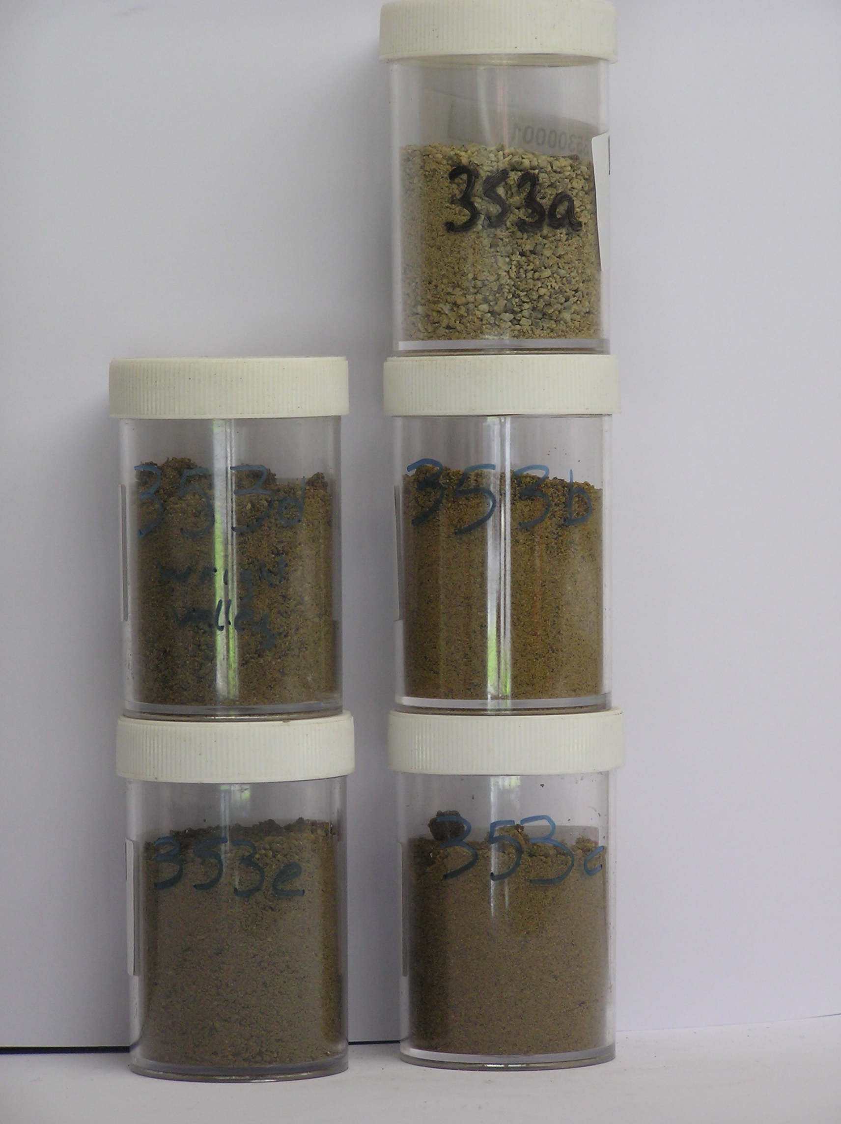
353a 2-0cm
101
surface pebbles and granular sand
102
granites weakly stained, dolerite weak to moderately stained, subrounded,
353b 0-5cm
201
olive yellow (2.5Y 6/6) sandy gravel
202
moderately cohesive
203
moderately developed vesicular structure
204
rock particles subangular and weakly stained but some crumbly
205
distinct boundary,
353c 5-15cm
301
light olive brown (2.5Y 5/6) very sandy gravel
302
moderately cohesive
303
many small diffuse salt flecks mostly concentrated around stones
304
rock particles subangular and unstained
305
indistinct boundary,
353d 15-55cm
401
light olive brown (2.5Y 5/6) sandy gravel
402
moderately to firmly cohesive
403
few scattered salt flecks
404
rock particles subangular and unstained
405
indistinct boundary,
353e 55-70cm
501
olive yellow (2.5Y 6/6) sandy gravel
502
moderately cohesive
503
rock particles angular and unstained
504
indistinct boundary, on sandy gravel
Yes
a,b,c,d,e
Dry frozen
70
3
(>70cm)
Geoland
| Dais is a prominent geomorphic feature formed partly from the dolerite sill influence and also from prolonged erosion; because of the island like |
| geomorphology, the till is not subject to local alpine influences but should represent major glacial activity in Wright Valley; further north some large marble |
| clasts were observed suggesting the possibility of up-valley ice influence |
| Soluble Salt |
| Concentration |
35300001
35300002
35300003
35300004
35300005
35300006
35300001
35300002
35300003
35300004
35300005
35300006
gypsum
35300001
35300002
35300003
35300004
35300005
35300006
12-Dec-2005
Page 310 of 896
353