Ross Sea Region Soil Sites
367000
367
14-Dec-1972
IBC, GGC
McMurdo Dry Valley region; McKelvey Valley
Soil weathering examination
USGS 1:50,000 Antarctic Topo. Ser. Victoria Upper Lake Quadrangle
B&W Pro & B&W+CS Lsc
No
162.5530
-77.4550
77deg 27.3'S
-162deg -33.2'E
| On the S side of McKelvey Valley at its junction with Bull Pass; a bench or high terrace surface on the NE side of Bull Pass; a moderately even surface, somewhat bouldery |
| with shallow sandy gravel depressions |
5
N
1,200
| Tills in Victoria and McKelvey Valleys are part of a sequence of old glacial deposits; the sequence history is less well known than those of Wright Valley; this surface is a little |
| lower than the Insel Range and could have similar aged soils |
(5o)
Snow patches; thaw from recent snow; soil moistening to 8cm in patches
-24
Coastal Mountain
Dolerite, sandstone and granite sandy to bouldery gravel till
(-24oC)
Nil observed
Non active but some old raised border polygons
| SURFACE WEATHERING or |
| SURFACE FEATURES |
cf. Notes for SURFWEA below
Nil
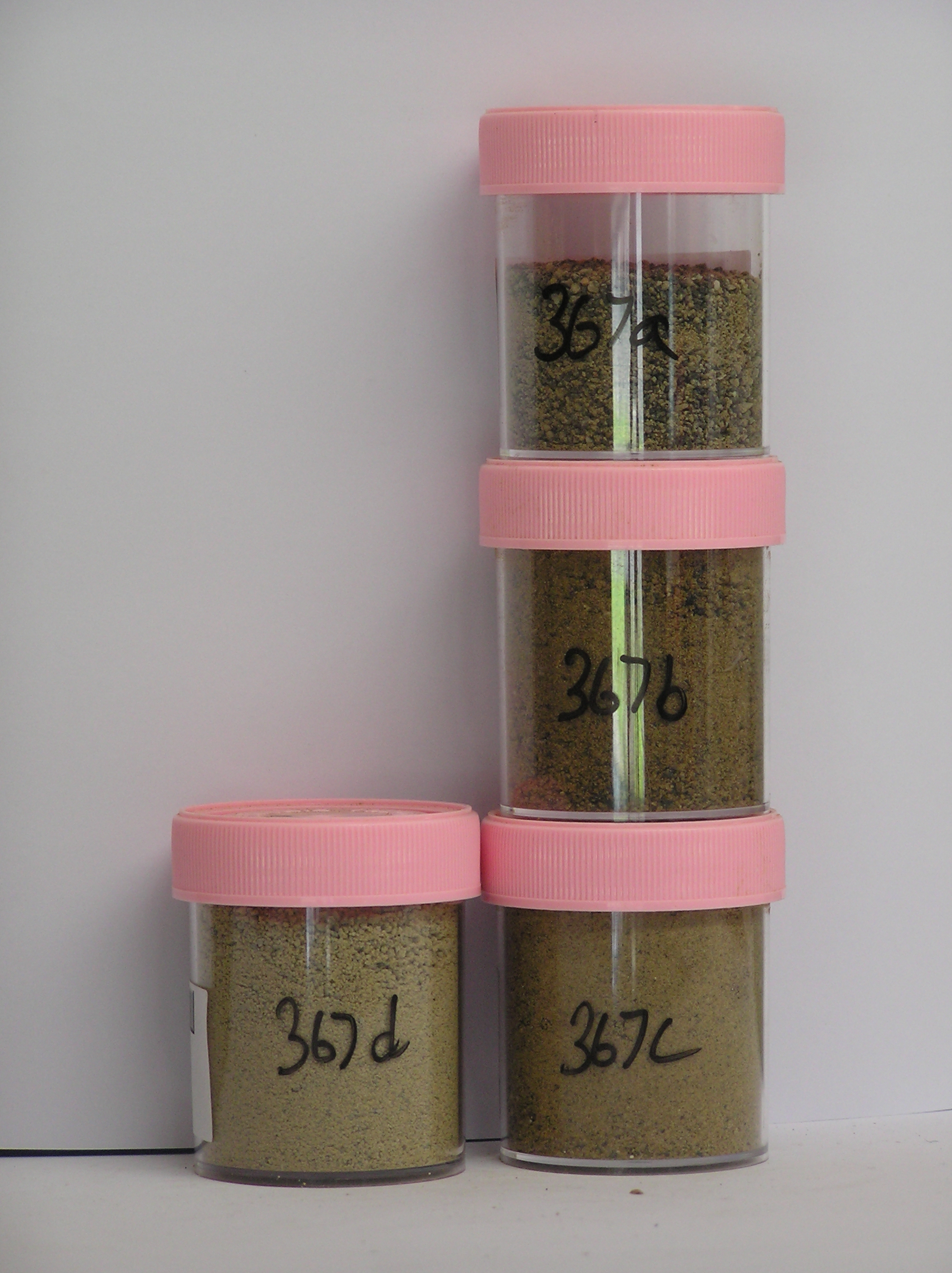
367a 1-0cm
101
surface boulders and cobbly granular sand
102
rock particles subangular to subrounded, moderately stained and some partly altered,
367b 0-5cm
201
light yellowish brown (2.5Y 6/4) sandy gravel
202
moderately to firmly cohesive
203
strongly developed vesicular structure
204
rock particles subangular and moderately stained with some partly crumbled
205
sharp wavy boundary,
367c 5-15cm
301
olive yellow (2.5Y 6/6) granular sandy gravel
302
firmly cohesive
303
salt cemented
304
distinct irregular salt horizon with greatest accumulation beneath surface boulders
305
rock particles subangular to subrounded and weakly stained
306
indistinct boundary,
367d 15-35cm
401
pale yellow (2.5Y 7/4) bouldery sandy gravel
402
moderately cohesive
403
rock particles mainly subangular to subrounded, weakly stained and some slightly crumbly
404
sharp boundary, on hard frozen ground
Yes
a,b,c,d
Dry frozen
35
4
(35cm)
Surfwea
| Scattered medium boulders rounded with some fragmentation; a moderate pebble pavement in between; dolerite boulders well stained; some pitting and |
| cavernous weathering; granites moderately crumbled; fine grained rocks polished; salts beneath surface stones |
| Soluble Salt |
| Concentration |
36700001
35.00
36700002
62.00
36700003
89.00
36700004
80.00
36700001
36700002
36700003
36700004
36700001
36700002
36700003
36700004
12-Dec-2005
Page 324 of 896
367