Ross Sea Region Soil Sites
385000
385
21-Nov-1977
IBC, GGC
Wright Valley at the Western end in the Asgard Range, at the SW end of Koenig Valley, approximately 0.8km SE of Mt Thor
Soil weathering examination
USGS, Antarctica 1:50,000 Topo. Ser. 1977 Labyrinth Antarctica
CS Lscp
No
160.7670
-77.6050
77deg 36.3'S
-160deg -46.0'E
An older moraine surface at a lower elevation on an uneven, slightly sloping surface
3
N
1,550
cf. Notes for GEOLAND below
(3o)
| Recent 3 cm snowfall with some thawing and water films on rock surfaces and some |
| moistening of the soil surface |
-30
Inland Mountain
Doleritic till, shallow over ice-cemented ground
Nil observed
Weakly developed nets
| SURFACE WEATHERING or |
| SURFACE FEATURES |
Surface boulders moderately rounded many clasts strongly oxidised; well developed pitting on some clasts on both upper and lower surfaces
Nil
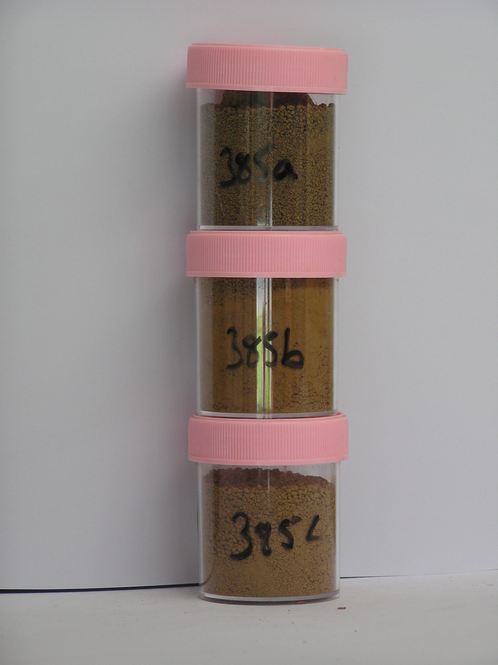
385a 2-0cm
101
surface boulders, cobbles and sandy gravel
102
moist
103
| rounded to subrounded, many strongly stained and moderately to strongly altered with yellowish red (5Y 5/8) |
| internal oxide coatings, |
385b 0-8cm
201
strong brown (7.5YR 5/6) sandy gravel
202
moderately to firmly cohesive
203
strongly developed vesicular structure
204
rock particles mainly subrounded and weakly stained with slight to moderate alteration
205
sharp boundary,
385c 8-10cm
301
strong brown (7.5YR 5/6) sandy gravel
302
ice cemented
303
rock particles subrounded and moderately stained
Yes
a,b,c
hard ice-cemented
8
4
(8cm)
Geoland
| The Asgard Range is comprised of Beacon Sandstone and Ferrar Dolerite; the landscape is ancient with the high altitude valley cirques cut in pre Miocene time; |
| subsequent glaciation has been restricted mainly to valley head cirque type activity; the glacial deposits represent accumulations of local head wall materials |
| which have probably been weathered in place before incorporation into local glaciers; the moraine sequence is complex |
| Soluble Salt |
| Concentration |
38500001
30.00
38500002
94.00
38500003
72.00
38500001
38500002
38500003
38500001
38500002
38500003
12-Dec-2005
Page 342 of 896
385