Ross Sea Region Soil Sites
392000
392
24-Nov-1977
IBC, GGC
Wright Valley at the Western end in the Asgard Range, at the NE end of Koenig Valley, approximately 1.2km N of Mt Freya
Soil weathering examination
USGS, Antarctica 1:50,000 Topo. Ser. 1977 Labyrinth Antarctica
CS & B&W & Lscp
No
160.8500
-77.6000
77deg 36.0'S
-160deg -51.0'E
A broad sloping slightly hummocky bouldery bench surface towards the mouth of Koenig Valley on the E side; the site is near the centre of an even sloping part of the surface
3
NW
1,725
cf. Notes for GEOLAND below
(3o)
A snow covered surface but some thaw on rock surfaces; soil surface mainly dry
-30
Inland Mountain
Dolerite and sandstone bouldery till
Nil observed
Nil
| SURFACE WEATHERING or |
| SURFACE FEATURES |
cf. Notes for SURFWEA below
Nil at site but previous activity in the area
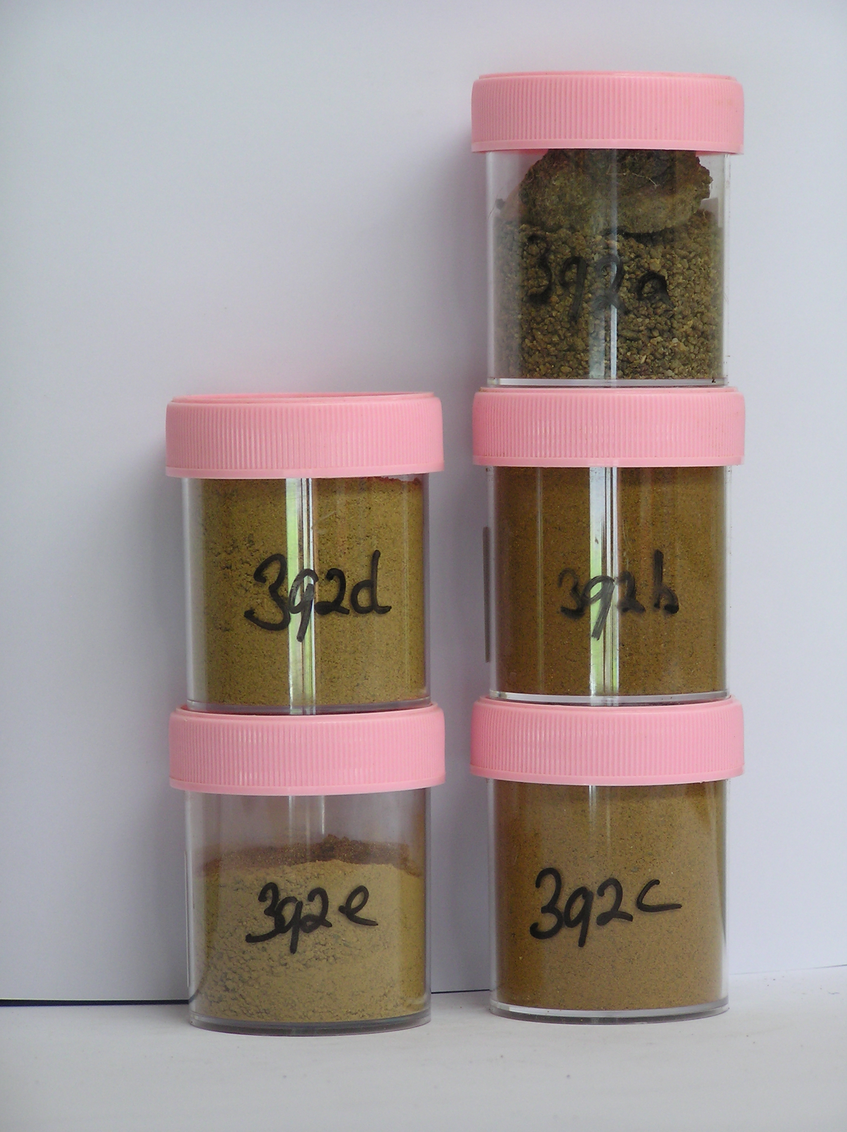
392a 2-0cm
101
surface granular sand between larger boulders
102
clasts strongly stained and many polished
103
distinct ventiforms,
392b 2-8cm
201
strong brown to yellowish brown (7.5YR 5/8 - 10YR 5/6) bouldery sandy gravel with a few reddish patches
202
moderately cohesive
203
moderately developed vesicular structure
204
scattered diffuse salt flecks
205
some dolerite and sandstone ghosts
206
dolerite rock particles subrounded, stained and moderately altered
207
indistinct boundary,
392c 8-28cm
301
yellowish brown (10YR 5/6) bouldery sandy gravel
302
weakly cohesive
303
few scattered salt flecks
304
some sandstone ghosts
305
rock particles mainly angular with some moderately altered
306
indistinct boundary,
392d 28-45cm
401
brownish yellow (10YR 6/6) bouldery sandy gravel
402
loose
403
rock particles subangular and mainly unstained
404
sharp boundary,
392e 45-50cm
501
dark yellowish brown (10YR 4/4 moist) ice cemented sandy gravel
Yes
a,b,c
Hard ice-cemented
45
4
(45cm)
Geoland
| The Asgard Range is comprised of Beacon Sandstone and Ferrar Dolerite; the landscape is ancient with the high altitude valley cirques cut in pre-Miocene time; |
| Koenig Valley has a similar moraine and till sequence to that found in Sessrumnir Valley; the high shoulder surfaces may relate to early valley filling ice |
| episodes as soils here tend to be the oldest; this surface is above the level at which granite erratics are found |
Surfwea
| Predominantly dolerite boulders, up to 1m but many having fractured; most show some rounding with strong surface staining; fine grained dolerite strongly |
| pitted; marked exfoliation of coarse grained dolerite; sandstone clasts with reddish oxide coatings and showing marked cavernous weathering; salts beneath |
| some surface stones |
| Soluble Salt |
| Concentration |
39200001
22.00
39200002
66.00
39200003
63.00
39200004
74.00
39200005
53.00
39200001
39200002
39200003
39200004
39200005
39200001
39200002
39200003
39200004
39200005
12-Dec-2005
Page 349 of 896
392