Ross Sea Region Soil Sites
394000
394
25-Nov-1977
IBC, GGC
Wright Valley at the Western end in the Asgard Range, at the NE end of Koenig Valley, approximately 1.2km NW of Mt Freya
Soil weathering examination
USGS, Antarctica 1:50,000 Topo. Ser. 1977 Labyrinth Antarctica
CS Pro & B&W Lscp
No
160.8170
-77.6250
77deg 37.5'S
-160deg -49.0'E
On the west sloping side of Koenig Valley floor on an uneven surface with weakly developed patterned ground; the site is near the centre of a polygon unit
6
NW
1,520
cf. Notes for GEOLAND below
(6o)
Small patchy snow remnants; dry soil after previous slight surface moistening
-30
Inland Mountain
Sandy gravel till from dolerite and sandstone
Nil observed
Broad 10-15m nets with weakly raised borders and <15cm troughs, weakly developed and mostly inactive
| SURFACE WEATHERING or |
| SURFACE FEATURES |
| A moderately developed cobble and pebble pavement with some dolerite boulders cavernously weathered and most showing distinct rounding; moderate to |
| strong surface staining; fine grained dolerite weakly pitted; some sandstone clasts disaggregated |
Nil
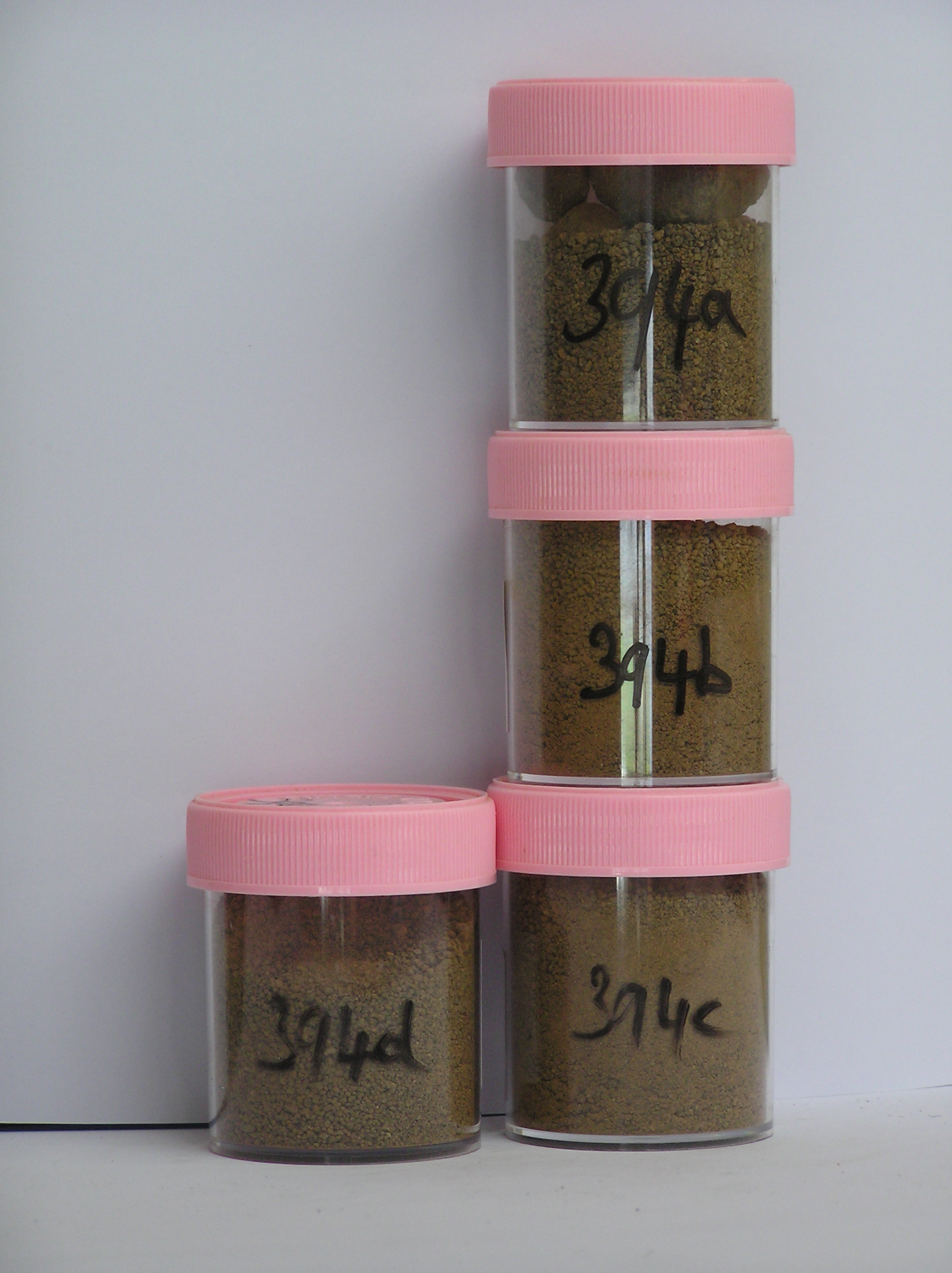
394a 2-0cm
101
surface pebbles and granular sand
102
mainly subrounded moderately to strongly stained and partly altered,
394b 0-5cm
201
brown to dark brown (7.5YR 4/4) sandy gravel
202
moderately cohesive
203
moderately developed vesicular structure
204
rock particles subrounded to subangular, moderately stained and weakly to moderately altered
205
indistinct boundary,
394c 5-20cm
301
yellowish brown to dark yellowish brown (10YR 5/4 - 4/4) sandy gravel
302
a few fine salt flecks
303
loose to weakly cohesive
304
rock particles subrounded to subangular and weakly stained
305
sharp boundary,
394d 20-25cm
401
ice cemented ground
Yes
a,b,c,d
0
3
Geoland
| The Asgard Range is comprised of Beacon Sandstone and Ferrar Dolerite; the landscape is ancient with the high altitude valley cirques cut in pre-Miocene time; |
| patterned ground covers part of the valley floor surface but is generally weakly expressed with some cracks appearing inactive; soil near the centre of the |
| polygon appears to be somewhat more weathered than at the edge |
| Soluble Salt |
| Concentration |
39400001
22.00
39400002
88.00
39400003
77.00
39400004
68.00
39400005
39400001
39400002
39400003
39400004
39400005
39400001
39400002
39400003
39400004
39400005
12-Dec-2005
Page 351 of 896
394