Ross Sea Region Soil Sites
467000
467
14-Dec-1979
IBC, GGC
West Antarctica in Ellsworth Land at the southern end of the Ellsworth Mountains
Soil weathering and salts examination
US Geological Survey, 1:250 000, 1967, Union Glacier
CS Lscp & Pro
No
-81.0250
-79.7833
79deg 47.0'S
81deg 1.5'E
cf. Notes for DESCR below
0
Nil
580
cf. Notes for GEOLAND below
| Soil in the lowest horizon is moist; it is likely that the site may have been more moist in the |
| past |
-20
Inland/Coastal Mountain
Argillitic till with thick salt precipitation
Nil observed
Nil
| SURFACE WEATHERING or |
| SURFACE FEATURES |
Surface rocks are angular with a thick incrustation of precipitated salts
Nil
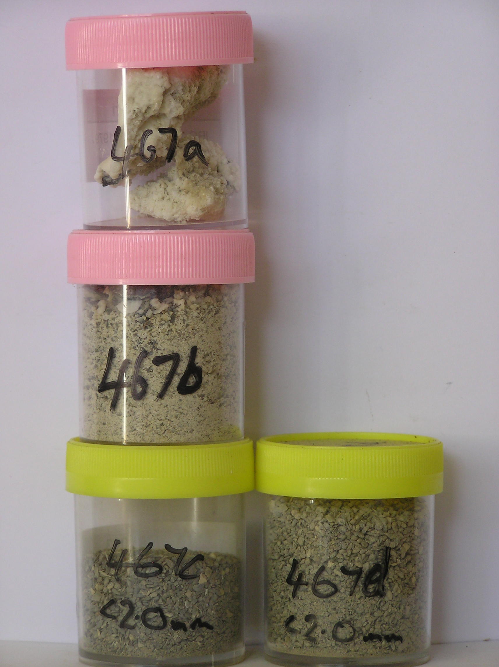
467a 2-0cm
101
surface salt crust incrustation
102
deposit is firmly crystalline, calcareous, botryoidal and partly to completely coating surface rocks,
467b 0-5cm
201
salts beneath the surface crust
202
profuse crystals with growths on rock particles
203
moderately cohesive
204
rock particles angular and unstained,
467c 5-10cm
301
light grey to grey (5Y 6/1) granular gravel
302
loose
303
some rock particles with thin calcium carbonate coatings
304
rock particles angular and unstained
305
distinct boundary,
467d 10-15cm
401
greyish brown (2.5Y 5/2) granular gravel
402
moist
403
rock particles angular and unstained
Yes
a,b,c,d
15
2
(>15cm)
Descr
| Meyer Hills in the southeast of the Heritage Range, approximately 2km northeast of Beaudoin Peak on the valley floor till; a small 1 square meter area in a small |
| slight hollow with a concentrated surface precipitation of salts; the area is close to site 466 |
Geoland
| The Ellsworth Mountains comprise a thick sequence of folded metasedimentary rocks comprising limestones, conglomerates and quartzites dating to |
| Precambrian; the West Antarctic Ice Sheet is believed to have fluctuated greatly in response to global sea level changes and evidence of these fluctuations should |
| be present in the tills and soil weathering record; the Meyer Hills are predominantly quartzitic sandstones |
| Soluble Salt |
| Concentration |
46700001
46700002
46700003
13.90
56.20
21.50
12.50
3.50
2.10
2.30
1.00
0.50
46700004
65.00
59.80
20.00
10.80
2.70
1.50
2.70
1.60
0.50
46700001
gypsum
46700002
gypsum
46700003
7.50
0.23
0.14
1.23
0.19
0.02
0.02
1.04
0.01
46700004
8.30
0.07
0.04
0.30
0.06
0.02
0.02
0.30
0.01
46700001
46700002
46700003
46700004
12-Dec-2005
Page 424 of 896
467