Ross Sea Region Soil Sites
501000
501
14-Jan-1983
IBC, GGC
Convoy Range, Trans-antarctic Mountains, in the valley of the Northwind Glacier
Soil characterisation
B&W & CS Pro & Lscp
No
161.0400
-76.7133
76deg 42.8'S
-161deg -2.4'E
cf. Notes for DESCR below
2
N
475
cf. Notes for GEOLAND below
Xerous to subxerous; the soil is >1m above an unfrozen pond and is moist throughout
-23
Central mountain
Fluvially reworked doleritic till
Algae are absent in this highly saline pond but are present in an adjacent less saline lake
Nil
| SURFACE WEATHERING or |
| SURFACE FEATURES |
| Salt encrustations are thick close to the water level covering boulders as well as fine soil material; salt encrusted rocks are unstained but beyond the saline |
| zone, there is weak staining on surface rocks |
Nil
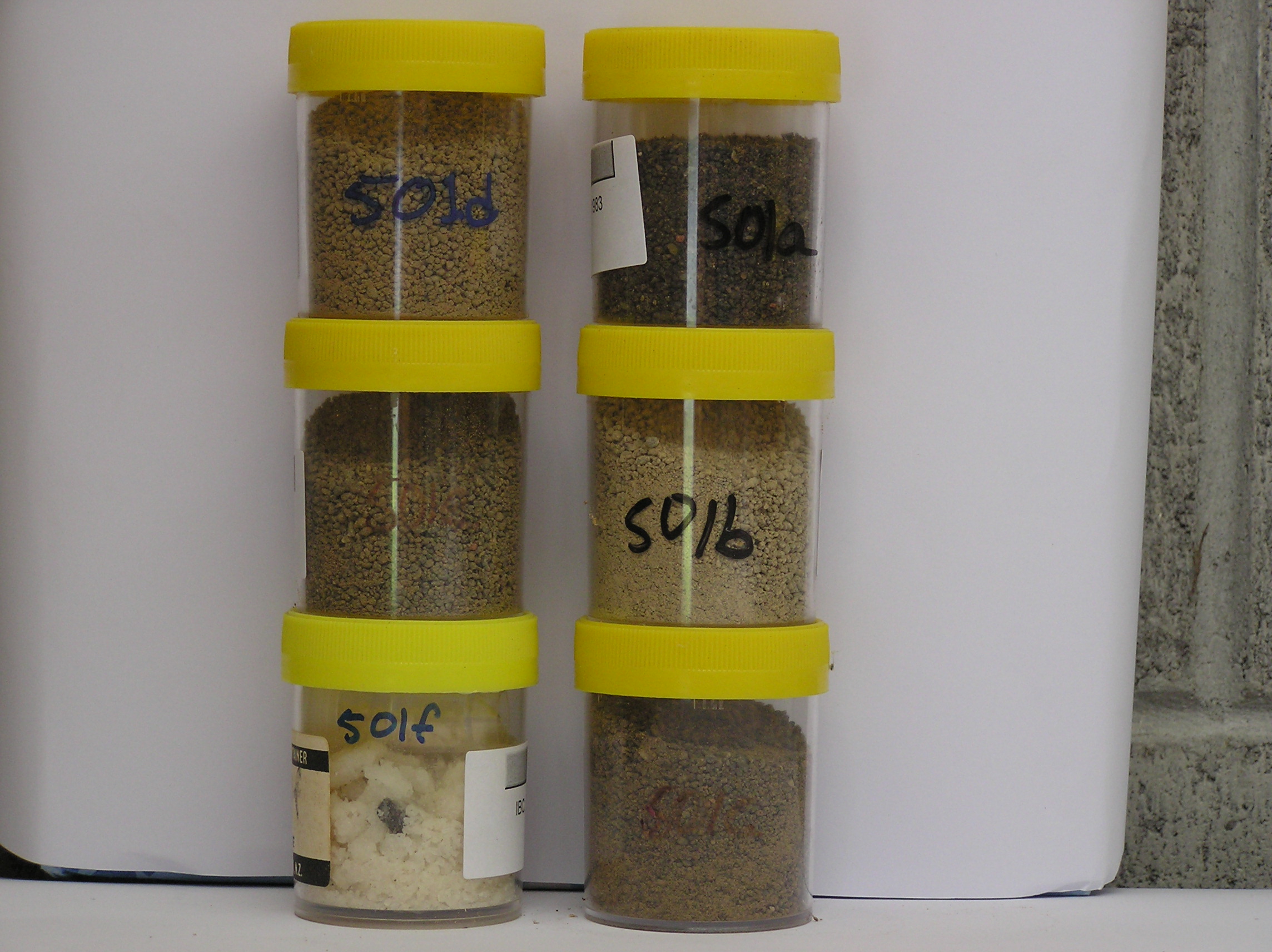
501a 1-0cm
101
surface salt incrustation
501b 0-3cm
201
dark brown (10YR 3/3) sandy pebbly granular gravel
202
moist
203
moderately cohesive
204
rock particles subangular, and very weakly stained
205
sharp boundary
501c 3-5cm
301
brown to dark brown (10YR 4/3) granular gravel
302
moist
303
slightly sticky
304
rock particles subangular to subrounded, weakly stained and moderately altered
305
sharp boundary,
501d 5-14cm
401
dark yellowish brown (10YR 3/6) pebbly granular gravel
402
moist
403
loose
404
rock particles subangular to subrounded, weakly stained and weakly altered
405
distinct boundary,
501e 14-18cm
501
dark yellowish brown (10YR 4/4) pebbly granular gravel
502
moist slightly sticky
503
rock particles subrounded to subangular, unstained and weakly altered
504
diffuse boundary,
501f 18-30cm
601
dark brown (10YR 3/4) pebbly granular gravel
602
moist
603
moderately cohesive
604
rock particles subrounded, weakly stained and unaltered
Yes
a,b,c,d,e,f
30
2
(>30cm)
Descr
| Approximately 1km from the SW end of the Northwind Glacier, in a deep landscape depression; the site is close to a small saline pond which has extensive salt |
| encrustations immediately adjacent to, and below the water line; the site is midway between the edge of the pond and the upper level of the salt encrusted |
| surface; the depression (>1km across) is a glacially formed hole similar to that found in other places in Antarctica |
Geoland
| The large depression formed in dolerite has possibly formed through glacial scour by ice coming from a previously enlarged Polar Plateau Ice Sheet; there have |
| been subsequent ice advances from NE filling much of the Northwind Valley; the latest ice advances have retreated down valley leaving successively younger |
| surfaces; the lower altitude surfaces of the Northwind Valley have deposits of young till that have been proglacially reworked as well as freshly exposed, little |
| fractured bedrock |
| Soluble Salt |
| Concentration |
50100001
37.00
47.00
37.00
12.00
2.00
1.00
1.00
1.00
0.11
50100002
63.00
44.00
24.00
14.00
5.00
4.00
7.00
3.00
0.16
50100003
50.00
43.00
28.00
17.00
6.00
3.00
2.00
2.00
0.17
50100004
58.00
39.00
27.00
16.00
6.00
4.00
5.00
3.00
0.18
50100005
42.00
39.00
28.00
13.00
7.00
4.00
3.00
2.00
0.13
50100006
50100001
8.70
6.00
26.00
9.50
5.50
0.05
20.50
9.20
5.30
50100002
9.10
1.05
4.80
1.10
0.52
0.02
2.20
2.00
1.10
50100003
9.10
1.41
6.40
1.00
0.60
0.02
0.70
2.30
1.10
50100004
9.10
0.98
4.70
0.47
0.30
0.01
0.50
2.60
0.50
50100005
9.10
0.92
4.10
0.75
0.39
0.03
0.01
2.00
0.50
50100006
gypsum
50100001
disordered mica and smectite
50100002
disordered mica and smectite
50100003
disordered mica and smectite
50100004
35
25
15
25
50100005
30
10
30
10
20
50100006
12-Dec-2005
Page 459 of 896
501