Ross Sea Region Soil Sites
522000
522
4-Jan-1988
IBC, GGC
Convoy Range, Transantarctic Mountains; Alatna Valley
Soil weathering examination and permafrost examination
Ross Island & Vicinity, Antarctica, 1:250 000 US Geological Survey, 1986
CS Pro & Lscp
No
161.0500
-76.9083
76deg 54.5'S
-161deg -3.0'E
Approximately 2km east of Battleship Promontory; on the lower south slope of Alatna Valley; 20m below the crest of a minor moraine ridge on the valley side
4
N
925
cf. Notes for GEOLAND below
(4o)
Occasional summer snowfalls; site is dry with no adjacent snow patches
-28
Coastal Mountain, xerous to subxerous
Sandy gravel derived from sandstone, dolerite and some granite; a wedge of paler coloured and finer textured material in the profile is an old patterned ground crack
Some lichen in cracks in boulders
Weakly developed broad hummocky nets
| SURFACE WEATHERING or |
| SURFACE FEATURES |
cf. Notes for SURFWEA below
Nil
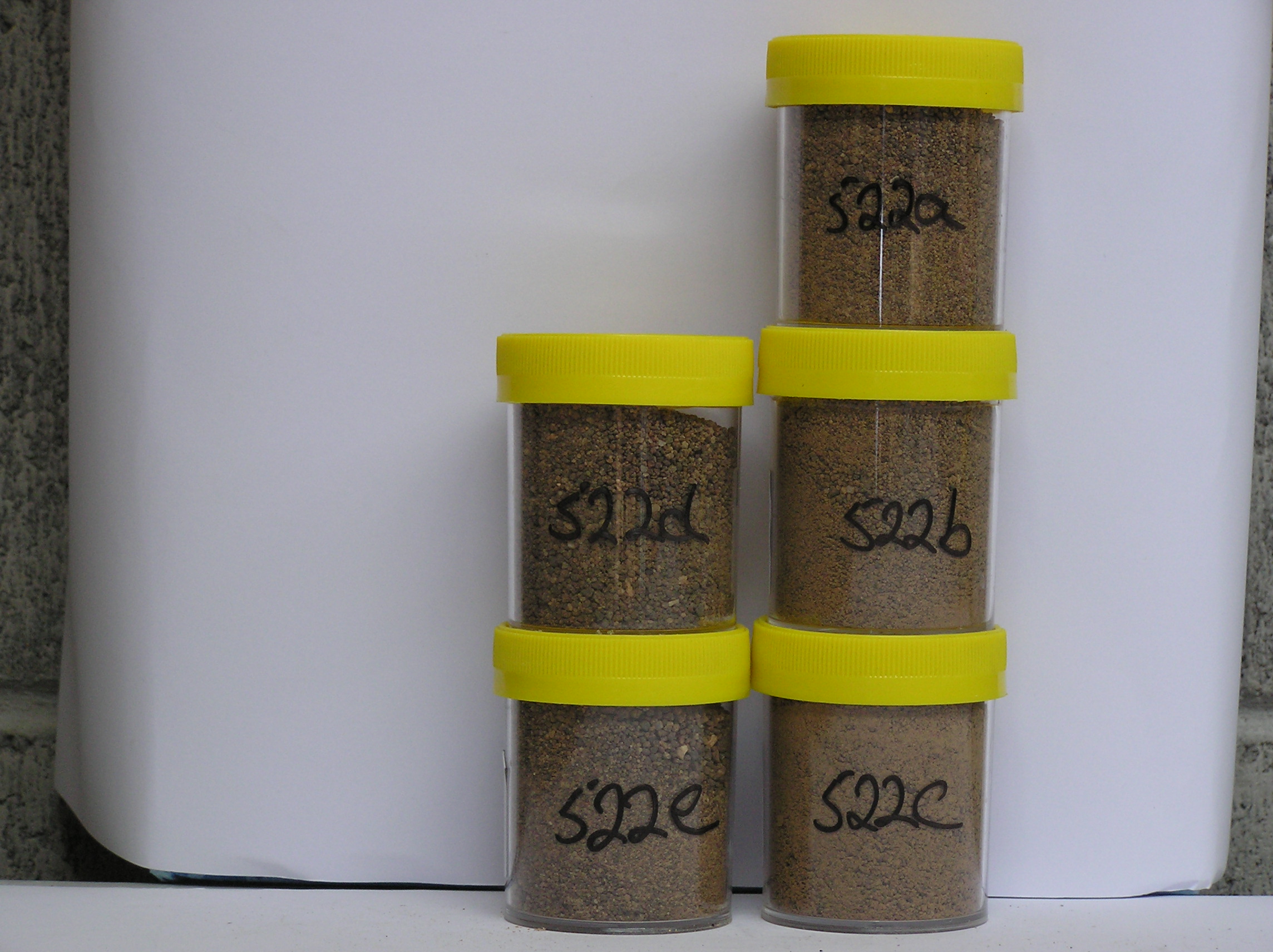
522a 2-0cm
101
surface pebbly to bouldery gravel
102
clasts dominantly subangular to subrounded and weakly to moderately stained
103
a few small salt accumulations,
522b 0-1cm
201
yellowish brown (10YR 5/6) gravelly sand (66% <2mm)
202
weakly cohesive
203
moderately developed vesicular structure forming a distinct surface crust
204
a few fine salt particles
205
rock particles subangular with small particles subrounded
206
distinct boundary
207
522c 1-4cm
301
yellowish brown (10YR 5/6) gravelly sand (74% <2mm)
302
weakly cohesive
303
a few small salt patches
304
some small reddish (2.5Y 4/8) oxidised patches around some clasts
305
rock particles subangular with smaller particles rounded to subrounded
306
indistinct boundary,
522d 4-23cm
401
yellowish brown (10YR 5/6) gravelly sand (84% <2mm)
402
weakly cohesive to loose
403
rock particles subangular to subrounded and weakly to moderately stained and some weakly altered
404
sharp boundary,
522e 23-25cm
501
dark yellowish brown (10YR 3/4 moist) ice-cemented ground,
522f-l 25-122cm
601
drill core
602
sandy gravel with 10cm ice lenses
Yes
a,b,c,d,e
Hard ice-cemented
23
3
(23cm)
Geoland
| Alatna Valley has formed through ice recession from the Benson Glacier and ice from Staten Island Heights; the local rocks are extensive Beacon Sandstone |
| outcrops capped with Ferrar Dolerite; the tills include granites and gneissic rocks which occur nearer the coast and indicate ice movement from the east |
Surfwea
| Some dolerite weakly pitted; exfoliation and spalling are active; some cavernous weathering; boulders moderately stained and slightly rounded; a bouldery |
| surface with some clasts upstanding; a weakly developed pavement with some ventiforms; some clasts with thick salt accumulations beneath |
| Soluble Salt |
| Concentration |
52200001
52200002
84.00
36.10
36.10
14.50
3.60
3.20
4.50
1.60
0.40
52200003
82.00
50.90
31.90
6.90
1.90
2.40
4.00
1.70
0.30
52200004
90.00
54.20
34.10
7.50
1.00
0.20
0.50
2.40
0.20
52200005
79.00
58.70
34.40
5.00
0.70
0.20
0.30
0.50
0.30
52200006
52200007
52200008
52200009
52200010
52200011
52200012
52200001
52200002
7.10
1.50
0.70
11.50
2.30
0.01
2.20
7.80
1.20
52200003
7.00
2.10
0.90
14.70
3.60
0.02
3.40
9.10
2.30
52200004
7.00
0.90
0.20
7.40
1.20
0.01
1.50
3.60
0.70
52200005
7.10
0.15
0.03
1.00
0.09
0.02
0.20
0.40
0.10
52200006
52200007
52200008
52200009
52200010
52200011
52200012
52200001
52200002
52200003
52200004
52200005
52200006
52200007
52200008
52200009
52200010
52200011
52200012
12-Dec-2005
Page 480 of 896
522