Ross Sea Region Soil Sites
539000
539
12-Jan-1988
IBC, GGC
Convoy Range, Transantarctic Mountains; Towle Valley
Soil weathering examination
Ross Island & Vicinity, Antarctica, 1:250 000 US Geological Survey, 1986
CS Pro & Lscp
No
160.5330
-76.7083
76deg 42.5'S
-160deg -32.0'E
cf. Notes for DESCR below
4
NW
1,700
| Towle Valley is formed almost entirely in dolerite; the higher dissected plateau like surfaces above the Towle Valley have been exposed by ice sheet retreat; the extensive |
| patchy snow cover may have restricted development of prolonged weathering |
(4o)
| Extensive snow cover but little indications of significant thawing; probably occasional soil |
| moistening |
-29
Coastal Mountain, xerous to subxerous
fragmental disaggregated dolerite
Lichens are plentiful
Weakly developed in hollows
| SURFACE WEATHERING or |
| SURFACE FEATURES |
| Dolerite decomposition largely through joint fracturing and surface exfoliation; feldsenmeer surfaces formed; distinct surface staining but pitting is |
| negligible; soils formed mostly in cracks or around boulders |
Nil
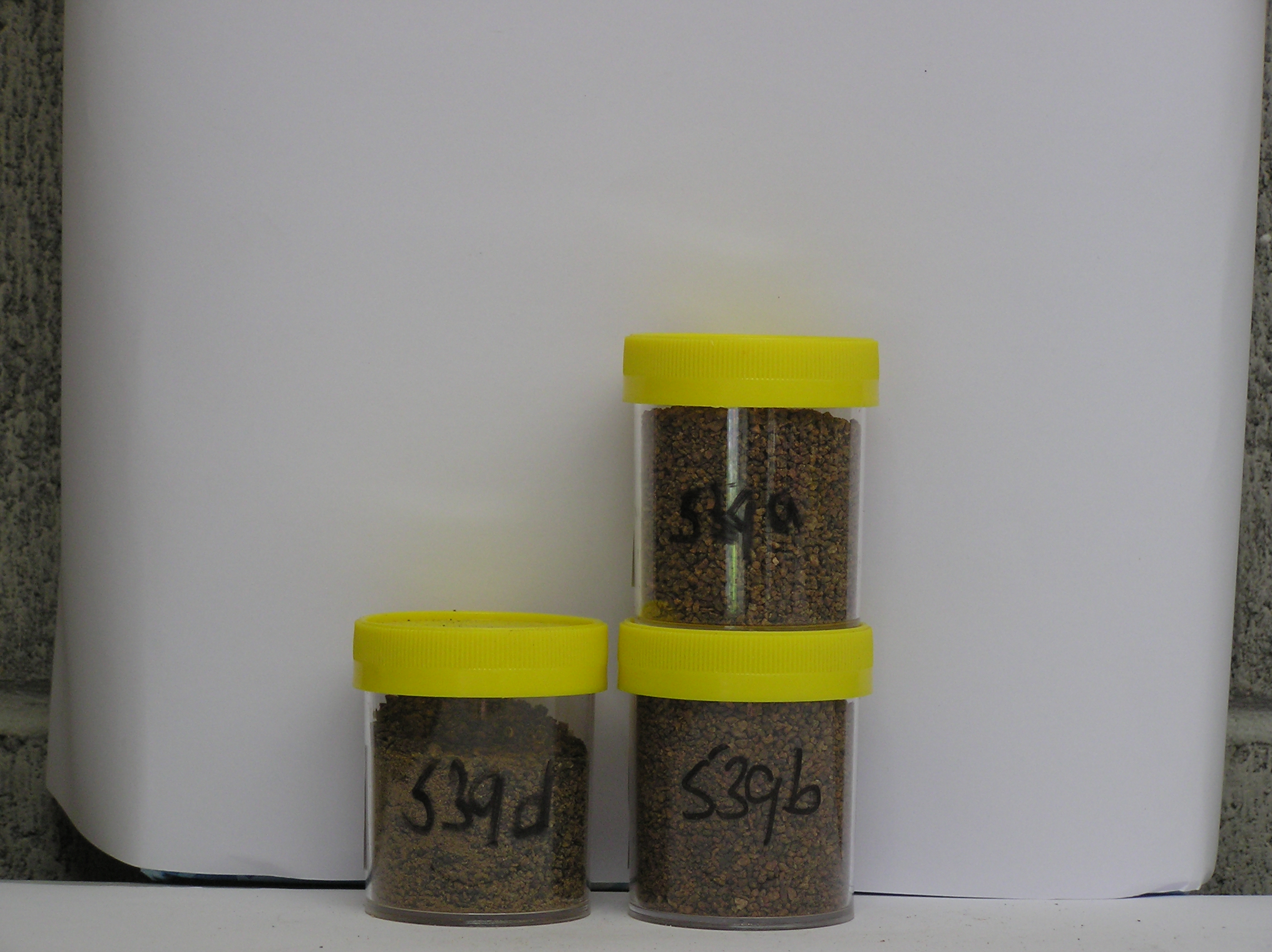
539a 0-5cm
101
dark reddish brown (5YR 3/4 moist) coarse granular sand
102
loose
103
rock particles subangular to subrounded, moderately to strongly stained and some partly altered
104
indistinct boundary,
539b 5-11cm
201
dark reddish brown (5YR 3/4) coarse granular sandy gravel
202
frosted
203
rock particles subangular to subrounded, moderately to strongly stained and some partly altered
204
distinct boundary,
539c 11-17cm
301
dark reddish brown (5YR 3/4) sandy granular gravel
302
loose
303
rock particles subangular, moderately stained and some partly altered
304
distinct boundary,
539d 17-24cm
401
brown to dark brown (7.5YR 4/4) sandy gravel from dominantly disaggregating bedrock
402
loose
403
rock particles subangular weakly stained but partly altered
404
sharp boundary, on weakly disaggregating bedrock
Yes
a,b,d
24
4
(>24cm)
Descr
| On a high dolerite surface above and to the Southwest of the Towle Valley, approximately 8km to the southwest of the Towle Glacier; an undulating largely |
| snow-covered bouldery surface formed by earlier ice over- riding; the site is a lower slope of a shallow gully |
| Soluble Salt |
| Concentration |
53900001
53900002
53900003
53900004
53900001
7.10
0.26
53900002
6.70
0.06
53900003
53900004
7.80
1.50
1.20
12.75
5.60
3.20
18.70
2.30
53900001
53900002
53900003
53900004
12-Dec-2005
Page 497 of 896
539