Ross Sea Region Soil Sites
548000
548
19-Jan-1988
IBC, GGC
Royal Society Range; Transantarctic Mountains
Soil Weathering examination
Ross Island & Vicinity, Antarctica, 1:250 000 US Geological Survey, 1986
CS Lscp & Pro
No
163.2670
-78.2500
78deg 15.0'S
-163deg -16.0'E
cf. Notes for DESCR below
0
Nil
400
cf. Notes for GEOLAND below
(0o)
| Moist; soil is moist to the surface and wet below; water at 22 cm; a snow patch partly covers |
| the floor of the hollow |
-20
Coastal Antarctic
Mixed gravelly drift from scoria; granite, dolerite and sandstone
Nil observed
Nil at site
| SURFACE WEATHERING or |
| SURFACE FEATURES |
A salty crust covers the centre of the floor of the depression; surface clasts are unoxidised
Nil
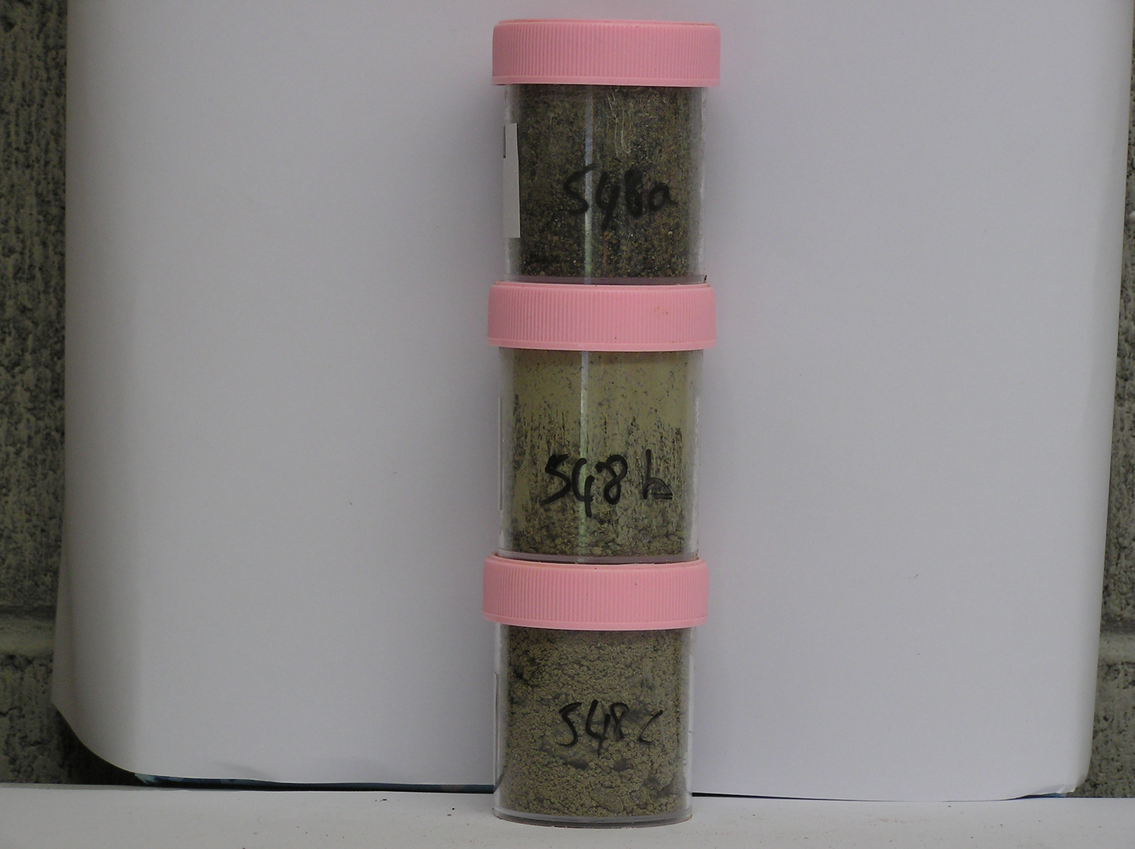
548a 0-3cm
101
light brownish grey (2.5Y 6/2 dried) sandy gravel
102
moist
103
extensively salt encrusted, distinct boundary,
548b 3-15cm
201
dark greyish brown (2.5Y 4/2) moist
202
moderately cohesive
203
most rock particles fresh but a few moderately stained
204
distinct boundary,
548c 15-22cm
301
pale olive (5Y 6/3) gravel
302
wet
303
moderately cohesive
304
clayey coatings on many rock particles,
Yes
a,b,c
0
1
Descr
| Walcott Bay, at the eastern edge of the Walcott Glacier; approximately 200m from the southern margin of Walcott Glacier and 4km from the Koetlitz Glacier; a |
| low lying depression forming a salty hollow; the sample site is near the centre of the depression where salts are precipitated |
Geoland
| The Walcott Bay area has a complex geology with basement rocks, small volcanic cones and an extensive drift mantle which include a wide range of rocks; the |
| area was previously covered by the Koetlitz Glacier which has retreated; lower altitude surfaces are late Ross Glaciation in age |
| Soluble Salt |
| Concentration |
54800001
54800002
54800003
54800001
54800002
54800003
54800001
54800002
54800003
12-Dec-2005
Page 506 of 896
548