Ross Sea Region Soil Sites
561000
561
24-Jan-1988
IBC, GGC
Brown Peninsula, southern McMurdo Sound
Soil Weathering examination
Ross Island & Vicinity, Antarctica, 1:250 000 US Geological Survey, 1986
CS Pro
No
165.3580
-78.0833
78deg 5.0'S
-165deg -21.5'E
Approximately 10km from the northern end of Brown Peninsula and about 200m from the coast; hummocky moraine surface with nearby small stream channels
0
Nil
35
cf. Notes for GEOLAND below
(0o)
Oceanic subxerous; no local snow patches; occasional summer snow falls
-18
Coastal Antarctic
Sandy basaltic till, dominantly olivine basalt; probable inclusion of crystalline and other mainland material indicated by the presence of granite and other erratics
Abundant moss in stream channels; 20-30 m2 patches
Active nets related to subsurface ice ablation
| SURFACE WEATHERING or |
| SURFACE FEATURES |
A moderately developed cobble and pebble pavement; unweathered; occasional thin salt efflorescences; some carbonate coatings
Nil
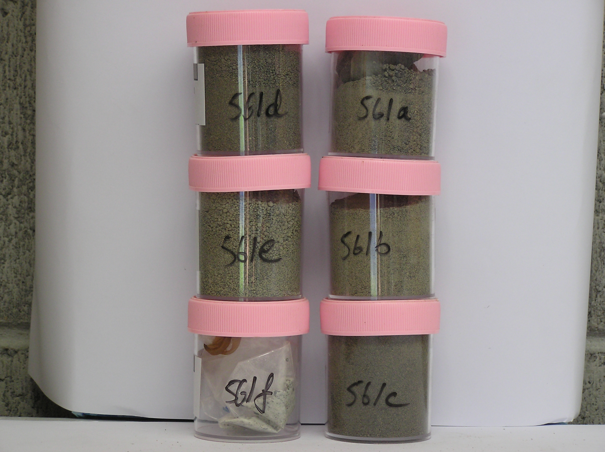
561a 3-0cm
101
surface pebbles, cobbles and boulders
102
angular to subrounded and unstained
103
a few thin salt accumulations beneath some clasts,
561b 0-2cm
201
light brownish grey (10YR 6/2) sandy gravel
202
weakly cohesive
203
weakly developed vesicular structure
204
rock particles subangular to subrounded and unstained
205
distinct boundary,
561c 2-14cm
301
light brownish grey to greyish brown (10YR 6/2 - 5/2) gravelly sand
302
loose
303
rock particles subangular to subrounded and unstained
304
indistinct boundary,
561d 14-27cm
401
greyish brown (10YR 5/2) gravelly sand
402
loose
403
rock particles subangular and unstained
404
sharp boundary,
561e 27-35cm
501
greyish brown (10YR 5/2) sandy gravel
502
moderately cohesive
503
moist
504
moderately developed vesicular structure
505
rock particles subangular and unstained
506
sharp boundary, on ice-cemented ground
Yes
a,b,c,d,e,f
Hard ice-cemented
35
1
(35cm)
Geoland
| Brown Peninsula comprises volcanic rocks, mainly scoria flows of the McMurdo Volcanics Group; the area was over-ridden during the Ross Glaciation by the |
| expanded Ross Ice Sheet; evidence of extensive ice sheet covering is provided by the presence of erratics, sandstone, dolerite and granite from the west; lower |
| altitude slopes are youngest and appear to be ice-cored |
| Soluble Salt |
| Concentration |
56100001
56100002
56100003
56100004
56100005
56100006
56100001
56100002
56100003
56100004
56100005
56100006
56100001
56100002
56100003
56100004
56100005
56100006
12-Dec-2005
Page 519 of 896
561