Ross Sea Region Soil Sites
604000
604
7-Feb-1990
IBC, GGGC, MRB
Pram Point, Scott Base, Ross Island
Lithium chloride leaching experiment; first resample
Dept of Interior US Geological Survey 1986
CS Pro & Lscp
Yes
166.7590
-77.8578
77deg 51.47'S
-166deg -45.54'E
cf. Notes for DESCR below
2
E
60
cf. Notes for GEOLAND below
| Oceanic subxerous; a dry site with no adjacent permanent snowbanks; a little snow on the |
| ground surface from a recent fall |
-18
Coastal Antarctic
Bouldery till and slope debris predominantly from scoria with minor accessions of sedimentary and granitic rocks
Some small yellow lichen and small moss occurrences
Weakly developed small net with indistinct borders
| SURFACE WEATHERING or |
| SURFACE FEATURES |
Carbonate coatings on underside of surface clasts; some small patchy salt precipitations
Probably some minor treading
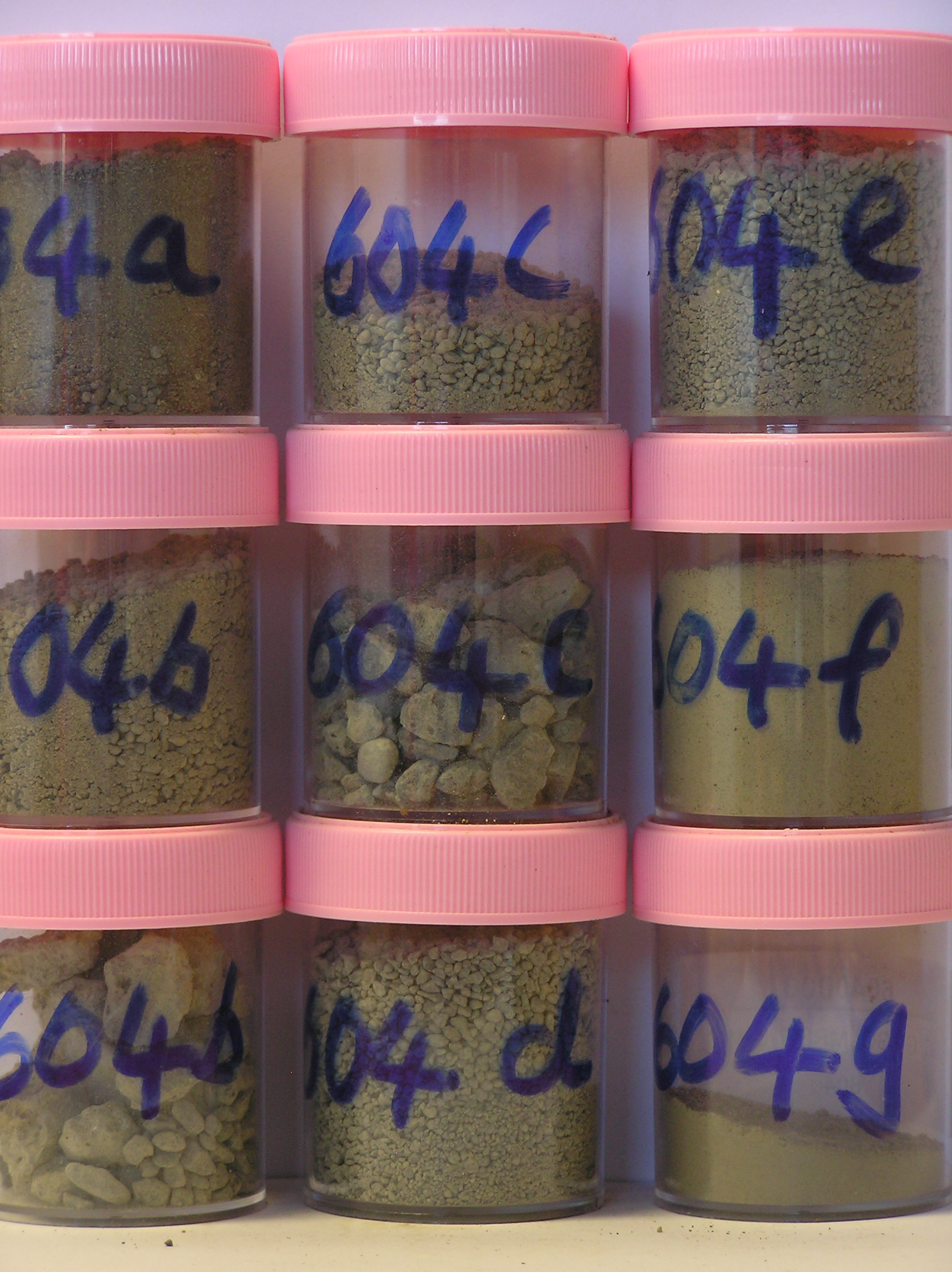
604a 2-0cm
101
surface pebbles granules and sand
102
loose
103
calcium carbonate coatings beneath some clasts
104
rock particles unweathered,
604b 0-5cm
201
light brownish grey (2.5Y 6/2) bouldery scoria gravel
202
loose to weakly cohesive
203
a few small surface salt precipitations
204
smaller rock particles mainly subrounded and unstained
205
calcium carbonate coatings beneath some clasts
206
indistinct boundary,
604c 5-10cm
301
light brownish grey (2.5Y 6/2) bouldery scoria gravel
302
loose
303
smaller rock particles mainly subrounded and unstained
304
distinct boundary,
604d 10-15cm
401
greyish brown (2.5Y 5/2) bouldery scoria gravel
402
loose
403
moist
404
some pale calcium carbonate coatings
405
smaller rock particles mainly subrounded and unstained
406
indistinct boundary,
604e 15-20cm
501
greyish brown (2.5Y 5/2) bouldery scoria gravel
502
loose
503
moist rock particles mainly subrounded
504
sharp boundary, drill core in ice-cemented ground
604f 20-25cm
601
[ light brownish grey to greyish brown (2.5Y 6/2 - 5/2) stony gravel,
604g 25-32cm
701
[ greyish brown (2.5Y 5/2) stony gravel,
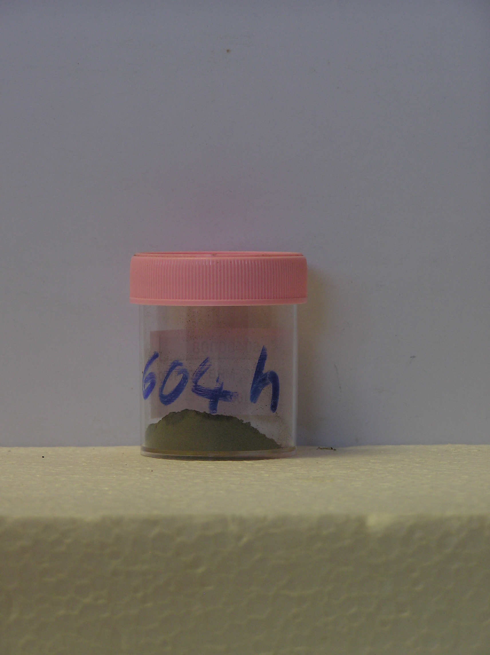
604h 32-36cm
801
[ greyish brown (2.5Y 5/2) stony gravel
Yes
a,b,c,d,e,f,g,h
a,b,c,d,e,f,g,h
Hard ice-cemented
20
1
(20cm)
Descr
| Approximately 350m northwest of the western end of Scott Base on a gently sloping step on a minor ridge, about 50m north of the Scott Base to McMurdo |
| Station walking track; a generally bouldery surface; at this site, 4 contiguous 1m X 1m plots were set out and 3 irrigated with LiCl, the 4th (southernmost) with |
| H2O; this was the first of the plot samplings |
Geoland
| Rocks are predominantly scoria flows of the McMurdo Volcanics; Last Glaciation Ross 1 ice covered the site and traces of rocks (sandstone and granite granules |
| and small pebbles) probably from the Royal Society Range can be found; the drift mantle is thin and patchy with bedrock a little below the surface |
| Soluble Salt |
| Concentration |
60400001
604a
2-0cm
-2
0
21.00
3.50
none
60400002
604b
0-5cm
0
5
25.00
2.60
none
60400003
604c
5-10cm
5
10
16.00
2.40
none
60400004
604d
10-15cm
10
15
35.00
3.40
none
60400005
604e
15-20cm
15
20
30.00
3.70
none
60400006
604f
20-25cm
20
25
13.00
11.10
none
60400007
604g
25-32cm
25
32
13.00
41.50
none
60400008
604h
32-36cm
32
36
6.00
61.50
none
60400001
29.00
22.90
30.80
10.20
4.40
2.20
0.50
60400002
43.90
17.90
20.80
7.30
3.70
5.50
1.00
60400003
48.40
15.40
20.80
7.20
2.70
4.40
1.10
60400004
76.40
14.70
5.00
0.80
0.30
1.70
1.20
60400005
67.10
14.70
9.90
3.00
1.20
2.70
1.50
60400006
44.00
14.00
13.10
6.90
8.90
12.00
1.20
60400007
13.90
13.50
18.20
13.80
18.50
21.00
1.10
60400008
18.60
17.60
18.30
14.10
17.10
13.20
1.20
60400001
60400002
60400003
60400004
60400005
60400006
60400007
60400008
60400001
15
5
25
lithium plots
60400002
15
15
5
30
see Claridge et al
60400003
5
2
3
10
30
perm. perigl. proc (10) 223-233
60400004
6
2
2
5
5
45
60400005
5
3
7
30
60400006
5
5
5
5
15
60400007
3
4
3
10
60400008
10
12-Dec-2005
Page 562 of 896
604