Ross Sea Region Soil Sites
651000
651
9-Dec-1991
IBC, GGC
Pram Point, Scott Base, Ross Island
Leaching experiment using lithium chloride tracer to determine rate of leaching
Dept of Interior USGS 1986 1:250,000, Ross Island & Vicinity
CS Lscp
No
166.7500
-77.8500
77deg 51.0'S
-166deg -45.0'E
cf. Notes for DESCR below
2
E
60
cf. Notes for GEOLAND below
Oceanic subxerous; a dry site with little snow accumulation or water activity
-18
Coastal Antarctic
Bouldery till and slope detritus with minor accessions of sedimentary and granitic rocks
Some local yellow lichen and small moss occurrences
Weakly developed small nets with distinct borders
| SURFACE WEATHERING or |
| SURFACE FEATURES |
Carbonate coatings on undersides of surface clasts; some thin patchy salt precipitations
Probably minor treading
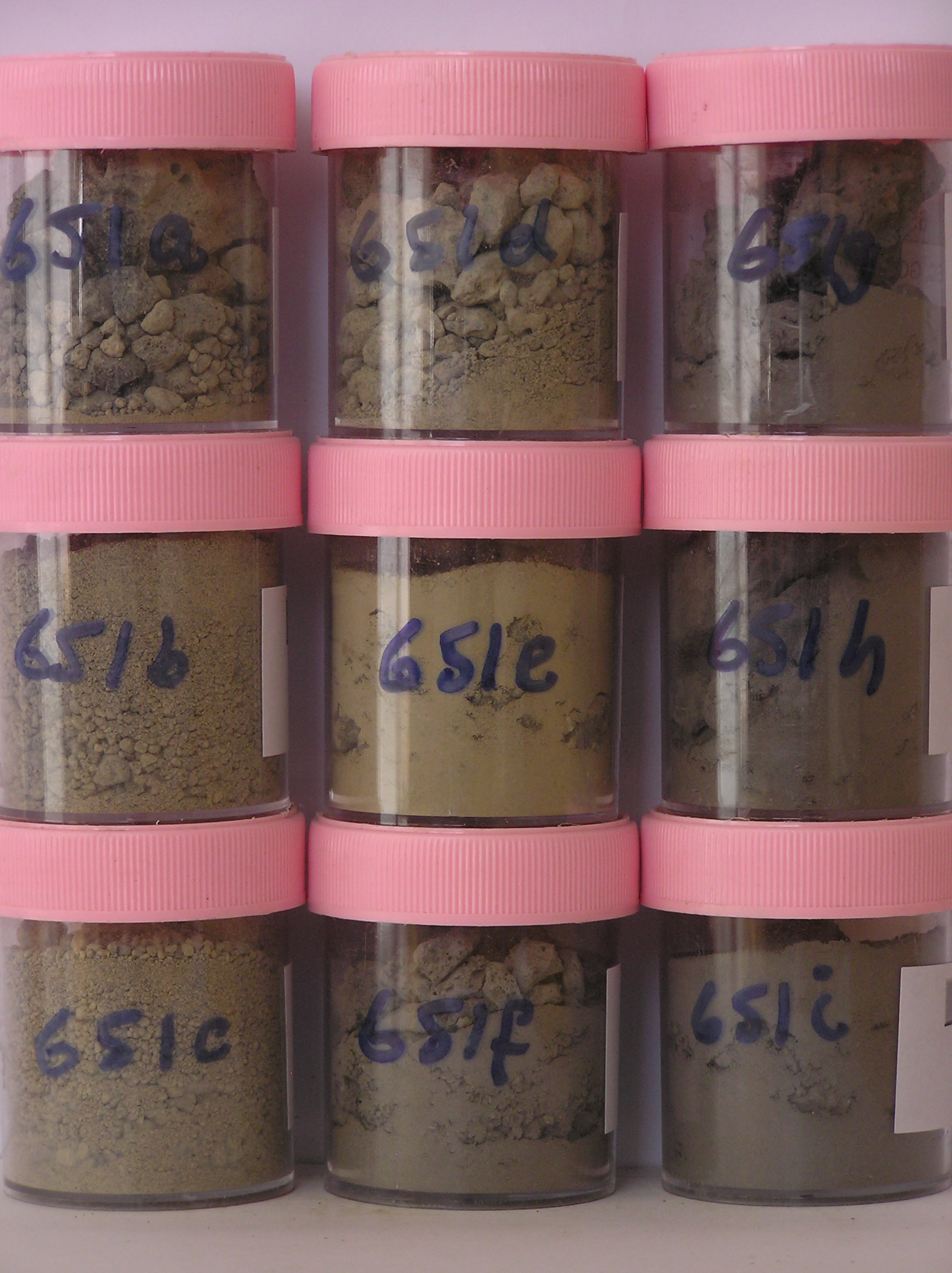
651a 2-0cm
101
surface scoria gravel
102
subangular to subrounded
103
some diffuse salt precipitations beneath stones
104
abundant carbonate coatings,
651b 0-3cm
201
greyish brown (2.5Y 5/2) sandy pebble cobble gravel
202
weakly cohesive
203
rock particles angular to subrounded
204
sharp boundary,
651c 3-10cm
301
light brownish grey (2.5Y 6/2) granular gravel
302
loose
303
rock particles subangular
304
indistinct boundary,
651d 10-26cm
401
light brownish grey (2.5Y 6/2) granular gravel
402
weakly cohesive
403
frosted
404
rock particles subangular
405
sharp boundary,
651e 26-32cm
501
light brownish grey to light yellowish brown (2.5Y 6/2 - 6/4) sandy to silty gravel
502
firmly frozen
503
rock particles subangular to subrounded,
651f 32-50cm
601
drill core
602
grey (10YR 5/1) scoria gravel includes rock
651g 50-63cm
701
drill core
702
grey (10YR 5/1) scoria gravel includes rock,
651h 63-77cm
801
drill core
802
grey (10YR 5/1) scoria gravel,
651i 77-94cm
901
drill core
902
grey (10YR 5/1) scoria gravel includes rock
Yes
a,b,c,d,e,f,g,h,i
Hard ice-cemented
26
1
(26cm)
Geoland
| Rocks are predominantly scoria flows of the McMurdo Volcanics; Last Glaciation Ross 1 ice covered the site and traces of rocks (sandstone and granite granules |
| and small pebbles) probably from the Royal Society Range can be found; the drift mantle is thin and patchy with bedrock a little below the surface |
Descr
| Approximately 350m northwest of the western end of Scott Base on a gently sloping step on a minor ridge, about 50m north of the Scott Base to McMurdo |
| Station walking track; a generally bouldery surface; at this site, 4 contiguous 1m X 1m plots were set out and 3 irrigated with LiCl, the 4th (southernmost) with |
| H2O; this was the second plot resampling series; the site is 2m from the edge of the application plot |
| Soluble Salt |
| Concentration |
65100001
16.00
0.61
65100002
63.00
1.83
65100003
47.00
2.65
65100004
27.00
3.96
65100005
42.00
18.30
65100006
29.00
92.74
65100007
31.00
45.01
65100008
47.00
5.78
65100009
46.00
38.76
65100001
65100002
65100003
65100004
65100005
65100006
65100007
65100008
65100009
65100001
65100002
65100003
65100004
65100005
65100006
65100007
65100008
65100009
12-Dec-2005
Page 609 of 896
651