Ross Sea Region Soil Sites
660000
660
13-Dec-1991
IBC, GGC, MRB
Pram Point, Scott Base, Ross Island
| Leaching experiment using lithium chloride tracer to determine rate of leaching; a wet site compared with a |
| dry site |
Dept of Interior USGS 1986 1:250,000 Ross Island & Vicinity, Antarctica
CS Lscp
No
166.7330
-77.8333
77deg 50.0'S
-166deg -44.0'E
cf. Notes for DESCR below
3
E
50
cf. Notes for GEOLAND below
Oceanic subxerous; a wet site; surface water from recent snow thaw
-18
Coastal Antarctic
Bouldery till and slope detritus with minor accessions of sedimentary and granitic rocks
Nil at site; some yellow lichen and moss in the vicinity
Weakly developed frost heave polygons
| SURFACE WEATHERING or |
| SURFACE FEATURES |
Scattered basaltic boulders; unweathered
Probably some occasional treading
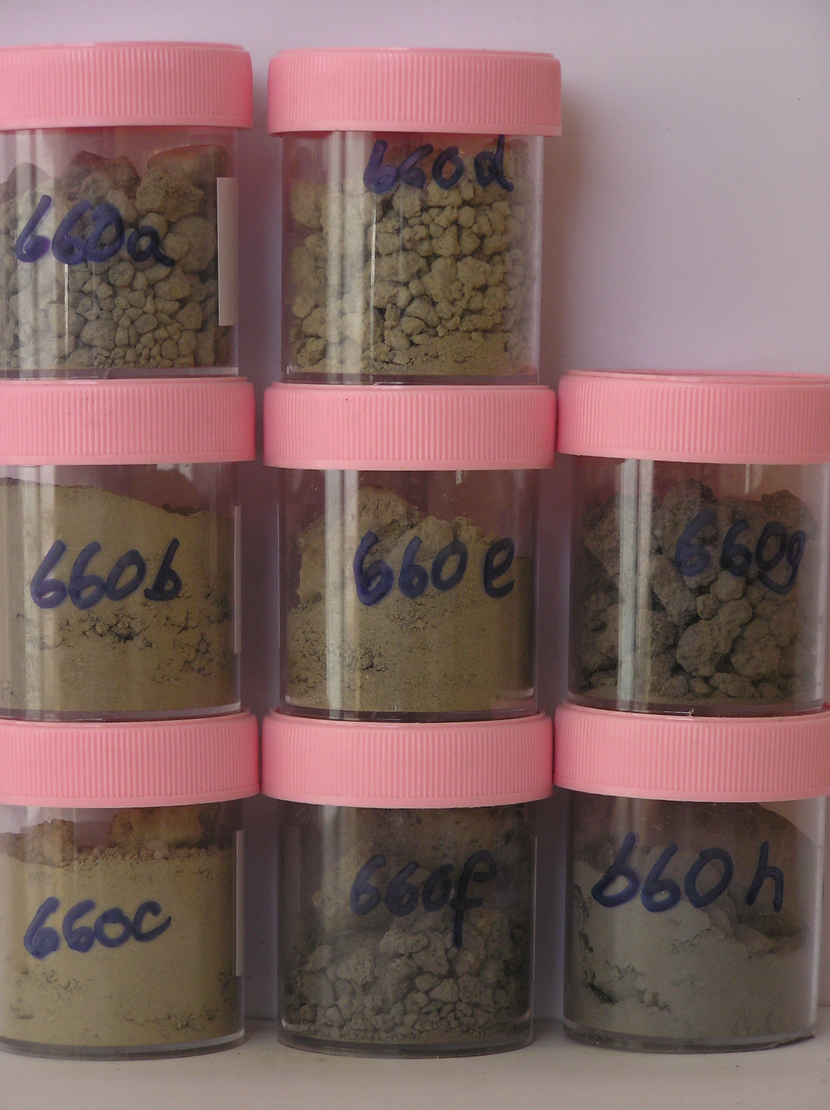
660a 1-0cm
101
surface sandy granular gravel
102
some surface salt precipitations
103
rock particles subrounded,
660b 0-5cm
201
greyish brown (10YR 5/2) sandy to silty gravel
202
weakly cohesive
203
moist
204
weakly developed vesicular structure
205
rock particles mainly subrounded
206
indistinct boundary,
660c 5-10cm
301
light brownish grey to light yellowish brown (2.5Y 6/2 - 6/4) sandy gravel
302
weakly cohesive
303
moist
304
weakly developed vesicular structure
305
rock particles dominantly subrounded
306
indistinct boundary,
660d 10-20cm
401
light brownish grey to light yellowish brown (2.5Y 6/2 - 6/4) sandy pebbly gravel
402
loose
403
wet
404
rock particles mainly subangular
405
sharp boundary
660e 20-25cm
501
light brownish grey (2.5Y 6/2) sandy to silty gravel
502
very firm
503
hard frozen
504
rock particles subangular
505
indistinct boundary,
660f 25-50cm
601
drill core
602
greyish brown (10YR 5/2) scoria gravel,
660g 50-58cm
701
drill core
702
rock,
660h 58-77cm
801
drill core
802
rock
Yes
a,b,c,d,e,f,g,h
Hard ice-cemented
20
1
(20cm)
Descr
| Approximately 350m northwest of the western end of Scott Base in the floor of a shallow gully; 20m NW of site 657 and approximately 3-4m lower in altitude; |
| about 50m N of the Scott base to McMurdo Station walking track; at this site, 4 contiguous 1m X 1m plots were set out and 3 irrigated with LiCl, the 4th |
| (northernmost) with H2O; this was the second plot resampling series; the site is 1.5m below the application plot |
Geoland
| Rocks are predominantly scoria flows of the McMurdo Volcanics; Last Glaciation Ross 1 ice covered the site and traces of rocks (sandstone and granite granules |
| and small pebbles) probably from the Royal Society Range can be found; the drift mantle is thin and patchy with bedrock a little below the surface |
| Soluble Salt |
| Concentration |
66000001
28.00
6.15
66000002
71.00
9.53
66000003
50.00
8.74
66000004
33.00
8.27
66000005
53.00
14.40
66000006
26.00
14.81
66000007
23.00
38.82
66000008
43.00
30.96
66000001
66000002
66000003
66000004
66000005
66000006
66000007
66000008
66000001
66000002
66000003
66000004
66000005
66000006
66000007
66000008
12-Dec-2005
Page 618 of 896
660