Ross Sea Region Soil Sites
674000
674
23-Dec-1992
IBC, GGC
Vanda Station, Wright Valley at the eastern end of Lake Vanda
| assessment of environmental impacts from past human activities at Vanda Station; determination of the |
| nature of the contamints and the depth of contamination |
not recorded
CS Pro
No
166.7500
-75.8333
75deg 50.0'S
-166deg -45.0'E
| on the floor of a shallow elongated gully, 40m SE of the main Vanda Station building; the site is in a shallow depression on the gully floor and close to the toe of a second |
| greywater disposal site |
0
-
91
cf. Notes for GEOLAND below
(flat)
| xerous; soil surface very occasionally moistened by summer snowfall; lower horizons are wet |
| probably as a result of inflow of water from rising Lake Vanda |
-20
central mountain
wind sorted granular sand largely derived from disaggregating granodiorite
| SURFACE WEATHERING or |
| SURFACE FEATURES |
a lower slope at a site of disposal of domestic waste waters; a previous camping site with a nearby accumulation of old camp refuse
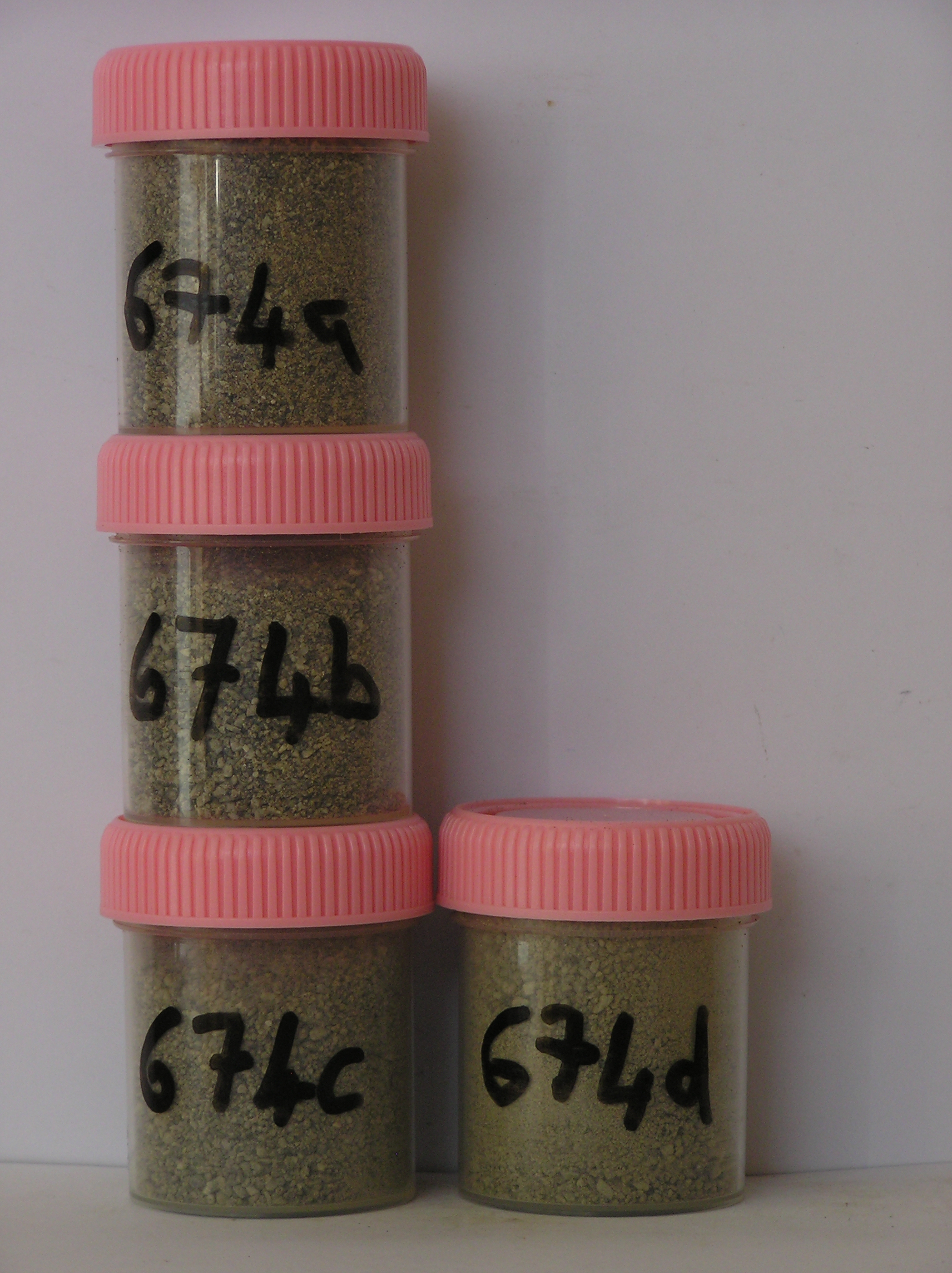
674a 0-2cm
101
light yellowish brown (2.5Y 6/4) pebbly gravelly sand
102
weakly cohesive with a thin organic crust
103
distinct boundary,
674b 2-7cm
201
light olive brown (2.5Y 6/4) granular and pebbly gravelly sand
202
slightly moist and weakly cohesive
203
sharp boundary,
674c 7-28cm
301
olive grey (5Y 5/2) sand
302
wet and cohesive
303
some disaggregating granodiorite pebbles
304
sharp boundary,
674d 28-35cm
401
gray (5Y 5/1) gravelly sand
402
saturated
403
running water present with ice crystals forming on the surface
404
shaarp boundary, on bedrock.
yes
a,b,c,d
dry frozen
35
1
(~35cm)
Geoland
| the rocks of the area are granodiorites that have been cut with lamprophyre dykes and form a strongly undulating ridge and gully topography as a result of ice |
| over riding from down-valley and up-valley glaciations and to a lesser extent, subaerial weathering; cryogenic weathering, probably assisted by repeated past |
| rises and falls of waters in Lake Vanda, has generally given rise to a heavily fractured upper bedrock surface with common angular platy boulders; sands, |
| derived partly from sorted lake sediments and also from aerial erosion fill most of the rock fracture interstices |
| Soluble Salt |
| Concentration |
67400001
674a
0-2cm
0
2
none
67400002
674b
2-7cm
2
7
none
67400003
674c
7-28cm
7
28
none
67400004
674d
28-35cm
28
35
none
67400002
76.00
9.30
67400001
74.00
1.30
67400003
84.00
13.90
67400004
92.00
12.10
67400002
8.40
0.14
0.46
0.06
0.04
0.06
0.24
0.05
0.01
67400001
8.10
0.26
0.52
0.25
0.12
0.14
0.34
0.44
0.01
67400003
8.10
0.13
0.33
0.13
0.07
0.06
0.23
0.07
0.02
67400004
8.70
0.17
0.39
0.20
0.08
0.07
0.27
0.14
0.00
67400002
67400001
67400003
67400004
12-Dec-2005
Page 632 of 896
674