Ross Sea Region Soil Sites
675000
675
23-Dec-1992
IBC, GGC
Vanda Station, Wright Valley at the eastern end of Lake Vanda
assessment of environmental impacts from past human activities at Vanda Station
not recorded
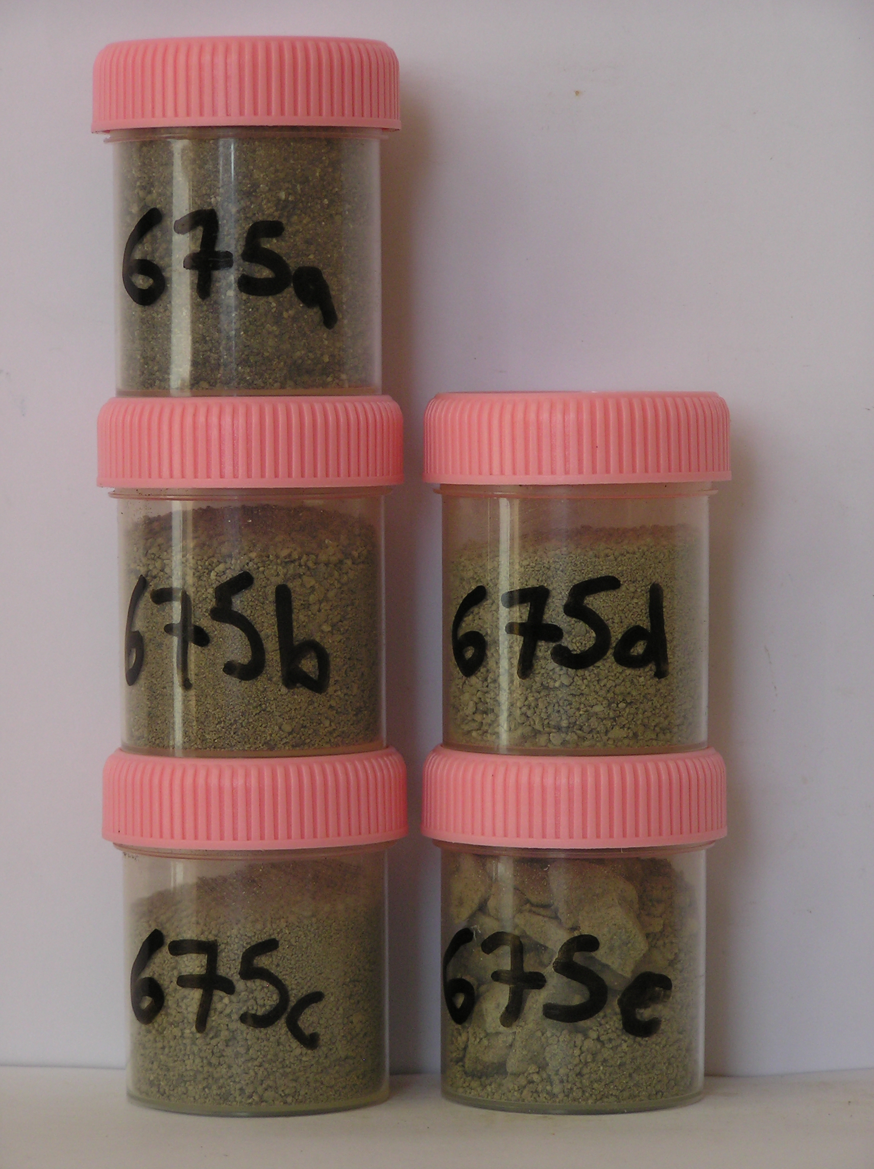
CS Site photo
No
166.7500
-75.8333
75deg 50.0'S
-166deg -45.0'E
| the upper surface of a greywater disposal site, 50m ES of the main Vanda Station building; the site is on the upper surface of a shallow, 4m deep gully and is on the edge of a |
| lamprophyre dyke; |
8
SE
93
cf. Notes for GEOLAND below
(8o)
| xerous; soil surface very occasionally moistened by summer snowfall; the soil has been |
| wetted in the past from discharges of Vanda Station greywaters |
-20
central mountain
coarse fraction is lamprophyre dyke rocks with quartz/feldspar sand filling the interstices; some organic material from domestic sources
| SURFACE WEATHERING or |
| SURFACE FEATURES |
some finer textured surface dyke rocks are abraded with distinctive ventiforms; coarser granodioritic clasts are crumbling by granular disintegration
a disposal sithe of domestic waste waters
675a 0-5cm
101
dark greyish brown to very dark greyish brown (10YR 4/2-3/2) organic stained bouldery sandy gravel
102
firmly cohesive
103
abundant fibres and foreign material
104
distinct odour
105
rock particles angular and unweatherd, distinct boundary,
675b 5-18cm
201
brown (10YR 5/3) sandy cobble gravel
202
slightly cohesive
203
rock particles angular and unweathered
204
indistinct boundary,
675c 18-40cm
301
pale brown (10YR 6/3) bouldery sandy gravel
302
slightly moist and weakly cohesive
303
some salt precipitation on drying soil surfaces
304
rock particles angular and unweathered
305
indistinct boundary,
675d 40-65cm
401
pale brown (10YR 6/3) sand infilling the cracks in fragmented bedrock
402
uncohesive
403
rock particles angular, interlocked and unweathered
404
indistinct boundary, on fragmented bedrock.
yes
a,b,c,d,e
dry frozen
35
1
(~35cm)
Geoland
| the rocks of the area are granodiorites that have been cut with lamprophyre dykes and form a strongly undulating ridge and gully topography as a result of ice |
| over riding from down-valley and up-valley glaciations and to a lesser extent, subaerial weathering; cryogenic weathering, probably assisted by repeated past |
| rises and falls of waters in Lake Vanda, has generally given rise to a heavily fractured upper bedrock surface with common angular platy boulders; sands, |
| derived partly from sorted lake sediments and also from aerial erosion fill most of the rock fracture interstices |
| Soluble Salt |
| Concentration |
67500001
675a
0-5cm
0
5
0.30
none
67500002
675b
5-18cm
5
18
2.00
none
67500003
675c
18-40cm
18
40
3.10
none
67500004
675d
40-65cm
40
65
4.00
none
67500001
43.00
0.30
67500002
38.00
2.00
67500003
51.00
3.10
67500004
29.00
4.00
67500005
21.00
3.80
67500001
6.70
0.14
0.23
0.10
0.08
0.09
0.07
0.06
0.00
67500002
8.10
0.09
0.13
0.04
0.03
0.05
0.03
0.04
0.00
67500003
8.60
0.06
0.14
0.05
0.04
0.06
0.03
0.03
0.01
67500004
8.30
0.14
0.21
0.15
0.07
0.11
0.04
0.04
0.07
67500005
8.50
0.12
0.24
0.16
0.06
0.11
0.07
0.09
0.03
67500001
67500002
67500003
67500004
67500005
12-Dec-2005
Page 633 of 896
675