Ross Sea Region Soil Sites
682000
682
24-Dec-1992
IBC, GGC
Vanda Station, Wright Valley at the eastern end of Lake Vanda
| assessment of environmental impacts from past human activities at Vanda Station; sampled for indications of |
| downslope contamination from the disposal of greywaters and urine |
not recorded
Cs Pro
No
166.7500
-75.8333
75deg 50.0'S
-166deg -45.0'E
20m northwest of the Vanda Station Mess building, 10m downslope from site 679 and 4m from the lake edge
10
NW
93
cf. Notes for GEOLAND below
(10o)
xerous; the soil surface is occasionally moistened by summer snowfall
-20
central mountain
fractured, flaggy and in situ, granodiorite with accumulations of granular sand in the cracks between the angular, fragmented boulder sized clasts
| SURFACE WEATHERING or |
| SURFACE FEATURES |
surface materials are angular and unstained; a partial surface cover of recent wind blown sand
| the surface has been heavily disturbed by base activities and is below a site where greywaters and urine were disposed off; a range of foreign materials are |
| present |
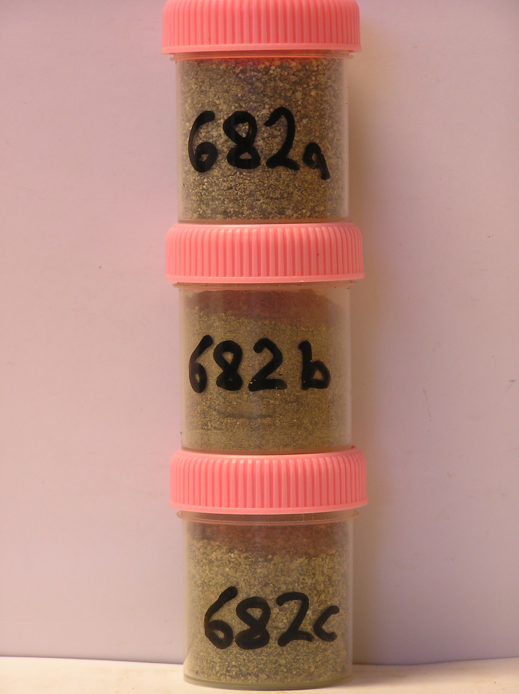
682a 0-3cm
101
pale olive (5Y 6/3) pebbly to bouldery sand
102
loose
103
rock particles angular and unstained
104
distinct boundary,
682b 3-9cm
201
greyish brown (2.5Y 6/2) pebbly to bouldery sand
202
moderately cohesive
203
some organic material present which may be crusted algae
204
rock particles angular and unstained
205
distinct boundary,
682c 9-25cm
301
| pale olive (5Y 6/3) crumbled granular to bouldery granodiorite with loose sand (<10%) filling the interstices on |
| smooth bedrock. |
yes
a,b,c
dry frozen
35
1
(~35)
Geoland
| the rocks of the area are granodiorites that have been cut with lamprophyre dykes and form a strongly undulating ridge and gully topography as a result of ice |
| over riding from down-valley and up-valley glaciations and to a lesser extent, subaerial weathering; at this site, the rock is fractured granodiorite; subsequent to |
| glaciation, the terrain has been subjected to drowning and emergence from fluctuating lake levels from Lake Vanda with some sorting or resorting of surficial |
| materials |
| Soluble Salt |
| Concentration |
68200001
682a
0-3cm
0
3
none
68200001
73.00
0.30
68200002
74.00
0.80
68200003
91.00
0.40
68200001
7.50
0.34
0.74
0.50
0.18
0.06
0.87
0.53
0.00
68200002
7.10
0.45
1.50
0.36
0.09
0.14
0.31
0.79
68200003
9.00
0.11
0.32
0.07
0.04
0.02
0.11
0.08
0.01
68200001
68200002
68200003
12-Dec-2005
Page 640 of 896
682