Ross Sea Region Soil Sites
686000
686
26-Dec-1992
IBC, GGC
Vanda Station, Wright Valley at the eastern end of Lake Vanda
| assessment of environmental impacts from past human activities at Vanda Station; sampled for indications of |
| contamination from greywater disposal at a greywater disposal site |
not recorded
CS Pro
No
161.6690
-77.5273
77deg 31.6'S
-161deg -40.1'E
| 22m southeast of the Vanda Station Mess building on sloping site forming part of the upper side slope of an elongated gully; a greywater disposal site, 6.1m downslope from |
| site 685 |
10
SE
93
cf. Notes for GEOLAND below
(10o)
2
8.3
30
1.5
40
-0.5
58
-0.7
| xerous; the soil surface is occasionally moistened by summer snowfall; there is some moisture |
| present below 17cm in the soil; this may be residual greywater |
-20
central mountain
fractured granodiorite and windblown sand
| SURFACE WEATHERING or |
| SURFACE FEATURES |
a bouldery to pebbly pavement with angular unstained surface rocks showing some wind abrasion
the surface has been heavily disturbed by base activities; this site has received runoff from the disposal of greywater
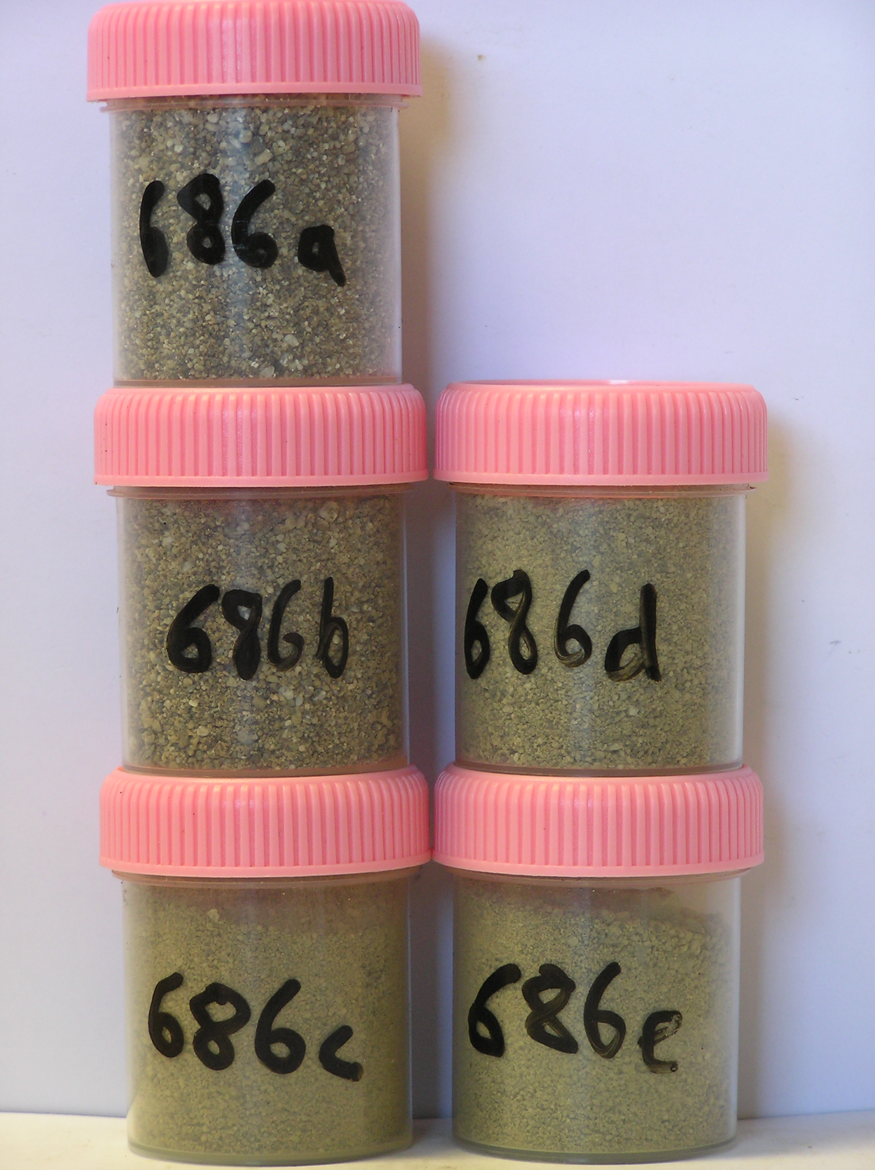
686a 2-0cm
101
surface pavement of bouldery to pebbly granular sand
102
rock particles angular to subangular and unweathered
103
some foreign particles
104
sharp boundary,
686b 0-3cm
201
brown (10YR 5/3) bouldery sandy gravel
202
cohesive
203
weakly developed platy structure
204
rock particles angular and unweathered
205
distinct boundary,
686c 3-18cm
301
brown (10YR 5/3) bouldery to pebbly granular sand
302
weakly cohesive
303
rock particles angular and unweathered
304
diffuse boundary,
686d 18-37cm
401
pale brown (10YR 6/3) bouldery sand
402
slightly moist and weakly cohesive
403
fragmented angular boulders with sand infilling the fissures
404
distinct boundary,
686e 37-56cm
501
pale brown (10YR 6/3) sand (10%) infilling fractured bedrock
502
moderately cohesive and moist on thawing
503
rock particles interlocked, angular and unweathered, on fractured granodiorite bedrock.
yes
a,b,c
weakly ice cemented
35
1
Geoland
| the rocks of the area are granodiorites that have been cut with lamprophyre dykes and form a strongly undulating ridge and gully topography as a result of ice |
| over riding from down-valley and up-valley glaciations and to a lesser extent, subaerial weathering; subsequent to glaciation, the terrain has been subjected to |
| drowning and emergence from fluctuating lake levels from Lake Vanda with some sorting or resorting of surficial materials |
| Soluble Salt |
| Concentration |
68600001
686a
2-0cm
-2
0
0.20
none
68600002
686b
0-3cm
0
3
0.10
none
68600003
686c
3-18cm
3
18
1.30
none
68600004
686d
18-37cm
18
37
1.40
none
68600005
686e
37-56cm
37
56
2.90
none
68600001
53.00
0.20
68600002
61.00
0.40
68600003
71.00
1.70
68600004
83.00
1.90
68600005
58.00
3.90
68600001
6.70
0.26
0.54
0.28
0.15
0.17
0.30
0.28
0.00
68600002
7.50
0.27
0.77
0.21
0.08
0.18
0.30
0.26
0.01
68600003
8.60
0.12
0.33
0.12
0.06
0.10
0.07
0.13
0.02
68600004
8.80
0.09
0.24
0.10
0.05
0.07
0.03
0.10
0.01
68600005
8.70
0.11
0.31
0.13
0.08
0.08
0.06
0.11
0.01
68600001
68600002
68600003
68600004
68600005
12-Dec-2005
Page 644 of 896
686