Ross Sea Region Soil Sites
802000
802
12-Jan-1995
IBC, GGC
Coombs Hills, northern Dry Valley region and to the north of Mt Brooke
Permafrost and soil moisture investigations
not recorded
CS Profile
No
159.9080
-76.8150
76deg 48.9'S
-159deg -54.5'E
| Approximately 2.4km NNE of Mt Brooke on the floor of a valley; the site is on the crest of a small moraine knoll on the undulating surface of the valley floor, about 300m SW |
| of site 801 |
0
Nil
2,015
cf. Notes for GEOLAND below
| Xerous; several snowfalls and a recent fall within 12 hours which produced 7mm of snow |
| with approximately .68mm of water; most ablated with little sign of soil moistening |
-32
Central Mountain
Dominantly dolerite/volcanic till but with the fine fraction from the more erodible haloclastite; partly crumbled dolerite/volcanic bouldery till
Nil observed at site
Nil at site
| SURFACE WEATHERING or |
| SURFACE FEATURES |
cf. Notes for SURFWEA below
Nil
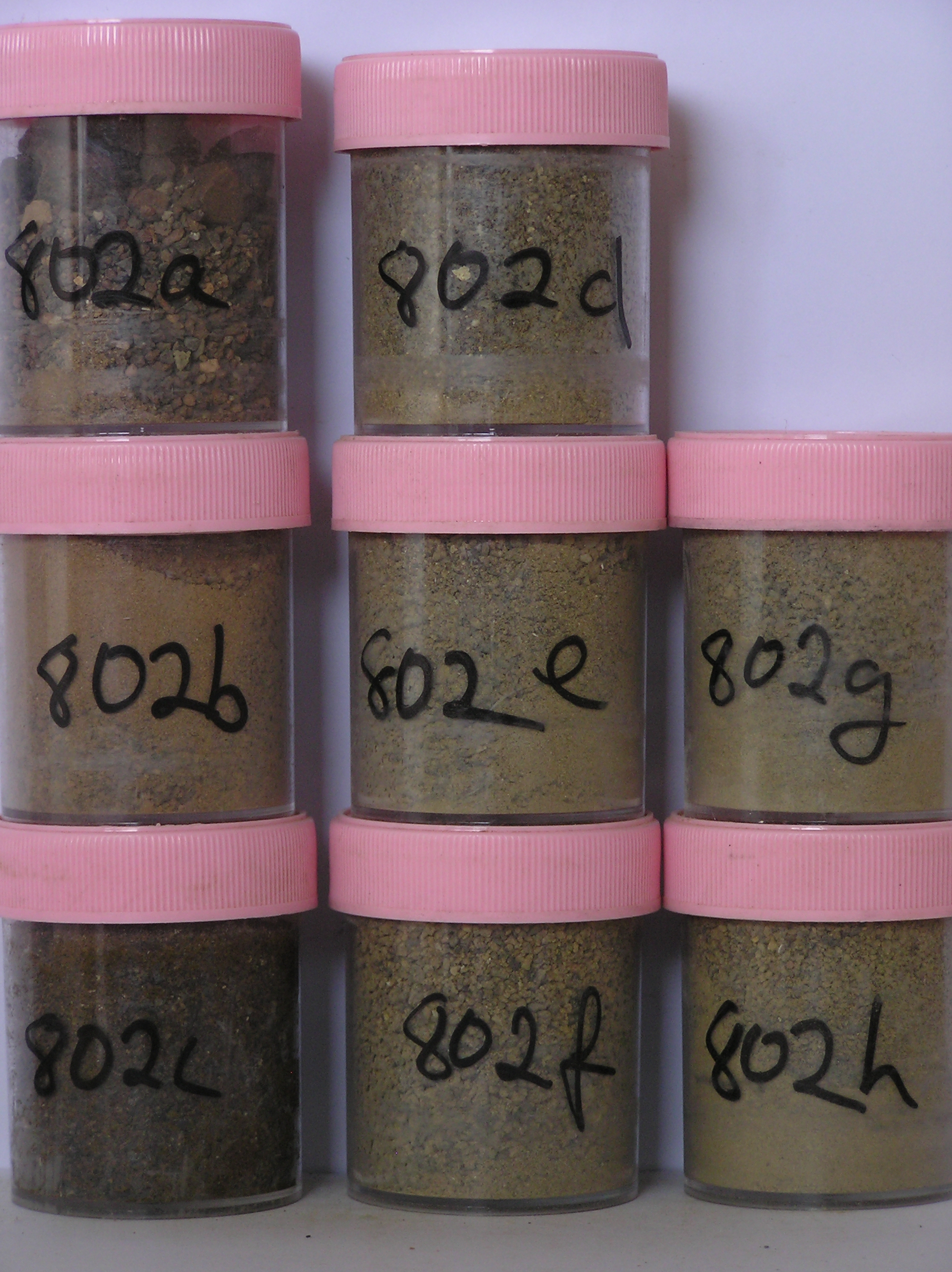
802a 4-0cm
101
surface cobbles, pebbles and boulders
102
subangular to subrounded
103
weakly stained,
802b 0-2cm
201
reddish brown to brown (5YR 5/4 - 7.5YR 5/4) cobbly gravelly sand
202
loose
203
few fine salt flecks and some accumulations beneath surface stones
204
rock particles subangular and non to weakly stained with some moderately altered
205
distinct boundary,
802c 2-14cm
301
yellowish brown (10YR 5/4) cobbly to pebbly gravel
302
weakly to moderately cohesive
303
abundant salt accumulations especially around some clasts
304
rock particles mainly subangular and unstained but oxidation ghosts around some clasts
305
distinct boundary,
802d 14-30cm
401
light yellowish brown (10YR 6/4) very stony cobble, pebble and boulder gravel
402
weakly cohesive
403
scattered salts
404
rock particles angular and unstained
405
indistinct boundary,
802e 30-50cm
501
light yellowish brown (10YR 6/4) very stony pebble and cobble gravel
502
weakly cohesive
503
some scattered salts
504
rock particles angular to subangular and unstained
505
indistinct boundary,
802f 50-70cm
601
light yellowish brown (10YR 6/4) very stony pebble and cobble gravel
602
weakly cohesive
603
some scattered salts
604
rock particles angular to subangular and unstained
605
indistinct boundary,
802g 70-90cm
701
light yellowish brown (10YR 6/4) very stony pebble and cobble gravel
702
weakly cohesive
703
some scattered salts
704
rock particles angular to subangular and unstained
705
indistinct boundary,
802h 90-110cm+
801
light yellowish brown (10YR 6/4) stony gravel
802
loose
803
rock particles angular to subangular and unstained,
Yes
a,b,c,d,e,f,g,h
dry frozen
0
4
Geoland
| Rocks of the area are dominantly volcanic (doleritic but dark coloured, fine grained and with a somewhat vesicular form compared with usual dolerite) and |
| softer haloclastite", (earlier described as tillite); the haloclastite contains basement rocks, dolerite and sandstone clasts with sedimentary structures in places; it is |
| softer and more erodible than the dolerite; the till cover across the area is quite variable and is generally thinner towards Mt Brooke and towards the higher |
| ridges; the till mantle has formed an undulating ridge and swale surface across the landscape with a mega- ripple appearance, which may relate to the manner in |
| which the ice sheets have retreated and ablated, rather than to subsequent landscape modification by wind; although the land surface has a mega ripple, the |
| deposits have no dune like characteristics" |
Surfwea
| Cobbly to bouldery surface with a weakly developed pavement; coarse grained dolerite strongly stained and fine grained dark dolerite unstained but moderately |
| polished; slight surface rounding and weakly ventiform; some rocks pitted and some showing disaggregation,,,,, |
| Soluble Salt |
| Concentration |
80200001
802a
4-0cm
-4
0
none
80200002
802b
0-2cm
0
2
1.39
57.30
1.92
none
80200003
802c
2-14cm
2
14
1.43
45.38
3.41
none
80200004
802d
14-30cm
14
30
1.53
25.63
3.39
none
80200005
802e
30-50cm
30
50
1.45
12.89
2.64
none
80200006
802f
50-70cm
50
70
1.52
15.48
2.82
none
80200007
802g
70-90cm
70
90
1.52
13.61
2.66
none
80200008
802h
90
110
1.51
35.95
3.62
none
80200001
10.40
1.06
80200002
57.30
1.92
80200003
45.40
3.41
80200004
25.60
3.39
80200005
12.90
2.64
80200006
15.50
2.82
80200007
13.60
2.66
80200008
35.90
3.62
80200001
80200002
80200003
80200004
80200005
80200006
80200007
80200008
80200001
80200002
80200003
80200004
80200005
80200006
80200007
80200008
12-Dec-2005
Page 779 of 896
802