Pacific soil data
Introduction
Manaaki Whenua – Landcare Research (MWLR) and its predecessor organisation, the NZ Soil Bureau, have a long history of supporting soil and land resources research in the Pacific, with the origins dating as far back as 1938 when Hamilton & Grange conducted an investigation of soils in Western Samoa.
The support has included funding and technical assistance to Pacific Island countries through soil surveys, soil laboratory analysis, soil characterisation, soil classification, soil fertility analysis, agronomic studies, soil interpretation for land use, information technology applications of soils data, and training for national and regional staff working in soils and agricultural research.
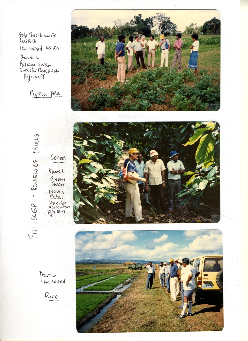
The work has been mainly conducted in the southwest Pacific – the Cook Islands, Fiji, Niue, Tonga, and Western Samoa – but has also involved regional soils projects including the South Pacific Agricultural Chemistry Laboratory Network (SPACNET).
Funding for this work has primarily been from the New Zealand Agency for International Development (NZAID) and its predecessors. Similarly, the NZ Soil Bureau was the major technical contributor to the New Zealand funded soils research in the Pacific.
Several reports are available which provide an inventory of the soil and related research in the Pacific supported by New Zealand over the last 70 years. These inventory is invaluable because soil and related agronomic research underpins the development of sustainable livelihoods in most Pacific countries. They limit the risk that details of the research would be lost through loss of institutional memory due to institutional change, staff turnover, retirements and loss of data within both Pacific and New Zealand organisations.
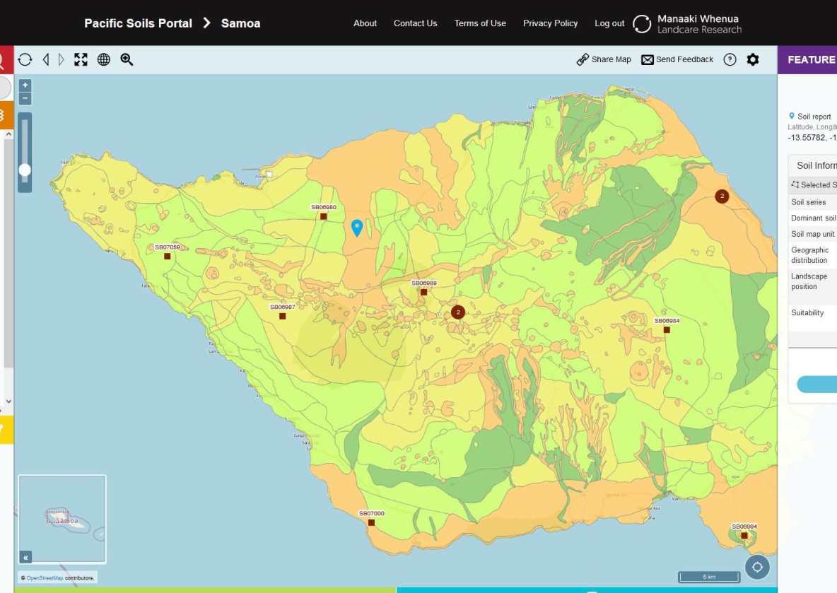
The Pacific Soils Portal
A new information platform for Pacific soils information