Current and upcoming soil surveys
General soil surveys of 1: 253,440 scale (4 miles to 1 inch) have been published for both the North Island (1954) and the South Island (1968). While these provide full coverage across the entire country, the small scale restricts their use to broading planning aspects.
For most applications today, soil surveys are performed at a nominal scale of approx. 1:50,000. While this scale is more appropriate for decision-making at local and regional levels, not all of the country has yet been assessed in that manner. As of August 2025, S-map coverage stood at 44.3%, and covering 60% of New Zealand’s farmable land.
Endeavours to increase coverage are in full swing across multiple regions. The map below provides an overview of ongoing and upcoming soils surveys in New Zealand.
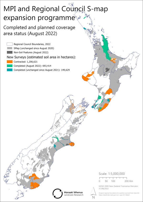
Updates and additions to S-map Online are published every year in August.