A history of New Zealand soil survey
Dr Philip John Tonkin, MSc, PhD, FNZSSS
Former Senior Lecturer, Department of Soil and Physical Sciences, Lincoln University and Former Senior Fellow in the Department of Geological Sciences, University of Canterbury New Zealand.
In his retirement, Phil Tonkin has compiled his wealth of knowledge in the History of Soil Survey and Selected Aspects of Soil Conservation in New Zealand. He has allowed us to reproduce his work to give an overview on the over 100-year soil survey history in Aotearoa New Zealand.
Some of the text has previously been published in New Zealand Soil News, Volume 55, No 2, April 2007 (Part 1), and New Zealand Soil News, Volume 55, No 3, June 2007 (Part 2).
The following sections contain numerous references. Please refer to our dedicated References section below for details.
When Māori migrated to temperate Aotearoa, their gardeners had to discover soils suited to growing kumara, taro, yam, and gourd. Some soils were modified to improve growing conditions for the food they relied on. Northern areas had familiar reddish-brown soils formed on weathered volcanic ash, scoria, and volcanic rocks, while fertile and well-drained soils on flat to rolling country were of great importance. Elsdon Best lists Māori names used to distinguish soils emphasizing soil colour and texture, soil fertility, ease of cultivation and drainage conditions. Examples are Tuatara wawata (brown friable fertile, suitable for kumara), One paraumu (very dark fertile friable), One kura (reddish poor), Kerematua (stiff clay), and One kopuru (wet situations).
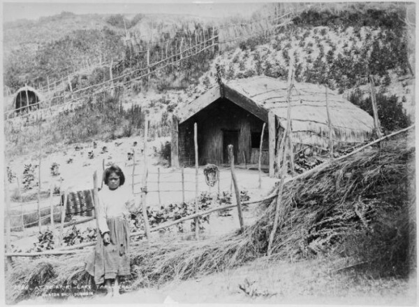
Young Maori girl at Te Ariki Pa. Shows her standing alongside a vegetable garden and a whare. Photograph taken in the 1880s by the Burton Brothers. Source: https://envirohistorynz.com/2010/06/07/maori-gardening-in-pre-european-nz/
If you are interested in the topic of soils in te ao Māori, please visit our dedicated pages.
Early European visitors to New Zealand, impressed by the lush forests, assumed erroneously that they were growing on fertile soils. Dr Ernst Dieffenbach the appointed naturalist to the New Zealand Company from 1839 to 1841, travelling throughout the western North Island, making collections of biological and geological specimens. He noted the geological origin of some soils in New Zealand and in the Chatham Islands where he spent four weeks (A.H. McLintock ed., 1966). Surveyors and missionaries recorded their impressions of soils under cultivation, and by 1840 these observations were included in information for prospective colonists (John Ward 1840, reprinted in 1975). The correlation of soil fertility with vegetation size, such as in the northern kauri forests, proved to be a fallacy, leading to the adoption of specific plant indicators of soil fertility, such as puriri trees, said to be an indicator of fertile soils developed on basaltic tuffs in North Auckland.
In the period 1840 to 1850, studies in United Kingdom and Europe on chemistry and plant nutrition changed the approach to soil analysis. In New Zealand, Europeans with geological knowledge made attempts to sample soils for analysis. A geological survey, established in Otago by James Hector during the 1860’s gold rush, had a laboratory staffed by C.S. Wood and subsequently by William Skey.
William Skey offered free soil analyses, comparing results with standard works of the European chemist Justus von Liebig, and in 1868 reported analyses of 33 soils, giving texture, constituents soluble in water, and fairly complete analyses of hydrochloric acid extracts. This was New Zealand’s first chemical ‘soil survey’ and formed part of a suitability assessment of lands for European settlement. In 1900, Bernard C. Aston was appointed to the new Chemistry Division of the Department of Agriculture. He modified soil analysis in the light of an 1899 study of soils on the Taupo Plains and advocated for a systematic soil survey of New Zealand. He initiated a reconnaissance ‘flying soil survey’ between 1903 and 1906, combined with pot tests of soils to examine nutrient deficiencies. His aim was to identify, but not map, the predominant soil types of a district from a consideration of climate and surface conditions, geological origin, physical and chemical characteristics, vegetation, and recognized economic adaptations. Bernard Aston’s approach was to test the soil in place, rather than in a laboratory. Between 1908 and 1909, he modified the chemical methods for assessing plant available nutrients in the soil, and with the co-operation of farmers, instituted a nation-wide series of soil fertility field experiments to a set design (Aston, B.C. 1923).
The first soil maps in the United States and England were published by 1911. The first soil maps in the early 20th century were in the form of soil texture observations across the landscape, annotated onto hand-drawn sketch maps or prints of the Geological Survey of New Zealand (NZGS). Early areas of exploration include the Wairau Plains, Hawke’s Bay, Gisborne – East Coast, and Wanganui. The soil survey of the Wairau Plains was produced in 1914 by Leonard Wild, used symbols to distinguish the soils on the map, but did not delineate the unit boundaries (Wild 1914). In 1916, Wild then proposed a soil survey of New Zealand, in which subdivisions would be based initially on climate and geological structures, with soil analyses in 0-15 cm and 15-30 cm depth increments, accompanied by a sketch of the soil profile.
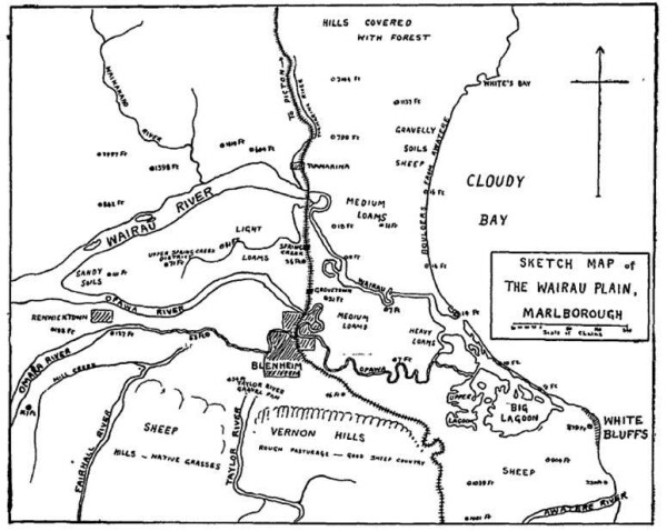
A sketch map of soil texture observations made in the Wairau Plains area by Leonard J. Wild in 1914.
Beginning in 1922, agrogeological surveys were conducted in Northland (Ferrar, H.T. 1922), Central Otago from 1926 to 1928 (Ferrar, H.T. 1929), and in the King Country between 1928 and 1932 (Ferrar, H.T. 1929/30; Marwick, J. 1945). Hartley Ferrar wrote “soils must be mapped, texture and parent material are key factors, climate is of primary concern but geology must be the basis” (Ferrar, H.T. 1925/26).
The idea of a national soil survey in 1923 was promoted again B.C. Aston (Aston 1923a, 1923b), suggesting soils should be identified by locality name and texture, and that different levels of detail be employed.
Theodore Rigg of the Cawthron Institute, Nelson, introduced a technique for field soil texturing and the use of the hand auger to examine the soil profile. Then began the first systematic soil survey in New Zealand, mapping the soils of the Waimea County in the Nelson District (Easterfield, T.H. 1934). The original map, dated 1922, shows twenty-three soil series and forty-three texturally distinguishable soil types.
Soil surveyors in the United States had a procedure for finding and mapping soil boundaries by 1906, that required a large number of systematic borings using a soil auger, with interpolation between locations. This was refined and by 1914, instructions acknowledged that soil surveyors might use landscape features to map soils, in addition to the knowledge of vegetation, parent material and the climate. The First International Soil Congress in Washington in 1927, introduced New Zealand to these new insights into soil classification based on climate, geology, texture, and chemical composition. It was emphasized that the soil profile should be examined and recorded to the depth of the parent rock (Rigg, T. 1928), whereas prior to this, the soil was commonly considered as only the organic, darkened surface A horizon.
In a 1928 report on the Soil Congress, the Russian concept of soil zonality was described, which was then introduced into the United States Cooperative Soil Survey between 1916 and 1920, with an English translation published in 1927, making it more widely available (Glinka, K.D. 1927). The arrival of this book in New Zealand created a paradigm shift, laying out a new pathway of soil investigation. No longer were soils the single unchanging product of a geological substrate, but were modified over time by weathering and leaching processes under the influence of climate and the biota. Hans Jenny’s Factors of Soil Formation (Jenny, H.1941) created a similar impact when it was published in 1941.
Government science was reorganized in 1926, with the establishment of the Department of Scientific and Industrial Research (DSIR). Around the same time, a solution was urgently needed for the problem of ‘bush sickness,' which was an illness affecting sheep and cattle on certain areas of pumice country and adjacent areas of the central North Island. The 1930 soil survey work by Les I. Grange and Norman H. Taylor showed clearly that this wasting stock disease was correlated with soils formed on specific ash showers. This was important new information, and it immediately focused attention on the potential value of soil surveys.
The Soil Survey Division was formed in 1936 from Geological Survey staff, with Grange as Director. It existed in pockets scattered about Wellington and in its district offices, but despite physical handicaps, the new Division made good progress with the first regional land use surveys in Hawke's Bay and Northland.
A DSIR soils team poses in the field in 1929. From left, Leslie Grange, Hartley Ferrar, J. A. Hurst and Norman Taylor. Ferrar’s surveying work in Egypt, and later in Northland, inspired other members of the group. Grange was the first director of the DSIR Soil Survey division (later Soil Bureau), between 1936 and 1952, and Taylor succeeded him (1952–62).
Following studies in south Australia on animal ailments, it was realised that bush sickness was caused by a cobalt deficiency. A palliative treatment with limonite was successful, because of the presence of trace amounts of cobalt. Similar symptoms to bush sickness were investigated in animals at Glenhope near Nelson and related it to soils developed on weathered granite (Rigg T. and Askew, H.O. 1932). In the late 1930s, it was demonstrated that Glenhope and Morton Mains diseases were both caused by a deficiency of cobalt in pastures and soils (Askew, H.O., Dixon J.K. 1937). These early soil surveys played a key role in the investigations of bush sickness and related diseases and subsequently in the identification of other mineral deficiencies in soils.
The 1932 depression slowed down land development and the requests for soil surveys. The then Prime Minister Rt. Hon George Forbes was approached to gain a three-month delay in winding up the soil survey, while support was sought from private firms and the Empire Marketing Board to continue the soil reconnaissance. From the outset, soil surveys had been closely associated with the identification of areas of nutrient and trace element deficiency that could then be treated with the appropriate use of fertilizers.
Methods were established for detailed soil mapping, and the resulting bulletin including large-scale soil maps constituted a milestone in New Zealand’s soil survey history, integrating an assessment of land-use, climate, topography, geology, native vegetation, physical and chemical analyses of selected soils, and soil moisture in relation to plant growth. By 1935, the soil survey team had grown to undertake district soil surveys in Hawkes Bay and Northland as part of more comprehensive studies of land utilization (Grange, L.I. 1939a, 1939b). These activities, tied closely to land-use, kept the soil survey in existence throughout the years of the 1930s depression.
During the early war years, the work of the Soil Survey Division was radically changed; detailed surveys were discontinued, and a start was made on undertaking a general survey of the North Island’s soil resources, at a map compilation scale of four miles to the inch (1:253,440). This was a co-operative project, with the Extension Division of the Department of Agriculture. The survey rapidly produced information on the soils of unmapped areas, which were then linked together with the soil surveys of the previously mapped areas, such as the Waikato, parts of Northland, Hawkes Bay and western Taranaki. Mapping started in February 1940, finished in March 1941, with provisional soil maps drawn and printed in 1942 (New Zealand DSIR Annual Reports for 1940 to 1945).
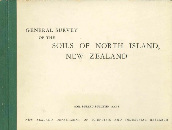
Cover of the NZ Soil Bureau Bulletin no.5. While most survey work was completed in the 1940's, the bulletin eventually appeared in 1954.
Soils were mapped as soil sets, defined as “convenient groupings of soils with like profiles or assemblages of profiles” (Taylor, N.H., Pohlen I.J. 1962). A comprehensive inventory of soil chemical data formed part of the survey together with summaries of relevant agricultural information, from which were produced a series of single factor maps. These were used during the war years to plan and set priorities for agriculture and horticulture production, as well as the distribution of scarce fertilizers. The army used the soil maps for logistical planning and identifying likely sites for airfields.
As part of the war effort, rapid reconnaissance surveys of the whole country and single-factor maps showing limitations to productivity were produced. From the beginning, the soil scientists had made strenuous efforts to correlate their soil types with soil use. In this, outstanding success was achieved, and by 1946 many soil users had come to accept a soil map as the essential basis for any land use planning. In the same year, the Soil Survey was reorganised to form the DSIR Soil Bureau with four divisions: soil survey, soil chemistry, soil physics and soil biology.
Throughout the 1940s, soil classification was at a formative state in New Zealand. Dr Les Grange published two articles on Farming in New Zealand, the first on North Island Soils (Grange, L.I. 1945) in which he listed the following Soil Groups: Recent Soils, Yellow-grey Loams, Podzol Soils, Brown Loams, Meadow Soils, Peaty Soils and Skeletal Soils. In the second article on South Island Soils (Grange, L.I. 1946), the eight groups of soils were: Recent Soils, Lowland Tussock Soils, Highland Tussock Soils in two divisions, Podzolic Soils, Brown Loams, Meadow Soils, Peaty Soils, and Skeletal Soils. In each article, the soil groups were briefly described, and their distribution shown on generalized maps (scale not given), four maps covering the North Island, and three maps covering the South Island. By the mid-1940s, Norman Taylor had formalized three classes of soil survey: general (soil sets, map scale 4 miles to 1 inch), district (showing more detail with patterns of soil types and map scales of 2 miles to 1 inch), and detailed (showing the soil pattern in relation to farm subdivision boundaries at map scale of 40 chains to 1 inch) (Taylor, N.H., Pohlen, I.J. 1962).
The early 1940s was a period of growing concern about the widespread occurrence of erosion and flooding. In the North Island, the floods were regarded as a consequence of the original forests having been felled for timber, or simply burnt in the conversion of lands to pastoral agriculture (Guthrie-Smith, H. 1999 3rd edition). The message was reinforced by the 1938 Esk Flood in Northern Hawkes Bay, clearly demonstrating the link between catchment conditions, flooding, and sediment deposition on flood plains, which occurred in the middle of the Hawkes Bay soil survey. More soil erosion research was needed, initiating a reconnaissance survey of soil erosion in the high country of the South Island (Gibbs, H.S. et.al., 1945). This was followed by an assessment of soil erosion in the southern half of the North Island (Grange, L.I., Gibbs, H.S. 1945), a study of soil erosion on loess downlands in Geraldine County in South Canterbury (Raeside, J.D., Baumgart, I.L. 1947), and a study of soil erosion on the Wither Hills in Marlborough (Gibbs, H.S. 1945).

The period after the Second World War was the golden age of soil surveys. Surveys were made as a result of requests from local authorities, agricultural groups, and a growing need to understand soils in places where there was little information. There were major investigations in:
- Gisborne Plains – later used to plan intensive horticulture
- Rotorua–Taupō region – for planning farms and forestry
- Fruit-growing and irrigation areas of Central Otago
- Manawatū sand country

In 1948, Taylor produced a 1: 2,000,000 scale soil map of New Zealand using his ‘New Zealand Genetic Soil Classification’ to organize the map legend. A proposed bulletin to accompany this map was never completed, although a summary version was produced in a short paper (Taylor, N.H., Cox, J.E. 1956). On the ground mapping for the general survey was largely completed by 1950, with reports and maps published at a 1 inch to 4 mile scale (1:253,440) scale for the North Island in 1954, and for the South Island in 1969. The South Island general survey completed coverage of the two main islands of New Zealand, giving an overall picture of the soil pattern.
The soil classification was based on soil processes, recognizing the soil as a dynamic system, comprising soil wasting, organic, and inorganic regimes. It highlighted the degree of weathering of soils, recognized the effect of latitudinal and altitudinal differences in climate on soil processes, and facilitated the study of soils as part of a coherent whole – groups, suites, sequences – rather than as discrete individuals. This soil classification brought a sense of order and structure to soil investigations, largely because it was simple in concept and easily understood by soil scientists, agriculturalists and others involved in the primary industries. In the following years, significant advances were accomplished in areas of soil chemistry, mineralogy, and biology. This provided information for planning of research into soil problems affecting land-use and provided a basis for research and management of soil macro and micronutrients.
In the 1950s, DSIR Soil Bureau staff participated in surveys of southwest Pacific Islands, following on from an earlier examination of soils in Western Samoa (Grange, L.I. 1937). Soils were mapped from the Cook Group (Grange, L.I., Fox, J.P. 1953), Chatham Island (Wright, A.C.S. 1959), Western Samoa (Wright, A.C.S. 1963), and Niue (Wright, A.C.S., Van Westerndorp, F.J. 1965).
After 1955, soil conservation and erosion mitigation measures on agricultural lands were executed by many of the South Island catchment boards, using conservation farm plans based on a land inventory survey and a land-use capability plan. These plans formed a basis for the subsequent design of farm developments, so that control of erosion was integrated into farm management operations. Farm plans were usually approved as five yearly programs, with specific targets to be met by the farmer. These were initiated in the period between 1956 and 1966, when the Works Departments soil conservators became advisory officers in the Department of Agriculture. The eventual adoption of an agreed conservation farm plan model by all catchment authorities, and the publication of the first Land-Use Capability Handbook by the Soil Conservation and Rivers Control Council in 1969, had an important bearing on progress, enhancement of consistency, quality, and the professional development of soil conservation.
Up until the end of the 1950s, the DSIR Soil Bureau had been housed in less than adequate conditions in a number of buildings in Wellington, including the infamous 54 Molesworth Street, opposite the Parliament buildings. In 1949, the acquisition of land at Taita on the eastern side of the Hutt Valley provided a permanent head office for Soil Bureau, to be known as the Taita Research Station. In the early 1950s, a relocated building on the Taita site established the soil biology section, and by 1962 the new purpose build laboratory was ready for occupation. This was the first time DSIR Soil Bureau staff, with the exception of the field offices, had been located together.
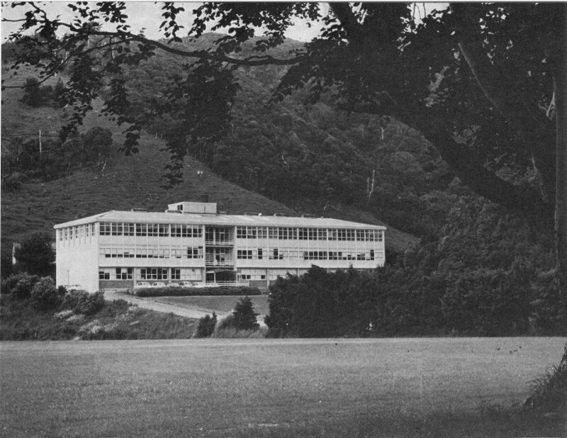
Headquarters of N.Z. Soil Bureau at Taita, Lower Hutt in 1962.
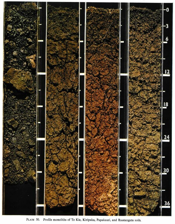
Soil monoliths depicted in Bulletin 26, Part 3 (1968)
In 1962, Soil Survey Method was published (Taylor, N.H., Pohlen, I.J. 1962, 1979), being one of the most comprehensive manuals available for soil surveyors at this time, and the first formally published in New Zealand. It set standards for soil description and mapping, and included the first published version of a New Zealand Genetic Soil Classification with the common and a novel technical nomenclature. This classification was republished in 1968 as part of the Soils of New Zealand (New Zealand Soil Bureau, 1968). An Inter-Congress Meeting of Commissions IV (Soil Fertility) and V (Pedology) was to be held in New Zealand. In the years prior to this meeting, Soil Bureau’s field and laboratory staff made a New Zealand-wide collection of reference soils with descriptions, to which were added chemical, physical and mineralogical analyses. The conference was held at Massey University in 1962 and included field tours throughout both islands. The conference and tours were a success and illustrated the integration between soil survey and soil fertility, and the application of this knowledge to agricultural, horticultural and forestry land-uses in New Zealand.
In 1964, survey teams were established in the North and South Islands. These teams were to undertake Land Use Capability assessments of catchments and other areas, such as Land and Survey Department development blocks as required by the National Water and Soil Conservation Organization (NWASCO). They mapped most of the development blocks on the volcanic plateau. In the early 1970s, NWASCO set out to map New Zealand to provide a series of three 1:250,000 scale maps: the potential erosion map, the land use capability (LUC) map, and the recommended land use map. The potential erosion map was completed, the recommended land use map was not, and the LUC map was changed to the New Zealand Land Resource Inventory (NZLRI) map series at a scale of 1:63360.
Throughout the 1970s, the soil survey programme was expanded with the addition of thirty new staff. Dr Leamy became the Chief Pedologist, responsible for overseeing the soil survey programme. Over the decade, soil survey offices in Oamaru, Wanganui, Whakatane, Pukekoke and Whangarei were closed, the Canterbury office moved to Lincoln, the Hamilton office shifted onto the Ruakura campus, and new offices were opened in Nelson, Rotorua and Auckland.
Major surveys included:
- Upper Waitaki Basin, led by David W. Ives and later refined by Trevor H. Webb,
- Inangahua Valley, led by Geoff Mew; the soil resources of large tracts of North Westland and the Buller were mapped between 1972 and 1991,
- King Country, led by Wim C. Rijkse and Wilde,
- and Manukau City, led by Brian R. Purdie.
Beginning in the late 1970s, Dr Leamy and David M. Leslie re-established soil surveys in Pacific Islands, that were to continue for two decades involving teams of pedologists in the Cook Islands, Fiji, Tonga and Samoa. These surveys were a continuation of a Pacific involvement that began with Grange in the 1930s and Fox, Wright, and others in the 1950s. Iain Campbell and Graham Claridge continued a program of soil studies in Antarctica that began with McCraw and Claridge in the summer of 1959-60.

Georgina Finau, Wim Rijkse, Malcolm McLeod, Vilitati Seru and Graham Shepherd discussing the soil survey of Sigatoka Research Station, Fiji (1981)
The 1973 Town and Country Planning Amendment Act recognized the need to conserve soils of high actual or potential use for food production. Consequently, pedologists were urged to include an increasing range of interpretations in their assessments of soils. Pedologists became involved in Town and Country Planning issues and were often called as expert witnesses before Planning Tribunal hearings. A consequence of these developments, together with the diversity of soil survey investigations occurring at this time, was the need to compare soil resources of different areas. As an aid to soil correlation and the establishment of soil survey standards, a major emphasis was given to documenting soil data and to generate soil-taxonomic and soil-map-unit description sheets for all soils.
By the end of the decade, the requests for soil surveys began to increase and exceed the resources available. For example, the Lands and Survey Department’s ambition to produce inch to the mile (1:63,360) soil maps for all 120 counties in the country within 10 years was behind schedule, with only 15 counties mapped by 1971. This was despite the reality that soil surveys were completed more quickly than they were being published by the Lands and Survey Department. Other new soil surveys included land resource surveys as part of a National Resources Survey, compiled for the Ministry of Works, Town and Country Planning Branch. Seven district soil surveys were also completed during this decade, and it was not uncommon for ten years to elapse between completion of a district survey and their publication as a printed and bound bulletin.

Nation-wide mapping was completed 1985, using inch to the mile (1:63,360) topographic maps. The maps incorporated soil data from DSIR Soil Bureau surveys, with some updating and modification of unit boundaries.

The NZLRI interpretation of the soils differed from that shown on the reconnaissance soil maps at times, but the NZLRI interpretation was used in preference in these instances. This applied mostly in areas of hill country and mountain-lands, where only reconnaissance soil maps were available. The earlier erosion surveys, initiated in the 1930s by DSIR Soil Bureau, were superseded by the NZLRI with its nationwide assessment of present and potential erosion.
Multidisciplinary catchment studies were initiated in the South Island. In the North Island, studies investigating the impact of soil erosion on pastoral agriculture in the Wairarapa, Taranaki, Hawke's Bay and on the East Coast begun. These were followed by comprehensive erosion and sedimentation studies at Lake Tutira in northern Hawke's Bay, in the Waipaoa catchment east of Gisborne, and in hill country in eastern Taranaki.
A focus of the Christchurch Hydrology Centre was the gauging of New Zealand’s rivers and measuring and estimating sediment yields. This center had an Alpine Processes Group that studied a selection of catchments along a central Southern Alps transect, documenting the history and tempo of erosion. Studies established the relationship between precipitation patterns, the relative rate of erosion and sedimentation, from studies of drainage basins along an east to west transect across the central Southern Alps. Soil stratigraphy was researched in four of these drainage basins, which showed that the highest present rates of soil erosion occurred in high rainfall western mountains even in the presence of a complete grass-shrub and forest vegetation cover (Tonkin, P.J., Basher, L.R. 1990).
A feature of the soil survey work in the mid to late 1980s was the number of small, detailed surveys for specific purposes, such as examination of orchards in central Otago, orchards and horticulture in the Waikato, viticulture in the Wairau Valley, the land disposal of sewage effluents near Rotorua, and on the lands adjacent to the Auckland airport. Another aspect of land-use concerned the restoration of land after mining, ranging from topsoil stripping to restoration following larger scale gold mining on the West Coast, gold and silver mining in the Coromandel, and coal mining in the Waikato and Southland.
Other district surveys were completed of the Marlborough Sounds, Heretaunga Plains and Ruataniwha Plains in Hawkes Bay, and the West Coast. Allan Hewitt and Ben Clayden were instrumental in revamping Horizon Notation for New Zealand Soils, published in 1989. In 1991, a replacement for Soil Survey Method was published, the Soil Description Handbook (Milne, J.D.G. et al., 1995), where the horizon notation for New Zealand was included.

In 1985, a comprehensive review of the Soil Resources Section was commissioned by the then Director of Soil Bureau. This review endorsed the need for an inventory of soil resources and noted that other sections of DSIR Soil Bureau were heavily reliant on the soil resources section for identifying research problems, selecting appropriate sites and samples, and providing a real basis for interpreting results. Despite this endorsement, by 1987, the soil survey programme was beginning to wind down, and the soil resources section dismantled. The last conventional soil map and report published by DSIR Soil Bureau was in 1987, and thereafter a new policy of user-pays was reflected in the withholding of soil maps and reports from publication, as they were deemed to be either too valuable or too commercially sensitive.
In 1987, the long-standing Ministry of Works and Development was disestablished, together with the Lands and Survey Department and the New Zealand Forest Service. Their functions were regrouped into new departments and ministries, with those scientists of the Water and Soil Division’s Science Centers who survived these changes divided between the Crown Research Institutes (CRIs) that emerged in the early 1990s: Landcare Research, NIWA and IGNS (now GNS Science), and Forest Research (now Ensis and Scion). Today, the policy and oversight functions of the former NWASCA are part of the role of the Ministry for the Environment under the Resource Management Act (RMA), and the function of the former catchment authorities has been incorporated into the regional and district councils. A consequence of these administrative changes has been a significant reduction in staff having soil conservation capabilities since the late 1980s.
Beginning in 1988, reorganization of science was underway with DSIR Soil Bureau and part of the Water and Soil Divisions, and Aokautere and the Christchurch Science Centers amalgamated to form the DSIR Division of Land and Soil Science. Further restructuring in 1990 led to the DSIR Ecology and Botany Divisions, and the Science Mapping Unit merging with the Division of Land and Soil Sciences to form DSIR Land Resources. In mid-1992, after a fifteen-month establishment phase, Landcare Research NZ Limited / Manaaki Whenua, one of ten new Crown Research Institutes, was established by combining DSIR Land Resources with Forest Research Institute’s Wildlife Ecology Division, DSIR Plant Protection Division, and DSIR Physics and Engineering Laboratory’s Remote Sensing Group. Landcare Research retained the remaining soil survey and soil conservation capability. An effect of these changes was to be felt in the universities, with a sharp decline in the number of postgraduates studying pedology and soil conservation corresponding with the dramatic decrease in employment opportunities. Consequently, there has continued to be a reduction of qualified and experienced pedologists and soil conservation specialists in New Zealand into the 1990s.

At the end of 1993, the former DSIR Soil Bureau Taita campus was closed, and many of the remaining staff transferred to either Palmerston North or Hamilton. Landcare Research decided to consolidate activities at fewer centers, closing former soil survey offices in Blenheim, Taita, Rotorua, Havelock North, and Dunedin between 1992 and 2001. The remaining pedologists were based at Lincoln, Palmerston North, and Hamilton, followed by a period of reduced soil survey activity. Some surveys that started in the days of DSIR Soil Bureau continued, but in those regions where offices were closed, soil surveys fell into abeyance. The few remaining pedologists were involved in monitoring soil water relationships, developing soil databases, and conducting soil surveys contracted by district and regional councils or private landowners.
A few conventional soil surveys were completed, some of which were begun prior to or during the years of transformation from DSIR Soil Bureau to Landcare Research. In 1993, a workshop was held at the Aokautere Science Centre bringing together many of the studies on soil-landscape modelling, highlighting a change in approach and the development new technologies applicable to soil and land resource surveys (Webb T.H. (editor) 1994). The 1990s were a period of reassessment and redefining of the role of land resource surveys. Today there are continuing developments of the New Zealand Land Resource database, which incorporates the NZLRI database, reformatted and digitized soil surveys on a common scale of 1: 50,000, and the New Zealand Soils Database composed of chemically and physically analyzed soil profiles.
Landcare Research inherited some large catchment studies in the Northern Hawkes Bay (Tutira) and Gisborne-East Coast (Waipaoa). These continue, and in addition there are integrated catchment studies of the Motueka and Riwaka Catchments in Nelson, and of the catchments bordering Raglan Harbour in the western North Island (Fine Sediment Study). These studies involve several CRIs, with soil and geomorphological surveys contributed by Landcare Research.
The role of the soil surveyor has changed in the past three decades, from that of the mapper of soils, to a wider range of activities that include modelling nutrient flows in the landscape, identifying catchments sensitive to pollution, making recommendations for land disposal of effluents, and planning and overseeing national-scale sampling and analysis for the carbon inventory and of contaminants. The national terrestrial carbon inventory began with soil chemical data gathered in soil surveys of the 1960s to 1980s, and has since been refined and enlarged, gathering all the available New Zealand soil and vegetation carbon data. This work has led onto the development of the Carbon Monitoring System, which began in 1996, with the development phase completed in late 2001. The implementation phase followed and continued until early 2007.
Between 1998 and 2001, a survey of the soils of Southland was undertaken as part of the Topoclimate South Project, an initiative of Crops for Southland, which in turn was established by the Southland Regional Council. Crops for Southland is a research and advisory body set up to investigate alternative crops that might be grown in Southland. A fundamental requirement of this research was better information on the region’s microclimates and soils at a farm scale. With little likelihood of a central government solution forthcoming through the CRIs, the Topoclimate South initiative was undertaken by a consortium of the Southland Regional Council, three District Councils and the Invercargill City Council, and underwritten by the Southland Community Trust. The Government eventually supported the project and contributed a little over a third of the total cost of 4.6 million dollars. In this regional study, teams of contract staff monitored the microclimate and surveyed the soils of 825,000 ha of intensively farmed Southland and South Otago at a scale of 1: 50,000. The Geography Department of the University of Otago assisted with the microclimate network and data processing. Landcare Research involvement began with employees taking on supervisory and advisory roles to the soil survey team, comprising recent graduates from Lincoln and Massey universities. The surveys produced 36 district soil maps and growing degree-day maps, which are available online, together with 170 two-page soil information sheets describing each soil series. In all, 65% of the project’s output was new soil mapping, 25% was minor resurveying of poor-quality existing soil maps, and 11% was reissuing of existing good quality DSIR Soil Bureau soil maps. A collection of 630 described typical soil profiles form the project’s SoilPro database, and approximately 450 have analyses of some chemical and physical attributes. Final maps were published and distributed in February 2002, followed by twenty public meetings to explain the maps and services available. Clients, mostly farmers, are able to purchase additional information from Venture Southland.

The Topoclimate South Project stimulated the Otago Regional Council to establish a similar initiative called growOTAGO, this time with the input of CRIs: NIWA managing the project, and AgResearch, and Landcare Research providing technical assistance. Landcare Research colleagues came together with GIS specialists and produced 43 growOTAGO soil maps at a scale of 1: 50,000 from existing soil map information at various scales and additional surveying where required. Apart from the Roxburgh Uplands, the soil mapping of the extensive uplands and mountains of Otago is generally poor. For these areas, the soil boundary information from the NZLRI surveys were overlain on a 1: 50,000 digital terrain model that allows the terrain to be visualized through the soil map layer. This is lower resolution information than available for the lowlands and valleys floors for which a lowland soil legend was compiled. The growOTAGO soil maps provide at a 1:50,000 scale, a correlated and rationalized soil coverage of Otago suitable for regional and local planning. The utilization of this resource was completed with the development of a regional soil database and the production of soil fact sheets for the 1300 soil types occurring in the intensively managed lowlands. These fact sheets became available over the web in December 2005, and can be automatically updated and generated using the latest information and models.

S-map, a new initiative of Landcare Research, funded by Foundation for Research Science and Technology (FRST), began in 2004 and represents a revitalised effort in soil survey and soil database development in New Zealand. Landcare Research has responsibility for the nationally significant database, the Land Resource Information System (LRIS), comprising the National Soils Database (NSD), the New Zealand Land Resource Inventory (NZLRI), and S-map. The current national soil maps are contained within the NZLRI and are known as Fundamental Soil Layers (FSLs). The NZLRI, originally formatted at a map scale of 1:63,360, contains soil map information from a range of soil maps published by DSIR Soil Bureau prior to 1979. The original NZLRI maps have been enlarged and reformatted on a 1:50,000 scale and those for Northland, Gisborne-East Coast, Wellington, and Marlborough have been revised.
S-map has a number of features that depart significantly from previous soil surveys. It is digital, meaning that it is not cartographically constrained in the manner of conventional printed soil maps. It is accompanied by a database that stores the fundamental soil classification and soil morphological data, is linked to the NSD, and provides data in a format more suitable for modelling. It provides an expression of variability with probability distributions estimated for most attributes in the S-map database. S-map focuses exclusively on soil classes and their attributes. Environmental considerations such as climate, topography or digital elevation models (DEMs), and to some degree vegetation and rock type that were commonly incorporated in conventional soil maps, can be handled as separate independent spatial layers in the geographical information system (GIS) database. S-map will have a national soil map legend that will be rationalized by correlating existing soil series into ‘Families’ and ‘Siblings’. Correlation of similar soil series into families will accumulate better datasets for the analysis of the families. Two approaches are to be used in S-map, one for lowlands and the other for uplands. Lowland landforms are of such low relief that DEMs based on 20-m contour data cannot be used for soil-landscape modelling and so conventional soil mapping methods, based on air-photo interpretation and free survey techniques, are used. In uplands comprising dominantly hill and mountain terrain, relief allows the application of soil-landscape modelling based on DEMs and other spatial information. The predominant technique will be to derive soil distribution rules and apply these to modelled landform land elements. S-map builds on Topoclimate South and growOTAGO, and is being applied to the Dry Eastern Greywacke Mountains (Ian Lynn), Motueka Catchment (Dr Allan Hewitt), Canterbury and North Otago (Trevor Webb), Wairarapa (Hugh Wilde), and Northland (Malcolm McLeod).
The establishment of the CRIs in the early 1990s did not resolve the fragmentation of soil science and land-use research that had been a feature of earlier decades. This fragmentation between CRIs had serious consequences in a competitive funding environment. This came to a near crisis in 2002-2003, when several CRIs failed to secure sufficient FRST funding to support soil science research programmes. The response was that in late 2003 four CRIs, AgResearch, Crop and Food Research, Hort Research and Landcare Research, proposed forming an entity to coordinate soil science and land-use research, the Sustainable Land-use Research Initiative (SLURI), with the objective of outlining themes, issues, impacts, and identifying research needs.
 Cover of the 3rd edition of the LUC Handbook (2009)
In February 2004, the Manawatu and Wanganui regions were impacted by a severe storm causing widespread erosion and flooding. This was nature’s wakeup call, and in its aftermath the Horizon Regional Council, district councils, Federated Farmers, and many others including the relevant CRIs, developed the Sustainable Land-use Initiative (SLU).
From this, came the recognition of the need to revitalise the training of soil and land-use specialists, the updating and republishing of the Land-use Capability handbook (Lynn, I. H. et al., 2009) that displayed the renewed interest and importance of LUC once again, and the development and delivery of whole farm plans. The whole farm plans are the key, recognizing that the landowner is the decision maker. The landowner needs both the support of trained technical advisors and researchers, and the opportunity to develop the requisite knowledge and skills focused on resource conservation. Such conservation includes the sustainable managements of soils, land, water, vegetation, and the on-farm and off-farm management of sediment, water, and effluents.
In developing the SLU, the lack of soil resource information at the scale at which individual landowners make decisions has been identified as a limitation, as is the critical shortage of trained professionals with skills in soil and land resource mapping and the development of appropriate environmental programmes. It is recognized that in the first five years of the SLU initiative there is a need to build capability by rebuilding the skills of specialists, both professional and practitioner.
Allbrook, R.F. 1983. Some physical properties of allophane soils from the North Island, New Zealand. New Zealand Journal of Science 26, 481-492.
Allbrook, R.F. 1985. The effect of allophane on soil properties. Applied Clay Science 1, 65-69. https://doi.org/10.1016/0169-1317(85)90562-9.
Bakker, L. 1997. Towards a model of valley-side development on ignimbrite terrain, Mamaku Plateau, New Zealand. PhD thesis, University of Waikato, Hamilton. Ex Libris Discovery - Towards a model of valley-side development on ignimbrite terrain, Mamaku Plateau, New Zealand (exlibrisgroup.com).
Bakker, L., Lowe, D.J., Jongmans, A.G. 1996a. A micromorphological study of pedogenic processes in an evolutionary soil sequence formed on Late Quaternary rhyolitic tephra deposits, North Island, New Zealand. Quaternary International 34-36, 249-261. https://doi.org/10.1016/1040-6182(95)00090-9.
Bakker, L., Morad, M., Lowe, D.J. 1996b. Landform classification of the Mamaku Plateau using a digital elevation model. Proceedings of Spatial Information Research Centre’s 8th Colloquium, University of Otago, 189-197. (PDF) Landform classification of the Mamaku Plateau using a digital elevation model. (researchgate.net).
Balks, M.R. 2009. Footprints at the end of the Earth: impacts and management of human activities on frozen soils. Norman Taylor Memorial lecture 2008. New Zealand Soil News 57 (1), 33-42. New Zealand Soil News - New Zealand Soil News - Manaaki Whenua Landcare Research Digital Library.
Balks, M. R., O’Neill, T. A. 2016. Soil and permafrost in the Ross Sea Region of Antarctica: Stable or dynamic? Cuadernos De Investigacion Geografica 42, 415-434. https://doi.org/10.18172/cig.2923.
Churchman, G.J., Lowe, D.J. 2012. Alteration, formation, and occurrence of minerals in soils. In: Huang, P.M., Li, Y., Sumner, M.E. (eds), “Handbook of Soil Sciences. 2nd edition. Vol. 1: Properties and Processes”. CRC Press, Boca Raton, FL, pp.20.1-20.72. (PDF) Alteration, formation, and occurrence of minerals in soils (researchgate.net).
Cunningham, M.J., Lowe, D.J., Wyatt, J.B., Moon, V.G., Churchman, G.J. 2016. Discovery of halloysite books in altered silicic Quaternary tephras, northern New Zealand. Clay Minerals 51, 351-372. https://doi.org/10.1180/claymin.2016.051.3.16.
Dalrymple, J.B., Blong, R.J., Conacher, A.J. 1968. A hypothetical nine-unit landsurface model. Zeitschrift für Geomorphologie 12, 60-76.
Davoren A. [with McCraw, J.D., Thompson, K.] 1978. A survey of New Zealand peat resources. Ministry of Works, Water and Soil Technical Publication 14. 157 pp. + maps. https://webstatic.niwa.co.nz/library/wstp14.pdf.
Earth Sciences Staff 1987. Department of Earth Sciences 1970-1987. Department of Earth Sciences, University of Waikato, Occasional Report 12. 93 pp.
Gibbs, H.S., Lowe, D.J., Hogg, A.G. 1982. Parent materials of Yellow-brown loams in the Waikato-Coromandel district. In: Neall, V.E. (editor) “Soil Groups of New Zealand. Part 6. Yellow-brown loams”. New Zealand Society of Soil Science, Lower Hutt, pp. 12-13. https://afc5667b-48dd-46b7-8f5a-18ce4614bc39.usrfiles.com/ugd/623971_0cb5c8ce77ca498ba8fbe75e574ce5d2.pdf.
Gumbley, W., Higham, T.F.G., Lowe, D.J. 2004. Prehistoric horticultural adaptation of soils in the middle Waikato Basin: review and evidence from S14/201 and S14/185, Hamilton. New Zealand Journal of Archaeology 25, 5-30. https://nzarchaeology.org/download/prehistoric-horticultural-adaptation-of-soils-in-the-middle-waikato-basin-review-and-evidence-from-s14201-and-s14185-hamilton.
Hainsworth, S.B. 2012. Properties and distribution of soils on the Ruataniwha Plains, Hawke’s Bay: a new approach integrating classical and digital mapping techniques. MSc thesis, University of Waikato, Hamilton. https://hdl.handle.net/10289/6129.
Hartemink, A.E., Balks, M.R., Chen, Z-S., Drohan, P., Field, D.J., Krasilnikov, P., Lowe, D.J., Rabenhorst, M., van Rees, K., Schad, P., Schipper, L.A., Sonneveld, M., Walter, C. 2014. The joy of teaching soil science. Geoderma 217-218, 1-9. https://doi.org/10.1016/j.geoderma.2013.10.016.
Heaphy, M.J., Lowe, D.J., Palmer, D.J., Jones, H.S., Gielen, G.J.H.P., Oliver, G.R., Pearce, S.H., 2014. Assessing drivers of plantation forest productivity on eroded and non-eroded soils in hilly land, eastern North Island, New Zealand. New Zealand Journal of Forestry Science 44: 24 (10 pp.). https://doi.org/10.1186/s40490-014-0024-5.
Hewitt, A.E. 2010. New Zealand Soil Classification 3rd edition. Landcare Research Science Series 1. 136 pp. doi.org/10.7931/DL1-LRSS-1-2010.
Hodder, A.P.W., Wilson, A.T., 1976. Identification and correlation of thinly bedded tephra: the Tirau and Mairoa ashes. New Zealand Journal of Geology and Geophysics 19, 663-682. https://doi.org/10.1080/00288306.1976.10426313.
Hodder, A.P.W., Green, B.E., Lowe, D.J. 1990. A two-stage model for the formation of clay minerals from tephra-derived volcanic glass. Clay Minerals 25, 313-327. https://doi.org/10.1180/claymin.1990.025.3.07.
Hogg, A.G., McCraw, J.D., 1983. Late Quaternary tephras of Coromandel Peninsula, North Island, New Zealand: a mixed peralkaline and calcalkaline tephra sequence. New Zealand Journal of Geology and Geophysics 26, 163-187. https://doi.org/10.1080/00288306.1983.10422515.
Huang, Y-T., Lowe, D.J., Zhang, H., Cursons, R., Young, J.M., Churchman, G.J., Schipper, L.A., Rawlence, N.J., Wood, J.R., Cooper, A. 2016a. A new method to extract and purify DNA from allophanic soils and paleosols, and potential for paleoenvironmental reconstruction and other applications. Geoderma 247, 114-125. https://doi.org/10.1016/j.geoderma.2016.04.003.
Huang, Y-T., Lowe, D.J., Churchman, G.J., Schipper, L.A., Cursons, R., Zhang, H., Chen, T.-Y., Cooper, A. 2016b. DNA adsorption by nanocrystalline allophane spherules and nanoaggregates, and implications for carbon sequestration in Andisols. Applied Clay Science 120, 40-50. https://doi.org/10.1016/j.clay.2015.11.009.
Jones, H.S. 1998. Evaluating soil classification and soil-landscape modelling for site-specific forest management, Woodlaw Forest, Southland, New Zealand. MSc thesis, University of Waikato, Hamilton. Ex Libris Discovery - evaluating soil classification and soil-landscape modelling for site-specific forest management (exlibrisgroup.com).
Jones, H.S. 2004. Impacts of forest harvesting on performance of soil-landscape modelling in a radiata pine forest, northern New Zealand. PhD thesis, University of Waikato, Hamilton. https://hdl.handle.net/10289/13258.
Jones, H.S., Lowe, D.J., McLay, C.D.A. 1997. Soil-landscape modelling and soil property variability for forestry land evaluation in Longwood Forest, Southland. Phase 1: Soil-landscape model development. Progress Report No.1 for Rayonier New Zealand Ltd. University of Waikato, Hamilton. 54 pp. https://hdl.handle.net/10289/10236.
Jones, H.S., Lowe, D.J., Rijkse, W.C., McLay, Payn, T.W. 2000. A soil-landscape model for southern Mahurangi Forest, Northland. Mahurangi Forest-Soil Project Report No. 1 to Forest Research. Department of Earth Sciences, University of Waikato. 63 pp. (PDF) A soil-landscape model for Mahurangi Forest, Northland, New Zealand. (researchgate.net).
Kleyburg, M.A., Moon, V.G., Lowe, D.J., Nelson, C.S. 2015. Paleoliquefaction in Late Pleistocene alluvial sediments in Hauraki and Hamilton basins, and implications for paleoseismicity. Proceedings, 12th Australia New Zealand Conference on Geomechanics (ANZ 2015), 22-25 February 2015, Wellington, pp. 524-531. Paleoliquefaction in Late Pleistocene alluvial sediments in Hauraki and Hamilton basins, and implications for paleoseismicity | ISSMGE.
Kluger, M.O., Moon, V.G., Kreiter, S., Lowe, D.J., Churchman, G.J., Hepp, D.A., Seibel, D., Jorat, M.E., Mörz, T. 2017. A new attraction-detachment model for explaining flow sliding in clay-rich tephras. Geology 45, 131-134. https://doi.org/10.1130/G38560.1.
Lanigan, K. M. (2012). Characterisation and paleoclimatic signals within tephric loess deposits aged between c. 33 to 9.5 cal ka in the Rotorua area, northern New Zealand (Thesis, Master of Science (MSc)). University of Waikato, Hamilton, New Zealand. Retrieved from https://hdl.handle.net/10289/6513.
Linehan, J.P. 2015. Distribution of soils in the southern Hawke’s Bay greywacke foothills land system. BSc (Hons) dissertation, University of Waikato, Hamilton.
Lowe, D.J. 1979. Soils of Steele’s Farm, Airport Rd, Rukuhia, with 1:1250 map. Ruakura Agricultural Research Centre [per B. Willoughby], Ministry of Agriculture and Fisheries (MAF), Hamilton.
Lowe, D.J. 1986. Controls on the rates of weathering and clay mineral genesis in airfall tephras: a review and New Zealand case study. In: Colman, S.M., Dethier, D.P. (editors), “Rates of Chemical Weathering of Rocks and Minerals”. Orlando, Academic Press, pp. 265-330.
Lowe, D.J. 1988. Stratigraphy, age, composition, and correlation of late Quaternary tephras interbedded with organic sediments in Waikato lakes, North Island, New Zealand. New Zealand Journal of Geology and Geophysics 31, 125-165. https://doi.org/10.1080/00288306.1988.10417765.
Lowe, D.J. 1989. Distinguishing rhyolitic and andesitic tephra as soil parent materials for series definition. New Zealand Soil News 37, 90-93. https://doi.org/10.7931/DL30-1989_VOL37_4_ORC.
Lowe, D.J. 1990. Review of “Horizon Notation for New Zealand Soils” by B. Clayden and A.E. Hewitt. New Zealand Soil News 38, 33-34. https://doi.org/10.7931/DL30-1990_VOL38_2_ORC.
Lowe, D.J. 1992. Review of “New Zealand Soil Classification” by A.E. Hewitt. New Zealand Soil News 40, 201-206. https://doi.org/10.7931/DL30-1992_VOL40_6_ORC.
Lowe, D.J. 2002a. Soil science at the University of Waikato: a brief history. In: Adams, J.A. (editor), “Jubilee Reminiscences: Fifty Years of Soil Science Memories”. New Zealand Society of Soil Science Occasional Publication 3, 37-39. https://www.researchgate.net/publication/251875893_Soil_science_at_the_University_of_Waikato_a_brief_history.
Lowe, D.J. 2002b. The time machine. Norman Taylor Memorial Lecture 2002. New Zealand Soil News 50, 124-135. https://doi.org/10.7931/DL30-2002_VOL50_6_ORC.
Lowe, D.J. (editor) 2006. Guidebook for ‘Land and Lakes’ field trip, New Zealand Society of Soil Science Biennial Conference, Rotorua. New Zealand Society of Soil Science. 63 pp. https://www.researchgate.net/publication/264463807_Guidebook_for_'Land_and_Lakes'_field_trip_New_Zealand_Society_of_Soil_Science_Biennial_Conference_Rotorua.
Lowe, D.J. (editor) 2008. Guidebook for Pre-conference North Island Field Trip A1 ‘Ashes to Issues’, 28-30 November, 2008. Australian and New Zealand 4th Joint Soils Conference, Massey University, Palmerston North (1-5 December). New Zealand Society of Soil Science. 194 pp. https://hdl.handle.net/10289/9081.
Lowe, D.J. 2010. Quaternary volcanism, tephras, and tephra-derived soils in New Zealand: an introductory review. In: Lowe, D.J., Neall, V.E., Hedley, M., Clothier, B., Mackay, A. 2010, Guidebook for Pre-conference North Island, New Zealand ‘Volcanoes to Oceans’ field tour (27-30 July). 19th World Soils Congress, International Union of Soil Sciences, Brisbane. Soil and Earth Sciences Occasional Publication No. 3, Massey University, Palmerston North, pp. 7-29. https://hdl.handle.net/10289/5314.
Lowe, D. J. (2016). Introduction to tephra-derived soils, North Island, New Zealand: University of Waikato and University of Wisconsin-Platteville post-conference Andisol excursion, 21-23 December 2016 (Report). Guidebook for informal three-day field trip following the joint conference of the New Zealand Society of Soil Science and Soil Science Australia, Queenstown, New Zealand, 12-16 December 2016. Hamilton, New Zealand: School of Science, University of Waikato. https://hdl.handle.net/10289/10856.
Lowe, D.J., Balks, M.R. 1996. Review of “Soil Description Handbook – Revised Edition” by J.D.G. Milne et al. New Zealand Soil News 44, 117-119. https://doi.org/10.7931/DL30-1996_VOL44_3_ORC.
Lowe, D.J., Green, B.E. 1992. A hydrofluoric acid dissolution method for determining volcanic glass content of tephra-derived soils (Andisols). Australian Journal of Soil Research 30, 573-581. https://doi.org/10.1071/SR9920573.
Lowe, D.J., Palmer, D.J. 2005. Andisols of New Zealand and Australia. Journal of Integrated Field Science 2, 39-65. https://hdl.handle.net/10289/215.
Lowe, D.J., Percival, H.J. 1993. Clay mineralogy of tephras and associated paleosols and soils, and hydrothermal deposits, North Island [New Zealand]. Review and Guide F1 Field Tour New Zealand. Tenth International Clay Conference, Adelaide, Australia, 110 pp. https://www.researchgate.net/publication/265728856_Clay_mineralogy_of_tephras_and_associated_paleosols_and_soils_and_hydrothermal_deposits_North_Island_New_Zealand.
Lowe, D.J., Tonkin, P.J. 2010. Unravelling upbuilding pedogenesis in tephra and loess sequences in New Zealand using tephrochronology. In: Gilkes, R.J., Prakongkep, N. (editors), Proceedings of the 19th World Congress of Soil Science “Soil Solutions for a Changing World” (1-6 August, Brisbane), Symposium 1.3.2 Geochronological techniques and soil formation, pp. 34-37. https://www.researchgate.net/publication/259715940_Unravelling_upbuilding_pedogenesis_in_tephra_and_loess_sequences_in_New_Zealand_using_tephrochronology.
Lowe, D.J., Wigley, G.N.A., Dahm, J., Nagatomo, Y. 1992. Late Quaternary tephrostratigraphy and Holocene dune development in the Papamoa-Te Puke area, Bay of Plenty. In: Rijkse, W.C. (editor), ‘Notes for Field Days 1992 Conference’. New Zealand Society of Soil Science, 36-41. https://ref.coastalrestorationtrust.org.nz/site/assets/files/8021/lowe_et_al__1992_tour_guide_notes_straightened.pdf.
Lowe, D.J., Shane, P.A.R., Alloway, B.V., Newnham, R.M. 2008. Fingerprints and age models for widespread New Zealand tephra marker beds erupted since 30,000 years ago: a framework for NZ-INTIMATE. Quaternary Science Reviews 27, 95-126. https://doi.org/10.1016/j.quascirev.2007.01.013.
Lowe, D.J., Neall, V.E., Hedley, M., Clothier, B., Mackay, A. 2010. Guidebook for pre-conference North Island, New Zealand ‘Volcanoes to Ocean’ field tour (27-30 July). 19th World Soils Congress, International Union of Soil Sciences, Brisbane. Soil and Earth Sciences Occasional Publication No. 3, Massey University, Palmerston North. 239 pp. https://www.researchgate.net/publication/240349058_Guidebook_for_pre-conference_North_Island_New_Zealand_%27Volcanoes_to_Ocean%27_field_tour_27-30_July_2010_19th_World_Soils_Congress_International_Union_of_Soil_Sciences_Brisbane.
Lowe, D.J., Lanigan, K.M., Palmer, D.J. 2012. Where geology meets pedology: Late Quaternary tephras, loess, and paleosols in the Mamaku Plateau and Lake Rerewhakaaitu areas. In: Pittari, A. (compiler), Field Trip Guides, Geosciences 2012 Conference, Hamilton, New Zealand. Geoscience Society of New Zealand Miscellaneous Publication 134B, pp. 2.1−2.45. https://www.researchgate.net/publication/303286028_Where_geology_meets_pedology_Late_Quaternary_tephras_loess_and_paleosols_in_the_Mamaku_Plateau_and_Lake_Rerewhakaaitu_areas.
Lowe, D.J., Balks, M.R., Laubscher, N. 2014. Once despised now desired: innovative land use and management of multilayered Pumice Soils in the Taupo and Galatea areas, central North Island, New Zealand. Guidebook for field trip ‘Hot volcanic soils’, New Zealand Society of Soil Science conference “Soil Science for Future Generations”, Hamilton (1-4 December), 85 pp. https://researchcommons.waikato.ac.nz/server/api/core/bitstreams/e96c6f32-910e-4674-8db5-251a8eadc947/content.
Lowe, D.J., Tonkin, P.J., Palmer, J., Lanigan, K., Palmer, A.S. 2015. Dusty horizons. In: Graham, I.J. (editor), “A Continent on the Move: New Zealand Geoscience Revealed, 2nd Edition”. Geoscience Society of New Zealand Miscellaneous Publication 141, pp. 286-289. https://www.researchgate.net/publication/279533533_Dusty_horizons
Lynn, I., Manderson, A., Page, M., Harmsworth, G., Eyles, G., Douglas, G., Mackay, A., Newsone, P. 2009. Land Use Capability Survey Handbook 3rd edition. AgResearch, Hamilton; Landcare Research, Lincoln; GNS Science, Lower Hutt. 162 pp. https://doi.org/10.7931/DL1MG6.
Macky, J.S. 1997. Stratigraphy, chronology, and correlation of post-230,000 yr BP cover beds, Tapapa-Tauranga region, North Island, New Zealand. MSc thesis, University of Waikato, Hamilton. Stratigraphy, chronology and correlation of post-230,000 year B.P. cover beds, Tapapa-Tauranga region, North Island, New Zealand and inferred paleoenvironments - University of Waikato (exlibrisgroup.com).
Manderson, A., Palmer, A., Mackay, A., Wilde, H., Rijkse, W. 2007. Introductory Guide to Farm Soil Mapping. AgResearch, Palmerston North. 64 pp. + sheets. https://lrp.landcareresearch.co.nz/resources/key-documents/introductory-guide-to-farm-soil-mapping/
McCraw, J.D. 1979. No man’s land. Norman Taylor Memorial Lecture for 1978. New Zealand Soil News 27, 6-16. https://doi.org/10.7931/DL30-1979_VOL27_1_ORC.
McCraw, J.D. 2002. Geology or Earth sciences? In: Adams, J.A. (editor), “Jubilee Reminiscences: Fifty years of soil science memories”. New Zealand Society of Soil Science Occasional Publication 3, 40-42.
McDaniel, P.A., Lowe, D.J., Arnalds, O., Ping, C.-L. 2012. Andisols. In: Huang, P.M., Li, Y., Sumner, M.E. (editors), “Handbook of Soil Sciences. 2nd edition. Vol. 1: Properties and Processes”. CRC Press, Boca Raton, FL, pp.33.29-33.48.
McLauchlan, K. 2001. The suitability of land adjacent to the Te Awamutu oxidation ponds for the removal of phosphorus. BSc(Hons) dissertation, University of Waikato, Hamilton.
McLeod, M. 2012. Soil and permafrost distribution, soil characterisation and soil vulnerability to human foot trampling, Wright Valley, Antarctica. PhD thesis, University of Waikato, Hamilton. https://hdl.handle.net/10289/6550.
McLeod, M., Bockheim, J., Balks, M., Aislabie, J. 2009. Soils of western Wright Valley, Antarctica. Antarctic Science 214, 355-365. doi: https://doi.org/10.1017/S0954102009001965.
Milne, D., Clayden, B., Singleton, P., Wilson, A. 1995. Soil Description Handbook, revised edition. Manaaki Whenua Press, 157 pp. doi: https://doi.org/10.7931/DL1JG6.
Moon, V.G., de lange, W.P. 2017. Potential shallow seismic sources in the Hamilton Basin: final report for EQC project No. 16/717 (5 July 2017). School of Science, University of Waikato, Hamilton, 41 pp. https://www.naturalhazards.govt.nz/assets/Publications-Resources/3805-Potential-shallow-seismici-sources-Hamilton-Basin.pdf.
Moon, V.G., Lowe, D.J., Cunningham, M.J., Wyatt, J., Churchman, G.J., de Lange, W.P., Mörz, T., Kreiter, S., Kluger, M.O., Jorat, M.E. 2015. Sensitive pyroclastic-derived halloysitic soils in northern New Zealand: interplay of microstructure, minerals, and geomechanics. In: Rotonda, T., Cecconi, M., Silvestri, F., Tommasi, P. (ediors), “Volcanic Rocks and Soils”. Proceedings of the International Workshop on Volcanic Rocks and Soils, Lacco Ameno, Ischia Island, Italy, 24-25 September, 2015. Taylor and Francis Group, London, pp. 3-21. https://www.researchgate.net/publication/312662267_Sensitive_pyroclastic-derived_halloysitic_soils_in_northern_New_Zealand_Interplay_of_microstructure_minerals_and_geomechanics.
Moon, V.G., Mills, P.R., Kluger, M.O., Lowe, D.J., Churchman, G.J., de Lange, W.P., Hepp, D.A., Kreiter, S., Mörz, T., 2017. Sensitive pyroclastic soils in the Bay of Plenty, New Zealand: microstructure to failure mechanisms. In: Alexander, G.J., Chin, C.Y. (editors), “Proceedings 20th New Zealand Geotechnical Society Symposium”, 24-26 November 2017, Napier (in press). https://www.researchgate.net/publication/321507633_Sensitive_pyroclastic_soils_in_the_Bay_of_Plenty_New_Zealand_microstructure_to_failure_mechanisms.
Nelson, C.S. 2000. Publication record for the Department of Earth Sciences, University of Waikato, New Zealand - the first three decades (1970-1999). Department of Earth Sciences, University of Waikato, Occasional Report 24. 133 pp.
Nelson, C.S., Lowe, D.J., Tonkin, P.J. 2015. The working life of John McCraw (1925-2014): a remarkable New Zealand pedologist and Earth scientist. Journal of the Historical Studies Group (Geoscience Society of New Zealand) 50, 2-29. https://www.researchgate.net/publication/279533542_The_working_life_of_John_McCraw_1925-2014_a_remarkable_New_Zealand_pedologist_and_Earth_scientist.
Noyes, A.M., Balks, M.R., Moon, V.G., Lowe, D.J. 2016. Soil recovery following landsliding at Whatawhata Research Station, Waikato, New Zealand: preliminary results. Proceedings of Hill Country Symposium 2016 (New Zealand Grassland Association, New Zealand Society of Animal Production, and New Zealand Grassland Trust, 12-13 April 2016, Rotorua), pp. 83-88. https://doi.org/10.33584/rps.16.2016.3227.
O’Neill, T. A. (2013). Soil physical impacts and recovery rates following human-induced disturbances in the Ross Sea region of Antarctica (Thesis, Doctor of Philosophy (PhD)). University of Waikato, Hamilton, New Zealand. Retrieved from https://hdl.handle.net/10289/7345.
O’Neill, T.A., Aislabie, J., Balks, M.R. 2015. Human impacts on soils. In: Bockheim, J.G. (editor), “The Soils of Antarctica”. World Soils Book Series, Springer, Dordrecht, pp. 281-303. https://doi.org/10.1007/978-3-319-05497-1_15.
Palmer, D.J. 2002. Testing a soil-phosphate-driven model of forest sustainability developed for Kinleith Forest, southern Mamaku Plateau, New Zealand. MSc thesis, University of Waikato, Hamilton. Testing a soil-phosphate-driven model of forest sustainability developed for Kinleith Forest, southern Mamaku Plateau, New Zealand - University of Waikato (exlibrisgroup.com).
Palmer, D.J. 2008. Development of national extent terrain attributes (TANZ), soil water balance surfaces (SWatBal), and environmental surfaces, and their application for spatial modelling of Pinus radiata productivity across New Zealand. PhD thesis, University of Waikato, Hamilton. https://hdl.handle.net/10289/4403.
Palmer, D.J., Lowe, D.J., Payn, T.W., Höck, B.K., McLay, C.D.A., Kimberley, M.O. 2005. Soil and foliar phosphorus as indicators of sustainability for Pinus radiata plantation forestry in New Zealand. Forest Ecology and Management 220, 140-154. https://doi.org/10.1016/j.foreco.2005.08.029.
Palmer, D.J., Höck, B.K., Kimberley, M.O., Lowe, D.J., Payn, T.W. 2009a. Comparison of spatial prediction techniques for developing Pinus radiata productivity surfaces across New Zealand. Forest Ecology and Management 258, 2046-2055. https://doi.org/10.1016/j.foreco.2009.07.057.
Palmer, D.J., Höck, B.K.,Lowe, D.J., Dunningham, A.G., Payn, T.W. 2009b. Developing national-scale terrain attributes for New Zealand (TANZ). Forest Research Bulletin No. 232, 1-81. https://scion.contentdm.oclc.org/digital/collection/p20044coll6/id/210/rec/2
Palmer, D.J., Watt, M.S., Höck, B.K., Lowe, D.J., Payn, T.W. 2009c. A dynamic framework for spatial modelling Pinus radiata soil-water balance (SWatBal) across New Zealand. Forest Research Bulletin No. 234, 1-93. https://scion.contentdm.oclc.org/digital/collection/p20044coll6/id/214/rec/1
Pryce, T.V. 1997. Distribution and geotechnical properties of Quaternary volcanogenic deposits and soils, Flagstaff North, Hamilton, New Zealand. MSc thesis, University of Waikato, Hamilton. Distribution and geotechnical properties of quaternary volcanogenic deposits and soils, Flagstaff North, Hamilton, New Zealand - University of Waikato (exlibrisgroup.com).
Schipper, L.A. 2016. Carbon, nitrogen, energy storage in organic matter of pasture soils ‒ and cake. N.H. Taylor Memorial Lecture presented at the joint New Zealand Society of Soil Science and Soil Science Australia conference “Soil, a balancing act Downunder”, Queenstown, 12-16 December 2016.
Schipper, L.A., Mudge, P.L., Kirschbaum, M.U.F., Hedley, C.B., Golubiewski, N.E., Smaill, S.J., Kelliher, F.M. 2017. A review of soil carbon change in grazed New Zealand pastures. New Zealand Journal of Agricultural Research 60, 93-118. https://doi.org/10.1080/00288233.2017.1284134.
Selby, M.J. 1971. Runoff, infiltration and soil erodibility studies in the Otutira catchment. DPhil thesis, University of Waikato, Hamilton. https://hdl.handle.net/10289/16107.
Selby, M.J., Hosking, P.J. 1973. The erodibility of pumice soils of the North Island, New Zealand. Journal of Hydrology (New Zealand) 12, 32-56. https://www.jstor.org/stable/43944270.
Schipper, L., Lowe, D.J. 2012. Wai-BOP Soils - a “flash” conference? New Zealand Soil News 60, 18-19. https://doi.org/10.7931/dl30-2012-vol60-1-ocr.
Singleton, P.L. 1981. Soil survey of a catchment near Tauwhare. MSc thesis, University of Waikato, Hamilton. Soil survey of a catchment near Tauwhare - University of Waikato (exlibrisgroup.com).
Singleton, P.L. 1991. Soils of Ruakura. DSIR Land Resources Scientific Report 5. 127 pp. + map. https://doi.org/10.7931/DL1-DLRSR-5
Stiles, S. 1998. The distribution of soils on the AgResearch farm at Newstead. BSc(Tech) report EST 264, University of Waikato, Hamilton.
Taylor, M.D., Lowe, D.J., Hardi, P., Smidt, G., Schnug, E. 2016. Comparing volcanic glass shards in unfertilised and fertilised Andisols derived from rhyolitic tephras, New Zealand: evidence for accelerated weathering and implications for land management. Geoderma 271, 91-98. https://doi.org/10.1016/j.geoderma.2016.01.035.
Tonkin, P.J., Lowe, D.J., Nelson, C.S. 2015. Obituary − Emeritus Professor Dr John Davidson McCraw (1925−2014) MBE, MSc NZ, DSc Well, CRSNZ, FNZSSS. New Zealand Soil News 63, 14-35. https://doi.org/10.7931/dl30-2015-vol63-1-ocr.
Watt, M.J., Palmer, D.J., Kimberley, M.O., Höck, B.K., Payn, T., Lowe, D.J. 2010. Development of models to predict Pinus radiata productivity throughout New Zealand. Canadian Journal of Forest Research 40, 488-499. https://doi.org/10.1139/X09-207.
Webb, T.H. (editor) 1994. Soil-landscape modelling in New Zealand. Landcare Research Science Series 5. 173 pp. https://doi.org/10.7931/DL1-LRSS-5
Wigley, G. 1990. Holocene tephrochronology and evolution of Te Puke lowlands, Bay of Plenty, New Zealand. MSc thesis, University of Waikato, Hamilton. Holocene tephrochronology and evolution of the Te Puke lowlands, Bay of Plenty, New Zealand - University of Waikato (exlibrisgroup.com)
Wild, L.J. (1914): Notes on the Soils of the Wairau Plain, Marlborough. Transactions and Proceedings of the Royal Society of New Zealand, Volume 47: 413-416. https://paperspast.natlib.govt.nz/periodicals/TPRSNZ1914-47.2.4.1.46
More information
New Zealand Soil Survey Reports
Issued by NZ Soil Bureau between 1973-1991, these reports were used for publishing small or specialised surveys and for making basic soil survey information and maps available as quickly as possible. Each normally consists of one or more maps together with an extended legend and a booklet of explanatory notes.
Legacy Map Viewer
Zoom into a map of New Zealand to explore the reference soil maps produced by New Zealand Soil Bureau and predecessors between 1932 and 1989.
https://soils.landcareresearch.co.nz/tools/legacy-map-viewer/
Historic Maps Collections
Search the MWLR Digital Library for historic soil and other maps. There are two collections available:
- New Zealand Soil Bureau maps: Set of >350 soil 'reference' map scans from New Zealand and the Pacific. Most of them are also available through the Legacy Map Viewer
http://digitallibrary.landcareresearch.co.nz/digital/collection/p20022coll24/search - Legacy soil maps digital collection: Index of nearly 6,000 map items available from the MWLR Lincoln site. Most of these have not been scanned yet.
http://digitallibrary.landcareresearch.co.nz/digital/collection/p20022coll25/search
Pacific Soils Legacy
A good starting point to explore our comprehensive record of work in the Pacific is David Leslie's 'Record of significant soil and land resources research in the south west Pacific'
http://doi.org/10.7931/DL1KS3