







Physiographic Characterisation of Landscapes and Soils
Manaaki Whenua – Landcare Research has a long history of linking soils to the landscapes that form them — an approach known as physiographic characterisation. Rather than treating soil type and landform as separate classifications, this work captures why particular soils occur where they do, by tying soil distribution to the landform, lithology, climate and geomorphic processes that shaped them.
Why physiography matters
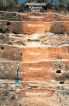
New Zealand's soils sit within young, tectonically active landscapes shaped by erosion and deposition over short distances. This produces sharp soil variation even within small areas. Understanding the landform context of a soil — its position on a terrace, floodplain, hillslope or dune sequence — is essential for mapping soils accurately, interpreting them for land use, and communicating that knowledge to land managers, iwi and other end users.
A legacy of physiographic legends
Traditional New Zealand soil surveys, going back to the NZ Soil Bureau era and carried on through the New Zealand Land Resource Inventory (NZLRI) and Land Use Capability (LUC) classification, typically carried two parallel legends: one based on soil taxonomy, and a second — the physiographic legend — that grouped soils according to the dominant landforms of the survey area (dunes, floodplains, terraces, hill country, and so on). This physiographic view, together with the narrative in each survey report, captured the relationship between soils and the landscapes they sit in, and remains a valuable historical record of soil–landform associations across the country.
Bringing geomorphic context into S-map
Manaaki Whenua's soil scientists have been working to carry that physiographic tradition into S-map, New Zealand's digital soil map and database. A dedicated S-map module now allows soil scientists to build "landform trees" that capture the geomorphic context of mapped soils, using a hierarchy — from land province and land region down to land system, land unit and landform element — developed from earlier soil-landscape modelling research.
Each level of a landform tree can carry a descriptive name, narrative, sketches, annotated photographs and even audio-visual material, so the geomorphic story behind a soil can be explored both "upwards" (to understand broader landscape context) and "downwards" (to access the kind of detailed soil–landform knowledge once only available in printed survey reports). This structure is also intended to sit more comfortably alongside a te ao Māori view of land than soil taxonomy alone, and feeds a companion tool, Sibling Finder, that helps land managers identify soil siblings from their own field observations.
A national landscape classification approach
This landscape-based way of thinking about soils and water sits within a wider national effort — the Physiographic Environment Classification, developed through the Our Land and Water National Science Challenge and made accessible via the LandscapeDNA platform. That classification brings together climate, geomorphology, lithology and hydrology to explain why water quality and contaminant loss vary across otherwise similar farmland, and is now used by regional councils, industry groups and farm advisors around the country. It reflects the same underlying principle that drives Manaaki Whenua's soil-landscape work: that the landscape itself is a powerful predictor of how soil and water systems behave.
Where this work is heading
Landform trees have already been built for parts of New Zealand and are available through the S-map Māori factsheets on S-map Online. Extending this coverage to the rest of the country depends on further investment, but the long-term goal is for every new soil survey feeding into S-map to capture its geomorphic context as a matter of course — keeping the physiographic tradition of New Zealand soil science alive in a modern, digital form.