| Funder | Collaborators | Duration |
|---|---|---|
| Tasman District Council (TDC); Ministry for Primary Industries (MPI) | Tasman District Council (TDC); Iain Campbell (consultant) |
3 years 7 months
Start date: 02 Nov 2020 End date: 30 Jun 2024 |
Tasman S-map soil survey
Why a soil survey?
In Aotearoa New Zealand, scientists have been undertaking soil surveys for over 100 years. The demand for surveys is predominantly driven by the need to minimise environmental impacts that result from different land uses. Current (and future) agricultural production, for example, or urban expansion into formerly unoccupied land. Soil information generated during a survey is the foundation of our knowledge about soil and therefore crucial to help conserving soils and ensure soil quality in the long-term.
Despite a long history of soil mapping, there are significant gaps in all land types relevant to primary production. Thus, improving the soil data coverage of New Zealand is an ongoing effort by Manaaki Whenua – Landcare Research (MWLR) with support and co-funding received from Regional Councils and the Ministry for Primary Industries (MPI).
Tasman District Council (TDC) is funding MWLR to undertake soil mapping in 2020-2024 with a focus on productive land. Mapping will be conducted at a nominal scale of approximately 1:50,000. Existing data from ‘legacy’ soil surveys will be incorporated where available and suitable.
Current survey areas in the Tasman District
 The current soil mapping campaign aims to ‘fill in’ the gaps and provide soil information for areas not yet covered by S-map.
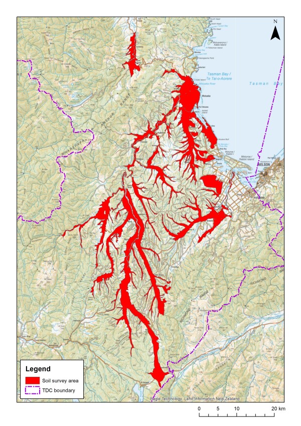
Five survey areas have been selected: 1) Upper Takaka, 2) Motueka and Riwaka, 3) Moutere Valley and Tasman, 4) Tapawera including nearby valleys, and 5) Brightwater and Wakefield.
What happens during a soil survey?
During a soil survey, the diversity of soils of a particular area are systematically examined, described, and classified.

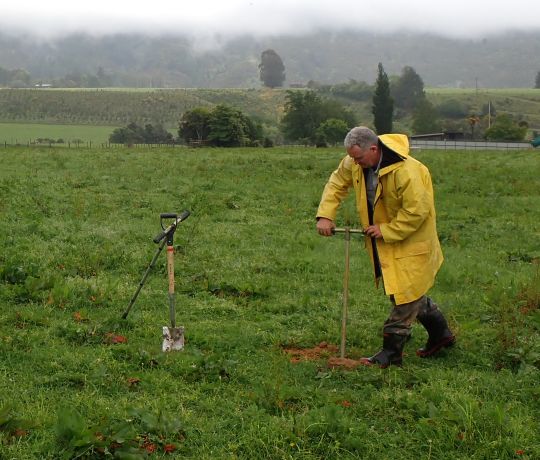
Soil mapping, using a hand auger
At a selected site, MWLR scientists will hand-auger to a maximum depth of 1 m or to hard rock. We will lay out the soil on the ground and describe its properties, e.g. colour, texture, and structure. Our approach follows a standardised method and may be complemented by taking samples for laboratory analyses. Lab data enable us to describe soil more thoroughly and classify soil following the New Zealand Soil Classification. No nutrient analyses will be performed. The auger bore will be backfilled with the previously excavated soil material and each site left as little disturbed as possible. The whole procedure usually takes between 15-30 minutes per site.
Read more about why and how we do surveys.
Survey outcomes
The typical outcome of a soil survey is a soil map.
All resulting soil maps from this survey effort will be made publicly available via the S-map Online platform. Registered users can access these soil maps for free as well as factsheets that specify soil physical and chemical properties.
What happens to the data collected?
Soil observation data from a particular location will not be publicly shared. These data will be securely stored in the National Soil Data Repository (NSDR) for potential further use such as improving the national soil mapping system (S-map). Data will be held as confidential, and no landowner will be individually identifiable in any reports or publications based on data derived from this survey. We are happy to provide soil data collected from a particular area to interested landowners once the survey has been completed and (potential) lab data are available.
Survey status
As of January 2023, the survey area ‘Upper Takaka’ has been completed and uploaded to S-map Online. Good progress has also been made in the Moutere Valley as well as in the Motueka/Riwaka areas. Motueka & Riwaka as well as Moutere Valley & Tasman areas are targeted for the August 2023 upload, with Tapawera to follow in 2024.
Historic soil survey data (selection)
The Cawthron Institute published a set of ‘Tobacco soil’ maps (1940’s approx.) at a scale of 1:15.840. The soil information from this work was reviewed and re-interpreted as part of a Massey University MSc thesis in 2003.
Soils and agriculture of Waimea County (1966)
Report | Map (1:126,720)
General survey of the soils of South Island, New Zealand (1968)
Report | Maps (1: 253,440): Sheet 1, Sheet 2
Supplement to the suitability of soils for irrigation in the Moutere Valley, Nelson (1981)
Report (incl. map)
A report on the soils of Umukuri Farm, Riwaka (1988)
Report (incl. map)
Intensive soil surveying was undertaken by Dr Iain Campbell in 2005-2018. The associated soil information have been partially integrated into S-map Online. Individual survey reports can be found and downloaded from the TDC website Valuing our soils | Tasman District Council.
The current state of soil mapping can be seen in S-map Online (free login required)
Contact details
Thomas Caspari
Manaaki Whenua - Landcare Research, Lincoln, New Zealand
P:
+64 3 321 9729
Email Thomas