Towards a New Zealand soil mapping standard
Steps have been made in recent years towards establishing a NZ soil mapping protocol. The aim is to help New Zealand implement a nationally consistent approach to conduct soil mapping. It presents a framework and guidance to support the preparation of soil maps and supporting documentation, and to facilitate assessment of the soil map quality. It also provides guidance on the level of detail required for different applications.
Using the protocol should produce defensible soil maps that are fit for purpose to support land management decisions by providing clarity as to what procedures and level of detail is required, and against which an assessment of the mapped output could then be made.
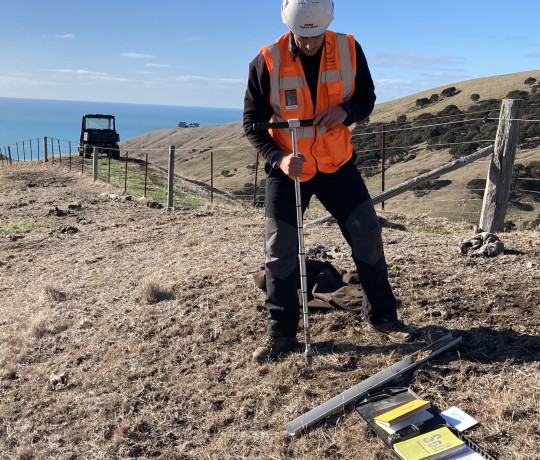
The protocol is generic and applicable for all soil mapping scales. However, the focus in preparation was for farm-scale soil mapping (about 1:500 to 1:20,000 scales). The approach and guidance provided is also likely to be applicable to other non-farming applications requiring soil maps, e.g. urban and peri-urban development, mine sites, effluent disposal schemes, and industrial sites.
Standards for different soil map applications are established for 6 procedures that are integral to soil mapping (site density, site distribution, soil characterisation, soil variation, provider, and review), and each have 3 levels of detail (low, medium, and high) that are defined with guidance information. This provides a framework to determine what is expected to be conducted to construct a soil map.
The full report is accessible from the Envirolink website:
https://www.envirolink.govt.nz/assets/Envirolink/Tools/R12-4-New-Zealand-soil-mapping-protocols-and-guidelines.pdf