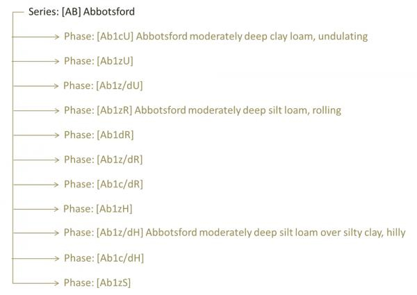
Series names
Innumerable Series
Series names group local soils with very similar properties. They are usually named after the locality where the type profile is found.
Phases
Phases distinguish soils within a series that have particular mixtures of depth, texture and field slope. For the phase name, these characteristics are usually described in full, appended to the Series name.
- Depth is recorded as (0) deep >100cm, (1) moderately deep 45-100cm (2) shallow 20-45cm, (3) stony 10-20cm, (4) very stony <10cm
- Texture is recorded as sand (a), clay loam (c), clay(e), fine sandy loam (f), peat (o), peaty loam (p), loamy peat (q), sandy loam (s), loamy silt (y), silty loam (z); if significant layering of two textures occurs texture will reported as a over b.
- Field slope is recorded as flat (F), gently undulating (G), undulating (U), rolling (R), hilly (H) or steep (S).
Typically there are up to a dozen or so Phases in a Series.
S-map Online Factsheets
Soil series factsheets
The Regional factsheets contain information about the key properties of a particular soil, as well as interpreted information derived from a suite of models that classify various environmental risks.